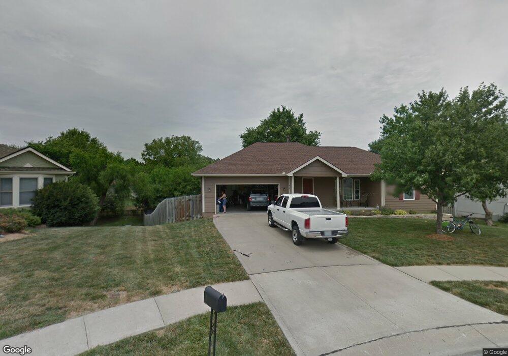
610 E 15th St Kearney, MO 64060
Estimated Value: $318,000 - $354,000
3
Beds
2
Baths
1,451
Sq Ft
$233/Sq Ft
Est. Value
About This Home
This home is located at 610 E 15th St, Kearney, MO 64060 and is currently estimated at $337,619, approximately $232 per square foot. 610 E 15th St is a home located in Clay County with nearby schools including Kearney Junior High School and Kearney High School.
Ownership History
Date
Name
Owned For
Owner Type
Purchase Details
Closed on
Apr 4, 2006
Sold by
Jpmorgan Chase Bank
Bought by
Baker Jamie and Baker Lydia
Current Estimated Value
Home Financials for this Owner
Home Financials are based on the most recent Mortgage that was taken out on this home.
Original Mortgage
$126,900
Outstanding Balance
$72,334
Interest Rate
6.22%
Mortgage Type
Fannie Mae Freddie Mac
Estimated Equity
$265,285
Purchase Details
Closed on
Dec 29, 2005
Sold by
Ferris William J and Ferris Patricia J
Bought by
Jpmorgan Chase Bank
Purchase Details
Closed on
Jul 29, 1999
Sold by
Aartech Investments Inc
Bought by
Ferris William J and Ferris Patricia J
Home Financials for this Owner
Home Financials are based on the most recent Mortgage that was taken out on this home.
Original Mortgage
$132,905
Interest Rate
7.63%
Create a Home Valuation Report for This Property
The Home Valuation Report is an in-depth analysis detailing your home's value as well as a comparison with similar homes in the area
Home Values in the Area
Average Home Value in this Area
Purchase History
| Date | Buyer | Sale Price | Title Company |
|---|---|---|---|
| Baker Jamie | -- | First American Title | |
| Jpmorgan Chase Bank | $140,250 | Continental Title Company | |
| Ferris William J | -- | -- |
Source: Public Records
Mortgage History
| Date | Status | Borrower | Loan Amount |
|---|---|---|---|
| Open | Baker Jamie | $126,900 | |
| Previous Owner | Ferris William J | $132,905 |
Source: Public Records
Tax History
| Year | Tax Paid | Tax Assessment Tax Assessment Total Assessment is a certain percentage of the fair market value that is determined by local assessors to be the total taxable value of land and additions on the property. | Land | Improvement |
|---|---|---|---|---|
| 2025 | $2,924 | $48,770 | -- | -- |
| 2024 | $2,924 | $42,660 | -- | -- |
| 2023 | $2,914 | $42,660 | $0 | $0 |
| 2022 | $2,691 | $38,100 | $0 | $0 |
| 2021 | $2,638 | $38,095 | $4,940 | $33,155 |
| 2020 | $2,593 | $34,070 | $0 | $0 |
| 2019 | $2,580 | $34,067 | $4,940 | $29,127 |
Source: Public Records
Map
Nearby Homes
- 1505 Emerald Cir
- 1710 Rockwater Ln
- 801 Southbrook Pkwy
- 1300 Robin Cir
- 623 E 13th St
- 1307 Stonecrest Dr
- 402 E 14th St
- 1209 Noah's Ln
- 709 Feldspar St
- 1204 Noah's Ln
- 1202 Noah's Ln
- 1300 Melissa Ct
- 1304 S Jefferson St
- 905 Susan St
- 1933 Meadowlane
- 819 Susan St
- 2118 Glenside Rd
- 1102 Melody Ct
- 200 E 10th St
- 1207 E 15th St
- 612 E 15th St
- 608 E 15th St
- 1503 Emerald Cir
- 614 E 15th St
- 607 E 15th St
- 707 Southbrook Pkwy
- 1501 Emerald Cir
- 611 E 15th St
- 609 E 15th St
- 613 E 15th St
- 1507 Emerald Cir
- 709 Southbrook Pkwy
- 700 E 15th St
- 1508 Rockwater Ln
- 1510 Rockwater Ln
- 711 Southbrook Pkwy
- 1506 Opal Rd
- 1506 Emerald Cir
- 702 E 15th St
- 1602 Rockwater Ln
Your Personal Tour Guide
Ask me questions while you tour the home.