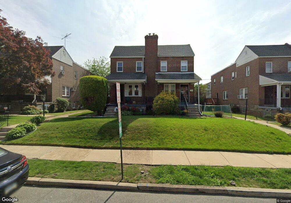
610 Fern St Lansdowne, PA 19050
Estimated Value: $250,000 - $286,000
3
Beds
2
Baths
1,598
Sq Ft
$169/Sq Ft
Est. Value
About This Home
This home is located at 610 Fern St, Lansdowne, PA 19050 and is currently estimated at $270,055, approximately $168 per square foot. 610 Fern St is a home located in Delaware County with nearby schools including Evans Elementary School, Penn Wood Middle School, and Penn Wood High School - Cypress Street Campus.
Ownership History
Date
Name
Owned For
Owner Type
Purchase Details
Closed on
Nov 16, 2001
Sold by
Jones Ronald and Jones Linae R
Bought by
Kornegay Michelle
Current Estimated Value
Home Financials for this Owner
Home Financials are based on the most recent Mortgage that was taken out on this home.
Original Mortgage
$89,269
Outstanding Balance
$34,685
Interest Rate
6.64%
Mortgage Type
FHA
Estimated Equity
$235,370
Create a Home Valuation Report for This Property
The Home Valuation Report is an in-depth analysis detailing your home's value as well as a comparison with similar homes in the area
Home Values in the Area
Average Home Value in this Area
Purchase History
| Date | Buyer | Sale Price | Title Company |
|---|---|---|---|
| Kornegay Michelle | $90,000 | Commonwealth Land Title Ins |
Source: Public Records
Mortgage History
| Date | Status | Borrower | Loan Amount |
|---|---|---|---|
| Open | Kornegay Michelle | $89,269 |
Source: Public Records
Tax History Compared to Growth
Tax History
| Year | Tax Paid | Tax Assessment Tax Assessment Total Assessment is a certain percentage of the fair market value that is determined by local assessors to be the total taxable value of land and additions on the property. | Land | Improvement |
|---|---|---|---|---|
| 2025 | $5,549 | $129,940 | $34,450 | $95,490 |
| 2024 | $5,549 | $129,940 | $34,450 | $95,490 |
| 2023 | $5,039 | $129,940 | $34,450 | $95,490 |
| 2022 | $4,805 | $129,940 | $34,450 | $95,490 |
| 2021 | $7,266 | $129,940 | $34,450 | $95,490 |
| 2020 | $4,580 | $73,340 | $19,880 | $53,460 |
| 2019 | $4,499 | $73,340 | $19,880 | $53,460 |
| 2018 | $4,437 | $73,340 | $0 | $0 |
| 2017 | $4,344 | $73,340 | $0 | $0 |
| 2016 | $402 | $73,340 | $0 | $0 |
| 2015 | $402 | $73,340 | $0 | $0 |
| 2014 | $402 | $73,340 | $0 | $0 |
Source: Public Records
Map
Nearby Homes
- 536 Cypress St
- 1016 Whitby Ave
- 702 Cedar Ave
- 503 Bonsall Ave
- 407 Church Ln
- 435 Bonsall Ave
- 740 Church Ln
- 711 Yeadon Ave Unit 1
- 530 Orchard Ave
- 722 Yeadon Ave
- 813 Arbor Rd
- 800 Bullock Ave
- 825 Laurel Rd
- 6030 Cedarhurst St
- 1212 S Millick St
- 6013 Baltimore Ave
- 6026 Baltimore Ave
- 1214 S 60th St
- 603 Penn St
- 1201 S Millick St