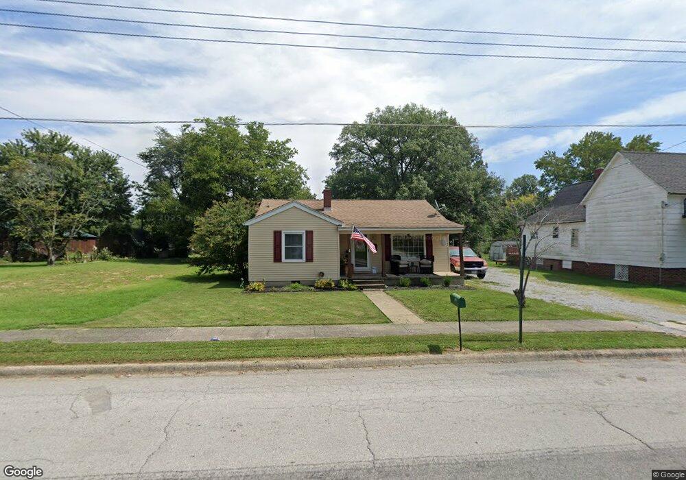
610 N Main St Carrier Mills, IL 62917
Estimated Value: $58,000 - $75,000
2
Beds
1
Bath
1,000
Sq Ft
$66/Sq Ft
Est. Value
About This Home
This home is located at 610 N Main St, Carrier Mills, IL 62917 and is currently estimated at $66,315, approximately $66 per square foot. 610 N Main St is a home located in Saline County with nearby schools including Carrier Mills-Stonefort Elementary School and Carrier Mills-Stonefort High School.
Create a Home Valuation Report for This Property
The Home Valuation Report is an in-depth analysis detailing your home's value as well as a comparison with similar homes in the area
Home Values in the Area
Average Home Value in this Area
Tax History Compared to Growth
Tax History
| Year | Tax Paid | Tax Assessment Tax Assessment Total Assessment is a certain percentage of the fair market value that is determined by local assessors to be the total taxable value of land and additions on the property. | Land | Improvement |
|---|---|---|---|---|
| 2023 | $1,467 | $21,355 | $1,505 | $19,850 |
| 2022 | $1,354 | $19,862 | $1,400 | $18,462 |
| 2021 | $1,231 | $18,056 | $1,273 | $16,783 |
| 2020 | $1,140 | $17,515 | $1,235 | $16,280 |
| 2019 | $1,166 | $17,515 | $1,235 | $16,280 |
| 2018 | $1,192 | $17,515 | $1,235 | $16,280 |
| 2017 | $1,217 | $17,515 | $1,235 | $16,280 |
| 2016 | $11 | $17,515 | $1,235 | $16,280 |
| 2015 | -- | $17,515 | $1,235 | $16,280 |
| 2014 | $972 | $17,515 | $1,235 | $16,280 |
| 2013 | $972 | $17,515 | $1,235 | $16,280 |
| 2012 | $972 | $17,515 | $1,235 | $16,280 |
Source: Public Records
Map
Nearby Homes
- 603 N Main St
- 437 N Thompson St
- 315 W Furlong St
- 205 W Washington St
- 720 N Mill St
- 518 Fife St
- 736 N Mill St
- 109 Delanor Dr
- 104 Deborann Dr
- 1501 Duncan Rd
- 1501 Duncan Rd
- 0 Frond Rd Unit Lot WP001
- 002 Robinson Hill Rd
- 000 Robinson Hill Rd
- 001 Robinson Hill Rd
- 0 Rock Hole Rd
- 315 Lighthouse Rd
- 615 Liberty Rd
- Robinson Hill Rd Unit LotWP001
- 7034 Parks Ln