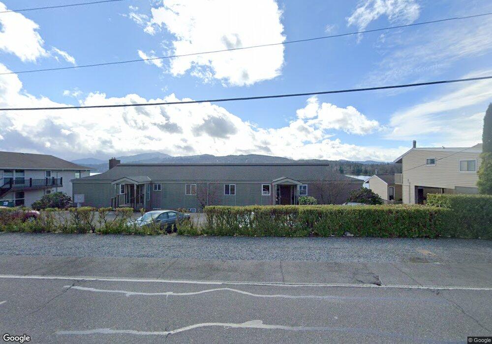
610 N Shore Dr Unit 6103 Bellingham, WA 98226
Silver Beach NeighborhoodEstimated Value: $507,012 - $635,000
2
Beds
1
Bath
990
Sq Ft
$583/Sq Ft
Est. Value
About This Home
This home is located at 610 N Shore Dr Unit 6103, Bellingham, WA 98226 and is currently estimated at $577,253, approximately $583 per square foot. 610 N Shore Dr Unit 6103 is a home located in Whatcom County with nearby schools including Silver Beach Elementary School, Whatcom Middle School, and Squalicum High School.
Ownership History
Date
Name
Owned For
Owner Type
Purchase Details
Closed on
May 22, 2006
Sold by
Ogren Kristin M and Ogren Thomas R
Bought by
Boggs Robert R and Menard Joanne H S
Current Estimated Value
Home Financials for this Owner
Home Financials are based on the most recent Mortgage that was taken out on this home.
Original Mortgage
$232,500
Outstanding Balance
$135,116
Interest Rate
6.46%
Mortgage Type
Fannie Mae Freddie Mac
Estimated Equity
$442,137
Purchase Details
Closed on
May 18, 2006
Sold by
Hall Lisa and Hall Daniel
Bought by
Boggs Robert R and Menard Joanne H S
Home Financials for this Owner
Home Financials are based on the most recent Mortgage that was taken out on this home.
Original Mortgage
$232,500
Outstanding Balance
$135,116
Interest Rate
6.46%
Mortgage Type
Fannie Mae Freddie Mac
Estimated Equity
$442,137
Purchase Details
Closed on
Sep 5, 2003
Sold by
Hall Daniel and Hall Lisa
Bought by
Sether Llc
Create a Home Valuation Report for This Property
The Home Valuation Report is an in-depth analysis detailing your home's value as well as a comparison with similar homes in the area
Home Values in the Area
Average Home Value in this Area
Purchase History
| Date | Buyer | Sale Price | Title Company |
|---|---|---|---|
| Boggs Robert R | $97,404 | Whatcom Land Title | |
| Boggs Robert R | $97,404 | Whatcom Land Title | |
| Hall Daniel | -- | Whatcom Land Title | |
| Sether Llc | -- | Chicago Title Insurance |
Source: Public Records
Mortgage History
| Date | Status | Borrower | Loan Amount |
|---|---|---|---|
| Open | Boggs Robert R | $232,500 |
Source: Public Records
Tax History Compared to Growth
Tax History
| Year | Tax Paid | Tax Assessment Tax Assessment Total Assessment is a certain percentage of the fair market value that is determined by local assessors to be the total taxable value of land and additions on the property. | Land | Improvement |
|---|---|---|---|---|
| 2024 | $4,278 | $549,533 | $235,514 | $314,019 |
| 2023 | $4,278 | $549,533 | $235,514 | $314,019 |
| 2022 | $3,739 | $495,075 | $212,175 | $282,900 |
| 2021 | $3,349 | $402,500 | $172,500 | $230,000 |
| 2020 | $3,193 | $340,261 | $127,598 | $212,663 |
| 2019 | $2,803 | $313,600 | $117,600 | $196,000 |
| 2018 | $2,820 | $276,000 | $103,500 | $172,500 |
| 2017 | $2,448 | $237,400 | $89,025 | $148,375 |
| 2016 | $2,183 | $215,400 | $80,775 | $134,625 |
| 2015 | $2,738 | $200,000 | $75,000 | $125,000 |
| 2014 | -- | $242,667 | $84,960 | $157,707 |
| 2013 | -- | $225,027 | $79,200 | $145,827 |
Source: Public Records
Map
Nearby Homes
- 610 Northshore Dr Unit 6123
- 4020 Academy St
- 4522 E Oregon St
- 4501 E Oregon St
- 4251 Northridge Way
- 3700 Alabama St Unit 316
- 2620 Birch St
- 2612 Birch St
- 2820 E Crestline Dr
- 3666 Woodlake Rd
- 3730 Spring Coulee Rd
- 3468 Deer Pointe Ct Unit 3468
- 2178 E Birch St Unit 7A
- 2321 Crestline Dr
- 3020 Alpine Dr
- 3121 Chandler Pkwy
- 3785 Greenville Place
- 3214 Spyglass Dr
- 1580 Hillsdale Rd
- 2104 Birch Cir Unit 5C
- 610 Northshore Dr Unit 4
- 610 Northshore Dr Unit 1
- 610 N Shore Dr Unit 6104
- 610 N Shore Dr Unit 6102
- 610 N Shore Dr Unit 6101
- 610 N Shore Dr Unit 6124
- 610 N Shore Dr Unit 6123
- 610 N Shore Dr Unit 6122
- 610 N Shore Dr Unit 6121
- 610 N Shore Dr Unit 610A
- 610 N Shore Dr
- 600 N Shore Dr Unit 6006
- 600 N Shore Dr Unit 6005
- 600 N Shore Dr Unit 6004
- 600 N Shore Dr Unit 6003
- 600 N Shore Dr Unit 6002
- 600 N Shore Dr Unit 6001
- 600 N Shore Dr Unit 6046
- 600 N Shore Dr Unit 6045
- 600 N Shore Dr Unit 6044