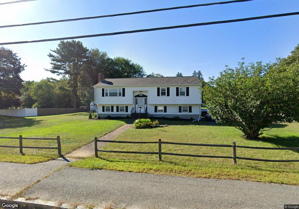
610 Pulaski Blvd Bellingham, MA 02019
Estimated Value: $510,358 - $574,000
3
Beds
2
Baths
1,635
Sq Ft
$332/Sq Ft
Est. Value
About This Home
This home is located at 610 Pulaski Blvd, Bellingham, MA 02019 and is currently estimated at $542,840, approximately $332 per square foot. 610 Pulaski Blvd is a home located in Norfolk County with nearby schools including Joseph F. DiPietro Elementary, Bellingham High School, and Rise Prep Mayoral Academy Middle School.
Ownership History
Date
Name
Owned For
Owner Type
Purchase Details
Closed on
Aug 5, 2004
Sold by
Kornicki Francis
Bought by
Perkins Ann M and Perkins Dennis M
Current Estimated Value
Home Financials for this Owner
Home Financials are based on the most recent Mortgage that was taken out on this home.
Original Mortgage
$120,000
Outstanding Balance
$60,295
Interest Rate
6.2%
Mortgage Type
Purchase Money Mortgage
Estimated Equity
$482,545
Create a Home Valuation Report for This Property
The Home Valuation Report is an in-depth analysis detailing your home's value as well as a comparison with similar homes in the area
Home Values in the Area
Average Home Value in this Area
Purchase History
| Date | Buyer | Sale Price | Title Company |
|---|---|---|---|
| Perkins Ann M | $345,000 | -- | |
| Kornicki Frances | -- | -- | |
| Perkins Ann M | $345,000 | -- |
Source: Public Records
Mortgage History
| Date | Status | Borrower | Loan Amount |
|---|---|---|---|
| Open | Kornicki Frances | $120,000 | |
| Closed | Perkins Ann M | $120,000 |
Source: Public Records
Tax History Compared to Growth
Tax History
| Year | Tax Paid | Tax Assessment Tax Assessment Total Assessment is a certain percentage of the fair market value that is determined by local assessors to be the total taxable value of land and additions on the property. | Land | Improvement |
|---|---|---|---|---|
| 2025 | $4,916 | $391,400 | $133,100 | $258,300 |
| 2024 | $4,712 | $366,400 | $121,500 | $244,900 |
| 2023 | $4,540 | $347,900 | $115,700 | $232,200 |
| 2022 | $4,439 | $315,300 | $96,500 | $218,800 |
| 2021 | $4,291 | $297,800 | $96,500 | $201,300 |
| 2020 | $4,087 | $287,400 | $96,500 | $190,900 |
| 2019 | $3,992 | $280,900 | $96,500 | $184,400 |
| 2018 | $3,726 | $258,600 | $97,300 | $161,300 |
| 2017 | $3,611 | $251,800 | $97,300 | $154,500 |
| 2016 | $3,515 | $246,000 | $101,200 | $144,800 |
| 2015 | $3,370 | $236,500 | $97,300 | $139,200 |
| 2014 | $3,357 | $229,000 | $93,900 | $135,100 |
Source: Public Records
Map
Nearby Homes