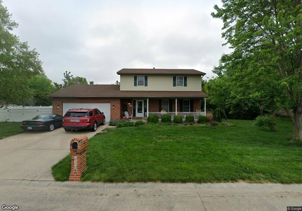
610 Red Oak Dr Freeburg, IL 62243
Estimated Value: $280,548 - $356,000
--
Bed
--
Bath
810
Sq Ft
$386/Sq Ft
Est. Value
About This Home
This home is located at 610 Red Oak Dr, Freeburg, IL 62243 and is currently estimated at $312,387, approximately $385 per square foot. 610 Red Oak Dr is a home located in St. Clair County with nearby schools including Freeburg Elementary School, Freeburg Community High School, and St. Joseph Catholic School.
Ownership History
Date
Name
Owned For
Owner Type
Purchase Details
Closed on
Apr 30, 2002
Sold by
Robertson Paul C and Robertson Patricia A
Bought by
Twenhoefel William T and Twenhoefel Laura A
Current Estimated Value
Home Financials for this Owner
Home Financials are based on the most recent Mortgage that was taken out on this home.
Original Mortgage
$187,500
Interest Rate
7.1%
Mortgage Type
Purchase Money Mortgage
Create a Home Valuation Report for This Property
The Home Valuation Report is an in-depth analysis detailing your home's value as well as a comparison with similar homes in the area
Home Values in the Area
Average Home Value in this Area
Purchase History
| Date | Buyer | Sale Price | Title Company |
|---|---|---|---|
| Twenhoefel William T | $160,000 | Town & Country Title Co |
Source: Public Records
Mortgage History
| Date | Status | Borrower | Loan Amount |
|---|---|---|---|
| Closed | Twenhoefel William T | $187,500 |
Source: Public Records
Tax History Compared to Growth
Tax History
| Year | Tax Paid | Tax Assessment Tax Assessment Total Assessment is a certain percentage of the fair market value that is determined by local assessors to be the total taxable value of land and additions on the property. | Land | Improvement |
|---|---|---|---|---|
| 2024 | $7,002 | $89,748 | $15,568 | $74,180 |
| 2023 | $6,781 | $85,961 | $15,025 | $70,936 |
| 2022 | $6,461 | $80,548 | $14,079 | $66,469 |
| 2021 | $6,227 | $75,832 | $13,255 | $62,577 |
| 2020 | $5,914 | $68,988 | $12,059 | $56,929 |
| 2019 | $6,008 | $72,914 | $12,464 | $60,450 |
| 2018 | $5,901 | $71,950 | $12,299 | $59,651 |
| 2017 | $5,625 | $68,792 | $11,759 | $57,033 |
| 2016 | $5,553 | $65,931 | $11,270 | $54,661 |
| 2014 | $4,761 | $64,142 | $11,565 | $52,577 |
| 2013 | $5,150 | $63,570 | $11,462 | $52,108 |
Source: Public Records
Map
Nearby Homes
- 520 N Edison St
- 401 N Edison St
- 302 N Railroad St
- 206 N Main St
- 207 N Edison St
- 312 W Phillips St
- 106 S Vine St
- 440 Foxtail Dr
- 420 Foxtail Dr
- 433 Foxtail Dr
- 3 Park St
- 363 Sleeping Indian Dr
- 359 Sleeping Indian Dr
- 304 Torrington Ln
- 222 Alamosa Dr
- 227 Alamosa Dr
- 0 Hickory Dr
- 103 Draco Dr
- 109 Willow Dr
- 111 Willow Dr
- 614 Red Oak Dr
- 606 Red Oak Dr
- 611 Brook Stone Ct
- 615 Brook Stone Ct
- 607 Brook Stone Ct
- 618 Red Oak Dr
- 602 Red Oak Dr
- 619 Brook Stone Ct
- 612 Brook Stone Ct
- 603 Brook Stone Ct
- 708 Oak Brook Dr
- 608 Brook Stone Ct
- 620 Brook Stone Ct
- 604 Brook Stone Ct
- 705 Oak Brook Dr
- 623 Brook Stone Ct
- 702 Meadow Brook Dr
- 712 Oak Brook Dr
- 613 Meadow Lake Dr
- 600 Brook Stone Ct