
Seller's Agent in 2025
Aaron Donner
Keller Williams Realty Partners Inc.
(913) 526-8626
2 in this area
286 Total Sales
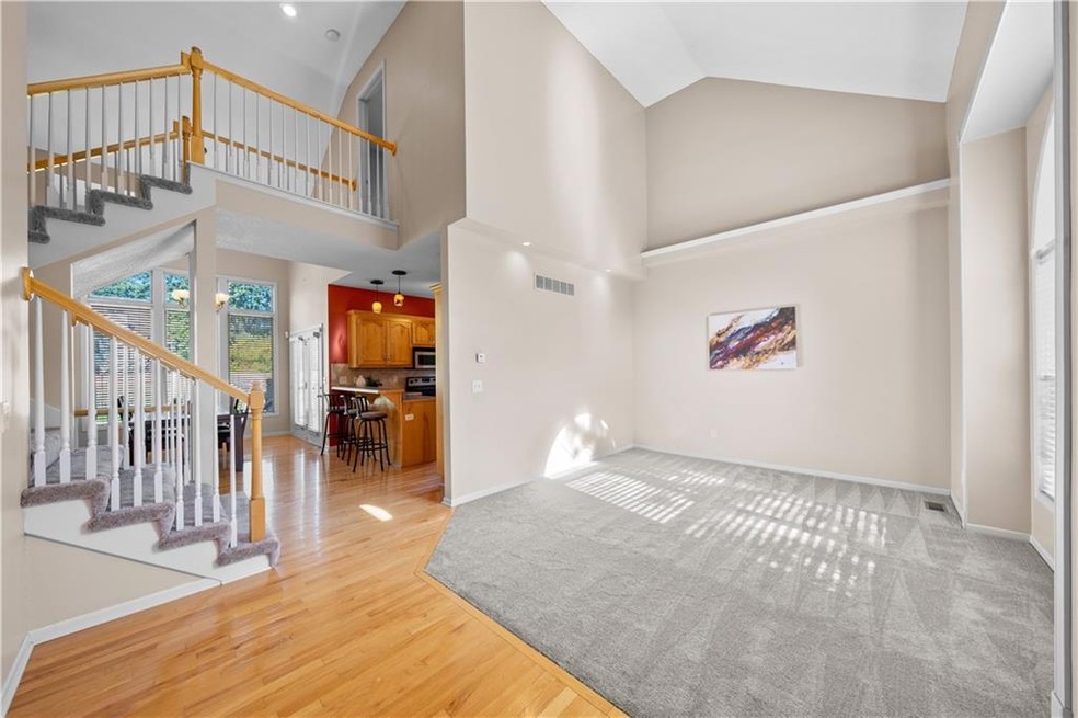
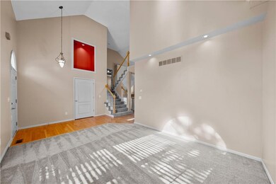
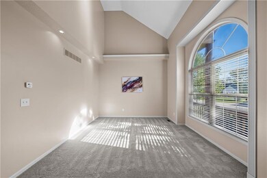
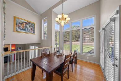
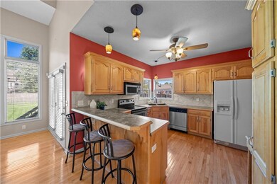
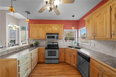
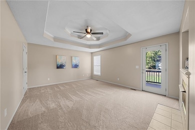
Welcome to this spacious and versatile home, thoughtfully designed to offer comfort and style. As you step inside, you're welcomed by soaring vaulted ceilings and large windows that fill the space with natural light, immediately creating an open and inviting ambiance. The bright, airy eat-in kitchen is truly the heart of the home—perfect for everyday living and effortless entertaining. With plenty of room for a dining table and easy flow into the main living area, it's a space where everyone can gather. Nearly every room has been freshly painted, and brand-new carpet runs throughout the home, giving it a fresh and updated feel. Upstairs, you’ll find two spacious bedrooms, each with generous closets and a shared full bath. A charming lofted fourth bedroom is perfect for a home office, guest room, or creative studio. The expansive primary suite is your private retreat, featuring a cozy fireplace, a private balcony for morning coffee or evening relaxation, and a luxurious ensuite bathroom with dual walk-in closets. The large family room also features a fireplace and opens directly to the backyard—ideal for hosting gatherings, BBQs, or simply enjoying a quiet evening at home. The lower level provides flexible space to suit your needs, whether it's a home gym, media room, playroom, game area, or all of the above. Even with all this finished space, there's still plenty of storage available. Additional highlights include a spacious three-car garage, a large yard perfect for outdoor activities or gardening, and a peaceful neighborhood setting with convenient access to schools, shopping, dining, and commuter routes. This home offers the perfect balance of privacy, functionality, and room to entertain—an ideal choice for anyone seeking space to spread out without sacrificing comfort or convenience.
Last Agent to Sell the Property
Keller Williams Realty Partners Inc. Brokerage Phone: 913-526-8626 License #SP00219104 Listed on: 10/10/2025
Co-Listed By
Keller Williams Realty Partners Inc. Brokerage Phone: 913-526-8626 License #00244862
| Date | Type | Sale Price | Title Company |
|---|---|---|---|
| Warranty Deed | -- | Platinum Title | |
| Quit Claim Deed | -- | None Available | |
| Special Warranty Deed | -- | -- | |
| Trustee Deed | $166,283 | -- |
| Date | Status | Loan Amount | Loan Type |
|---|---|---|---|
| Previous Owner | $187,064 | FHA |
| Date | Event | Price | List to Sale | Price per Sq Ft |
|---|---|---|---|---|
| 12/10/2025 12/10/25 | Sold | -- | -- | -- |
| 11/06/2025 11/06/25 | Pending | -- | -- | -- |
| 11/06/2025 11/06/25 | For Sale | $399,000 | 0.0% | $135 / Sq Ft |
| 11/03/2025 11/03/25 | Pending | -- | -- | -- |
| 10/17/2025 10/17/25 | Price Changed | $399,000 | -1.5% | $135 / Sq Ft |
| 10/10/2025 10/10/25 | For Sale | $405,000 | -- | $137 / Sq Ft |
| Year | Tax Paid | Tax Assessment Tax Assessment Total Assessment is a certain percentage of the fair market value that is determined by local assessors to be the total taxable value of land and additions on the property. | Land | Improvement |
|---|---|---|---|---|
| 2025 | $3,866 | $53,190 | $7,750 | $45,440 |
| 2024 | $3,866 | $47,510 | $7,050 | $40,460 |
| 2023 | $3,861 | $47,510 | $7,050 | $40,460 |
| 2022 | $3,394 | $41,480 | $7,050 | $34,430 |
| 2021 | $3,394 | $41,480 | $7,050 | $34,430 |
| 2020 | $3,391 | $40,710 | $7,050 | $33,660 |
| 2019 | $3,274 | $40,710 | $7,050 | $33,660 |
| 2018 | $3,014 | $36,190 | $5,820 | $30,370 |
| 2017 | $2,799 | $36,190 | $5,820 | $30,370 |
| 2016 | $2,799 | $34,890 | $5,820 | $29,070 |
| 2015 | $2,801 | $34,890 | $5,820 | $29,070 |
| 2014 | $2,802 | $34,890 | $5,820 | $29,070 |
| 2013 | -- | $34,890 | $5,820 | $29,070 |
Seller's Agent in 2025
Aaron Donner
Keller Williams Realty Partners Inc.
(913) 526-8626
2 in this area
286 Total Sales
Seller Co-Listing Agent in 2025
Natalie McGonegal
Keller Williams Realty Partners Inc.
(913) 284-4703
1 in this area
9 Total Sales
Buyer's Agent in 2025
John Eads
RE/MAX Premier Properties
(816) 679-4603
5 in this area
55 Total Sales
Source: Heartland MLS
MLS Number: 2579519
APN: 2326246
Disclaimer: Certain information contained herein is derived from information provided by parties other than Homes.com. All information provided is deemed reliable, but is not guaranteed to be accurate and should be independently verified.
![]() Based on information submitted to the MLS Grid. All data is obtained from various sources and may not have been verified by broker or MLS GRID. Supplied Open House Information is subject to change without notice. All information should be independently reviewed and verified for accuracy. Properties may or may not be listed by the office/agent presenting the information. Some IDX listings have been excluded from this website. Prices displayed on all Sold listings are the Last Known Listing Price and may not be the actual selling price.
Based on information submitted to the MLS Grid. All data is obtained from various sources and may not have been verified by broker or MLS GRID. Supplied Open House Information is subject to change without notice. All information should be independently reviewed and verified for accuracy. Properties may or may not be listed by the office/agent presenting the information. Some IDX listings have been excluded from this website. Prices displayed on all Sold listings are the Last Known Listing Price and may not be the actual selling price.
Listing Information presented by local MLS brokerage: TEN-X, INC., local REALTOR®- Arlene Richardson - (888) 952-6393
Based on information submitted to the MLS GRID.
Ask me questions while you tour the home.