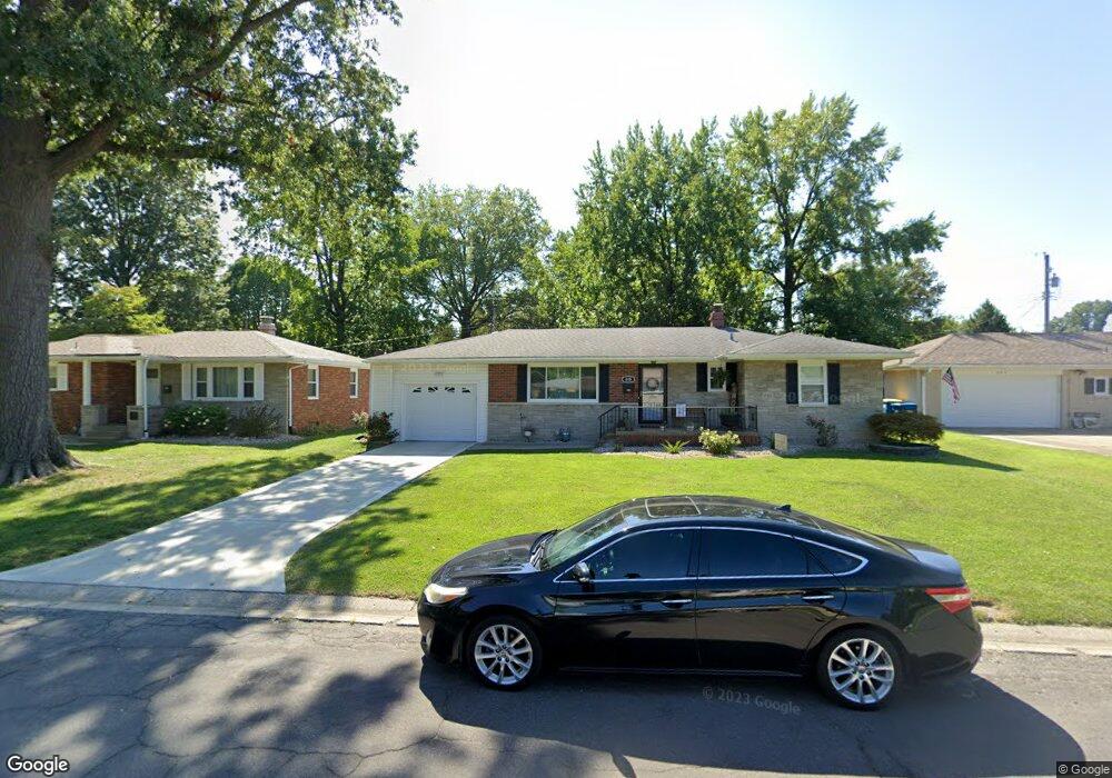
610 Roanoke Dr Edwardsville, IL 62025
Estimated Value: $201,718 - $233,000
3
Beds
1
Bath
1,178
Sq Ft
$187/Sq Ft
Est. Value
About This Home
This home is located at 610 Roanoke Dr, Edwardsville, IL 62025 and is currently estimated at $220,430, approximately $187 per square foot. 610 Roanoke Dr is a home located in Madison County with nearby schools including LeClaire Elementary School, Columbus Elementary School, and Liberty Middle School.
Ownership History
Date
Name
Owned For
Owner Type
Purchase Details
Closed on
Jul 9, 2010
Sold by
Scheibal David P and Scheibal Mary L
Bought by
Brewster John Paul and Brewster Karen E
Current Estimated Value
Home Financials for this Owner
Home Financials are based on the most recent Mortgage that was taken out on this home.
Original Mortgage
$140,113
Outstanding Balance
$94,950
Interest Rate
5.12%
Mortgage Type
FHA
Estimated Equity
$125,480
Create a Home Valuation Report for This Property
The Home Valuation Report is an in-depth analysis detailing your home's value as well as a comparison with similar homes in the area
Home Values in the Area
Average Home Value in this Area
Purchase History
| Date | Buyer | Sale Price | Title Company |
|---|---|---|---|
| Brewster John Paul | $142,000 | Mctc |
Source: Public Records
Mortgage History
| Date | Status | Borrower | Loan Amount |
|---|---|---|---|
| Open | Brewster John Paul | $140,113 |
Source: Public Records
Tax History Compared to Growth
Tax History
| Year | Tax Paid | Tax Assessment Tax Assessment Total Assessment is a certain percentage of the fair market value that is determined by local assessors to be the total taxable value of land and additions on the property. | Land | Improvement |
|---|---|---|---|---|
| 2024 | $4,106 | $63,510 | $9,110 | $54,400 |
| 2023 | $4,106 | $58,930 | $8,450 | $50,480 |
| 2022 | $3,834 | $54,470 | $7,810 | $46,660 |
| 2021 | $3,398 | $51,700 | $7,410 | $44,290 |
| 2020 | $3,281 | $50,100 | $7,180 | $42,920 |
| 2019 | $3,253 | $49,260 | $7,060 | $42,200 |
| 2018 | $3,191 | $47,040 | $6,740 | $40,300 |
| 2017 | $3,099 | $46,050 | $6,600 | $39,450 |
| 2016 | $2,796 | $46,050 | $6,600 | $39,450 |
| 2015 | $3,229 | $50,560 | $6,120 | $44,440 |
| 2014 | $3,229 | $50,560 | $6,120 | $44,440 |
| 2013 | $3,229 | $50,560 | $6,120 | $44,440 |
Source: Public Records
Map
Nearby Homes
- 629 Bollman Ave
- 503 Bollman Ave
- 426 Roanoke Dr
- 424 Hadley Ave
- 417 Montclaire Ave
- 638 Yale Ave
- 221 4th Ave
- 4 Hadley Ct
- 502 Jaime Lynn Ct
- 613 Jaime Lynn Ct
- 307 Monticello Place Unit A
- 1120 Franklin Ave
- 500 Monticello Place
- 424 Circle Dr
- 821 Sherman Ave
- 1101 N Oxfordshire Ln
- 808 Meade Ave
- 714 Sherman Ave
- 6 Greystone Ln
- 103 Thomas Terrace
- 614 Roanoke Dr
- 606 Roanoke Dr
- 621 Bollman Ave
- 625 Bollman Ave
- 617 Bollman Ave
- 609 Roanoke Dr
- 613 Bollman Ave
- 622 Roanoke Dr
- 1406 Madison Ave
- 613 Roanoke Dr
- 1514 Madison Ave
- 617 Roanoke Dr
- 628 Roanoke Dr
- 705 Bollman Ave
- 1402 Madison Ave
- 621 Roanoke Dr
- 618 Bollman Ave
- 1503 Madison Ave
- 614 Bollman Ave
- 610 Bollman Ave