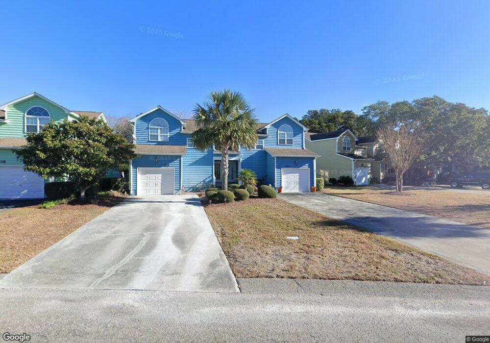
610 Sloop Pointe Ln Kure Beach, NC 28449
Estimated Value: $543,000 - $707,000
4
Beds
2
Baths
1,999
Sq Ft
$305/Sq Ft
Est. Value
About This Home
This home is located at 610 Sloop Pointe Ln, Kure Beach, NC 28449 and is currently estimated at $609,030, approximately $304 per square foot. 610 Sloop Pointe Ln is a home located in New Hanover County with nearby schools including Carolina Beach Elementary School, Charles P. Murray Middle School, and Eugene Ashley High School.
Ownership History
Date
Name
Owned For
Owner Type
Purchase Details
Closed on
Aug 28, 2025
Sold by
Chadwick Shawn Patrick
Bought by
Chadwick Shawn Patrick and Thomas Trisha
Current Estimated Value
Purchase Details
Closed on
Aug 21, 2025
Sold by
Chadwick G Scott G and Chadwick Geoffrey Scott
Bought by
Chadwick Shawn Patrick
Purchase Details
Closed on
May 16, 2005
Sold by
Mccormick Richard and Mccormick Catherine
Bought by
Chadwick John M and Chadwick Bettie L
Purchase Details
Closed on
Jun 16, 1995
Sold by
Gulf Stream Developers Inc
Bought by
Mccormick Richard Catherine
Purchase Details
Closed on
Oct 19, 1992
Sold by
Peoples Federal Savings Bank
Bought by
Gulf Stream Developers Inc
Create a Home Valuation Report for This Property
The Home Valuation Report is an in-depth analysis detailing your home's value as well as a comparison with similar homes in the area
Home Values in the Area
Average Home Value in this Area
Purchase History
| Date | Buyer | Sale Price | Title Company |
|---|---|---|---|
| Chadwick Shawn Patrick | -- | None Listed On Document | |
| Chadwick Shawn Patrick | $288,000 | None Listed On Document | |
| Chadwick Shawn Patrick | $288,000 | None Listed On Document | |
| Chadwick John M | $340,000 | None Available | |
| Mccormick Richard Catherine | $119,500 | -- | |
| Gulf Stream Developers Inc | $2,000,000 | -- |
Source: Public Records
Tax History
| Year | Tax Paid | Tax Assessment Tax Assessment Total Assessment is a certain percentage of the fair market value that is determined by local assessors to be the total taxable value of land and additions on the property. | Land | Improvement |
|---|---|---|---|---|
| 2025 | $0 | $574,400 | $110,000 | $464,400 |
| 2024 | $0 | $342,800 | $100,000 | $242,800 |
| 2023 | -- | $342,800 | $100,000 | $242,800 |
| 2022 | $1,270 | $342,800 | $100,000 | $242,800 |
| 2021 | $1,905 | $342,800 | $100,000 | $242,800 |
| 2020 | $2,408 | $269,100 | $68,400 | $200,700 |
| 2019 | $2,408 | $269,100 | $68,400 | $200,700 |
| 2018 | $0 | $269,100 | $68,400 | $200,700 |
| 2017 | $2,301 | $269,100 | $68,400 | $200,700 |
| 2016 | $2,136 | $235,200 | $68,400 | $166,800 |
| 2015 | $1,965 | $235,200 | $68,400 | $166,800 |
| 2014 | $1,918 | $235,200 | $68,400 | $166,800 |
Source: Public Records
Map
Nearby Homes
- 221 Seawatch Way Unit LT5050
- 192 Seawatch Way
- 129 Seawatch Way
- 509 Seahorse Place
- 718 Sloop Pointe Ln
- 465 Fort Fisher Blvd N
- 305 Kure Village Way
- 402 Fort Fisher Blvd N
- 413 N Fort Fisher Blvd
- 717 Settlers Ln
- 130 Heather Ln
- 410 N Fort Fisher Blvd
- 734 Cutter Ct
- 737 Fort Fisher Blvd N
- 313 N Fort Fisher Blvd Unit A
- 304 M Ave
- 765 Sloop Pointe Ln
- 745 Settlers Ln
- 310 Fort Fisher Blvd N
- 114 Leeward Ct
- 614 Sloop Pointe Ln
- 570 Anchor Way
- 618 Sloop Pointe Ln
- 566 Anchor Way
- 558 Anchor Way
- 626 Sloop Pointe Ln
- 233 Seawatch Way
- 229 Seawatch Way
- 554 Anchor Way
- 225 Seawatch Way Unit LT5151
- 630 Sloop Pointe Ln
- 613 Sloop Pointe Ln
- 237 Seawatch Way
- 550 Anchor Way
- 609 Sloop Pointe Ln
- 801 Sloop Pointe Ln
- 617 Sloop Pointe Ln
- 634 Sloop Pointe Ln
- 805 Sloop Pointe Ln
- 621 Sloop Pointe Ln
Your Personal Tour Guide
Ask me questions while you tour the home.