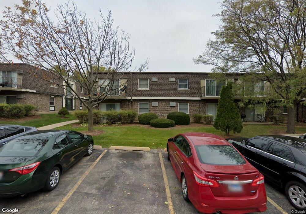
610 Trace Dr Unit 5102 Buffalo Grove, IL 60089
South Buffalo Grove NeighborhoodEstimated Value: $108,000 - $151,000
1
Bed
--
Bath
750
Sq Ft
$180/Sq Ft
Est. Value
About This Home
This home is located at 610 Trace Dr Unit 5102, Buffalo Grove, IL 60089 and is currently estimated at $134,938, approximately $179 per square foot. 610 Trace Dr Unit 5102 is a home located in Cook County with nearby schools including Edgar A. Poe Elementary School, Cooper Middle School, and Buffalo Grove High School.
Ownership History
Date
Name
Owned For
Owner Type
Purchase Details
Closed on
Jan 20, 2015
Sold by
Kittner Ronald
Bought by
Chicago Title Land Trust Company and Trust #Mp-012431
Current Estimated Value
Purchase Details
Closed on
Oct 28, 2013
Sold by
Kittner Ronald and Kittner Karen
Bought by
Kittner Ronald and Kittner Private Trust
Purchase Details
Closed on
Jun 1, 2001
Sold by
Mohammed Saleem A
Bought by
Kittner Ronald and Kittner Karen
Purchase Details
Closed on
Apr 11, 2001
Sold by
Chalupnik
Bought by
Mohammed Saleem A
Create a Home Valuation Report for This Property
The Home Valuation Report is an in-depth analysis detailing your home's value as well as a comparison with similar homes in the area
Home Values in the Area
Average Home Value in this Area
Purchase History
| Date | Buyer | Sale Price | Title Company |
|---|---|---|---|
| Chicago Title Land Trust Company | $40,000 | Chicago Title Land Trust Co | |
| Kittner Ronald | $45,000 | None Available | |
| Kittner Ronald | $60,000 | -- | |
| Mohammed Saleem A | -- | Ticor Title Insurance |
Source: Public Records
Tax History Compared to Growth
Tax History
| Year | Tax Paid | Tax Assessment Tax Assessment Total Assessment is a certain percentage of the fair market value that is determined by local assessors to be the total taxable value of land and additions on the property. | Land | Improvement |
|---|---|---|---|---|
| 2024 | $2,671 | $8,348 | $2,158 | $6,190 |
| 2023 | $2,570 | $8,348 | $2,158 | $6,190 |
| 2022 | $2,570 | $8,348 | $2,158 | $6,190 |
| 2021 | $1,636 | $4,630 | $215 | $4,415 |
| 2020 | $1,592 | $4,630 | $215 | $4,415 |
| 2019 | $1,584 | $5,115 | $215 | $4,900 |
| 2018 | $1,389 | $4,033 | $172 | $3,861 |
| 2017 | $1,363 | $4,033 | $172 | $3,861 |
| 2016 | $1,267 | $4,033 | $172 | $3,861 |
| 2015 | $1,342 | $3,951 | $1,078 | $2,873 |
| 2014 | $1,320 | $3,951 | $1,078 | $2,873 |
| 2013 | $408 | $3,951 | $1,078 | $2,873 |
Source: Public Records
Map
Nearby Homes
- 705 Grove Dr Unit 101
- 751 W Happfield Dr Unit 30
- 715 W Happfield Dr
- 715 W Whiting Ln
- 6 Villa Verde Dr Unit 103
- 812 W Whiting Ln
- 811 W Nichols Rd
- 720 Weidner Rd Unit 302
- 859 Beechwood Rd
- 813 Stradford Cir Unit 21B2
- 18 E Heritage Ct
- 571 Estate Dr
- 921 Bernard Dr
- 3227 N Heritage Ln
- 820 Weidner Rd Unit 4013
- 820 Weidner Rd Unit 409
- 3222 N Heritage Ln
- 1115 Miller Ln Unit 104
- 535 Estate Dr
- 972 Thornton Ln Unit 102
- 610 Trace Dr Unit 5206
- 610 Trace Dr Unit 5202
- 610 Trace Dr Unit 5105
- 610 Trace Dr Unit 5203
- 610 Trace Dr Unit 5106
- 610 Trace Dr Unit 5101
- 610 Trace Dr Unit 5207
- 610 Trace Dr Unit 5104
- 610 Trace Dr Unit 5204
- 610 Trace Dr Unit 5201
- 610 Trace Dr Unit 5103
- 610 Trace Dr Unit 102
- 610 Trace Dr Unit 202
- 610 Trace Dr Unit 106
- 610 Trace Dr Unit 103
- 610 Trace Dr Unit 204
- 610 Trace Dr Unit 104
- 620 Trace Dr Unit 6208
- 620 Trace Dr Unit 6206
- 620 Trace Dr Unit 6203