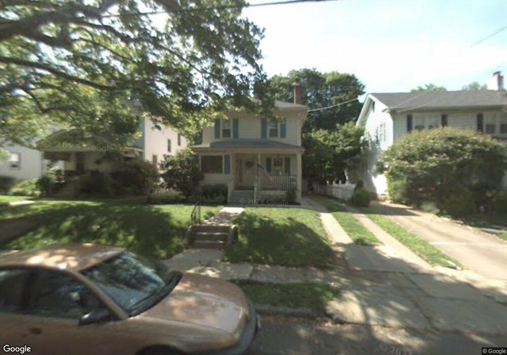
610 W High St Haddon Heights, NJ 08035
Estimated Value: $488,209 - $714,000
--
Bed
--
Bath
1,912
Sq Ft
$293/Sq Ft
Est. Value
About This Home
This home is located at 610 W High St, Haddon Heights, NJ 08035 and is currently estimated at $560,552, approximately $293 per square foot. 610 W High St is a home located in Camden County with nearby schools including Haddon Heights Jr Sr High School, Saint Rose of Lima Catholic School, and Brookfield Elementary School.
Ownership History
Date
Name
Owned For
Owner Type
Purchase Details
Closed on
Jul 19, 1995
Sold by
Lucher Robert J
Bought by
Betz Thomas and Betz Donna
Current Estimated Value
Home Financials for this Owner
Home Financials are based on the most recent Mortgage that was taken out on this home.
Original Mortgage
$88,000
Interest Rate
7.48%
Create a Home Valuation Report for This Property
The Home Valuation Report is an in-depth analysis detailing your home's value as well as a comparison with similar homes in the area
Home Values in the Area
Average Home Value in this Area
Purchase History
| Date | Buyer | Sale Price | Title Company |
|---|---|---|---|
| Betz Thomas | $130,000 | -- |
Source: Public Records
Mortgage History
| Date | Status | Borrower | Loan Amount |
|---|---|---|---|
| Closed | Betz Thomas | $88,000 |
Source: Public Records
Tax History Compared to Growth
Tax History
| Year | Tax Paid | Tax Assessment Tax Assessment Total Assessment is a certain percentage of the fair market value that is determined by local assessors to be the total taxable value of land and additions on the property. | Land | Improvement |
|---|---|---|---|---|
| 2025 | $10,193 | $296,300 | $117,600 | $178,700 |
| 2024 | $10,086 | $296,300 | $117,600 | $178,700 |
| 2023 | $10,086 | $296,300 | $117,600 | $178,700 |
| 2022 | $10,030 | $296,300 | $117,600 | $178,700 |
| 2021 | $10,030 | $296,300 | $117,600 | $178,700 |
| 2020 | $9,867 | $296,300 | $117,600 | $178,700 |
| 2019 | $9,701 | $296,300 | $117,600 | $178,700 |
| 2018 | $9,547 | $296,300 | $117,600 | $178,700 |
| 2017 | $9,295 | $296,300 | $117,600 | $178,700 |
| 2016 | $9,150 | $296,300 | $117,600 | $178,700 |
| 2015 | $8,960 | $296,300 | $117,600 | $178,700 |
| 2014 | $8,676 | $296,300 | $117,600 | $178,700 |
Source: Public Records
Map
Nearby Homes
- 401 E Atlantic Ave Unit U217
- 318 White Horse Pike
- 425 White Horse Pike
- 225 9th Ave
- 139 Albany Ave
- 302 3rd Ave
- 300 Austin Ave
- 325 Albany Ave
- 301 Station Ave
- 406 Austin Ave
- 107 9th Ave
- 134 Kent Rd
- 325 Reading Ave
- 233 Haines Ave
- 499 Austin Ave
- 330 Haines Ave
- 305 Crest Ave
- 47 E Kings Hwy
- 118 Woodland Ave
- 115 Woodland Ave
- 612 W High St
- 608 W High St
- 614 W High St
- 606 W High St
- 602 W High St
- 611 W High St
- 615 W High St
- 607 W High St
- 600 W High St
- 605 W High St
- 603 W High St
- 601 W High St
- 616 Sycamore Terrace
- 614 Sycamore Terrace
- 618 Sycamore Terrace
- 612 Sycamore Terrace
- 620 Sycamore Terrace
- 610 Sycamore Terrace
- 622 Sycamore Terrace
- 608 Sycamore Terrace