610 W Nursery Rd Rogers, AR 72758
--
Bed
--
Bath
58,600
Sq Ft
8.02
Acres
About This Home
This home is located at 610 W Nursery Rd, Rogers, AR 72758. 610 W Nursery Rd is a home located in Benton County with nearby schools including Jones Elementary School, Kirksey Middle School, and Rogers High School.
Ownership History
Date
Name
Owned For
Owner Type
Purchase Details
Closed on
Nov 16, 2022
Sold by
Eason Distribution & Warehousing Llc
Bought by
6420 Bentonville Rogers Llc
Home Financials for this Owner
Home Financials are based on the most recent Mortgage that was taken out on this home.
Original Mortgage
$3,782,500
Outstanding Balance
$231,369
Interest Rate
6.94%
Mortgage Type
New Conventional
Purchase Details
Closed on
Apr 25, 1991
Bought by
Infomat
Purchase Details
Closed on
Mar 31, 1986
Bought by
Pelfreez
Purchase Details
Closed on
Apr 9, 1985
Bought by
First National Bank & Trust Co
Purchase Details
Closed on
Aug 5, 1981
Bought by
Yaffe
Create a Home Valuation Report for This Property
The Home Valuation Report is an in-depth analysis detailing your home's value as well as a comparison with similar homes in the area
Home Values in the Area
Average Home Value in this Area
Purchase History
| Date | Buyer | Sale Price | Title Company |
|---|---|---|---|
| 6420 Bentonville Rogers Llc | $4,450,000 | City Title & Closing | |
| Infomat | $200,000 | -- | |
| Pelfreez | $38,000 | -- | |
| First National Bank & Trust Co | $350,000 | -- | |
| Stevenson | $38,000 | -- | |
| Yaffe | -- | -- |
Source: Public Records
Mortgage History
| Date | Status | Borrower | Loan Amount |
|---|---|---|---|
| Open | 6420 Bentonville Rogers Llc | $3,782,500 |
Source: Public Records
Tax History Compared to Growth
Tax History
| Year | Tax Paid | Tax Assessment Tax Assessment Total Assessment is a certain percentage of the fair market value that is determined by local assessors to be the total taxable value of land and additions on the property. | Land | Improvement |
|---|---|---|---|---|
| 2025 | $32,976 | $809,451 | $115,286 | $694,165 |
| 2024 | $29,492 | $809,451 | $115,286 | $694,165 |
| 2023 | $26,811 | $506,820 | $74,410 | $432,410 |
| 2022 | $27,875 | $506,820 | $74,410 | $432,410 |
| 2021 | $27,804 | $506,820 | $74,410 | $432,410 |
| 2020 | $25,330 | $478,090 | $83,150 | $394,940 |
| 2019 | $23,641 | $478,090 | $83,150 | $394,940 |
| 2018 | $21,952 | $478,090 | $83,150 | $394,940 |
| 2017 | $17,560 | $478,090 | $83,150 | $394,940 |
| 2016 | $17,560 | $478,090 | $83,150 | $394,940 |
| 2015 | $16,271 | $307,580 | $97,820 | $209,760 |
| 2014 | $16,271 | $307,580 | $97,820 | $209,760 |
Source: Public Records
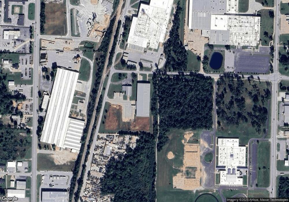
Map
Nearby Homes
- 9.02 Acres W Dyke Rd
- 2221 S 9th St
- 906 W Geneva St
- 1904 S 8th St
- 2006 S 11th St
- 122 E Glendale Ln
- 407 E Mccann Rd
- 1100 W Banz Rd
- 2911 S D St
- 1003 W Price Ln
- 1101 W Price Ln
- 0 Hwy 94 Dr Unit 1239629
- 2004 S 12th St
- 2011 S 13th St
- 3108 & 3110 S B St
- 825 W Linden St
- 1303 W Banz Rd
- 1008 W Linden St
- 3210 S 3rd St
- 1012 W Linden St
- 610 E Wire Dr
- 620 W Nursery Rd
- 2327 Rt 5 Box 739
- 2305
- 2101 S 7th St
- 2111 S 8th St
- 233 W Nursery Rd
- 2922 S 1st St
- 2204-C S 8th St
- 600 W Dyke Rd
- 2114 S 8th St
- 2802 Rt 1
- 2118 S 8th St
- 2710 Rt 1 Box 134 A
- 2202 S 8th St
- 25 W Nursery Rd
- 28 W Nursery Rd
- 45 1st Str S & Nursery
- 2705 S 1st St
- 2301 S 8th Str St