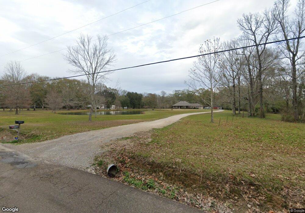
6100 MacHost Rd Zachary, LA 70791
Estimated Value: $492,000 - $511,848
--
Bed
--
Bath
2,386
Sq Ft
$211/Sq Ft
Est. Value
About This Home
This home is located at 6100 MacHost Rd, Zachary, LA 70791 and is currently estimated at $504,212, approximately $211 per square foot. 6100 MacHost Rd is a home located in East Baton Rouge Parish with nearby schools including Rollins Place Elementary School, Northwestern Elementary School, and Zachary Elementary School.
Ownership History
Date
Name
Owned For
Owner Type
Purchase Details
Closed on
Oct 29, 2025
Sold by
Savario Michael Thomas and Savario Gwendolon
Bought by
Fox Brant and Fox Kris
Current Estimated Value
Purchase Details
Closed on
Oct 28, 2016
Sold by
Hooge Stephen Edwared and Hooge Sarah Mier
Bought by
Savario Michael and Savario Gwendolon
Home Financials for this Owner
Home Financials are based on the most recent Mortgage that was taken out on this home.
Original Mortgage
$234,000
Interest Rate
3.5%
Mortgage Type
New Conventional
Create a Home Valuation Report for This Property
The Home Valuation Report is an in-depth analysis detailing your home's value as well as a comparison with similar homes in the area
Home Values in the Area
Average Home Value in this Area
Purchase History
| Date | Buyer | Sale Price | Title Company |
|---|---|---|---|
| Fox Brant | $502,000 | Cypress Title | |
| Savario Michael | $390,000 | Cypress Title Llc |
Source: Public Records
Mortgage History
| Date | Status | Borrower | Loan Amount |
|---|---|---|---|
| Previous Owner | Savario Michael | $234,000 |
Source: Public Records
Tax History Compared to Growth
Tax History
| Year | Tax Paid | Tax Assessment Tax Assessment Total Assessment is a certain percentage of the fair market value that is determined by local assessors to be the total taxable value of land and additions on the property. | Land | Improvement |
|---|---|---|---|---|
| 2024 | $5,020 | $48,048 | $11,458 | $36,590 |
| 2023 | $5,183 | $42,900 | $10,230 | $32,670 |
| 2022 | $5,380 | $42,900 | $10,230 | $32,670 |
| 2021 | $5,380 | $42,900 | $10,230 | $32,670 |
| 2020 | $5,335 | $42,900 | $10,230 | $32,670 |
| 2019 | $5,337 | $39,000 | $9,300 | $29,700 |
| 2018 | $5,356 | $39,000 | $9,300 | $29,700 |
| 2017 | $5,356 | $39,000 | $9,300 | $29,700 |
| 2016 | $3,011 | $29,600 | $9,300 | $20,300 |
| 2015 | $2,939 | $29,600 | $9,300 | $20,300 |
| 2014 | $2,930 | $29,600 | $9,300 | $20,300 |
| 2013 | -- | $12,300 | $9,300 | $3,000 |
Source: Public Records
Map
Nearby Homes
- 8807 Black Birch Ave
- 6729 Royal Oaks Ct
- 7945 Main St
- 8862 Reserve Oak Ave
- 7800-7900 La Hwy 64
- 9067 Redwood Lake Blvd
- 8276 Main St
- 9033 Reserve Oak Ave
- 8382 Main St
- 9188 Redwood Lake Blvd
- 9255 Redwood Lake Blvd
- 20611 Plank Rd
- 20671 Plank Rd
- 9981 Main St
- 22115 MacHost Rd
- 19533 Plank Rd
- 5702 Blvd
- 5708 Montegudo Blvd
- 5710 Montegudo Blvd
- 5704 Montegudo Blvd
- 20788 McHost Rd
- 5800 MacHost Rd
- 5800 McHost Rd
- 6120 MacHost Rd
- 20833 MacHost Rd
- 6150 MacHost Rd
- 6434 MacHost Rd
- 20823 McHost Rd
- 20833 McHost Rd
- 20661 MacHost Rd
- 20661 MacHost Rd
- 20823 MacHost Rd
- 20650 MacHost Rd
- 20650 MacHost Rd
- 20650 MacHost Rd
- 20934 MacHost Rd
- 20600 MacHost Rd
- 20549 MacHost Rd
- 20948 MacHost Rd
- 20966 MacHost Rd