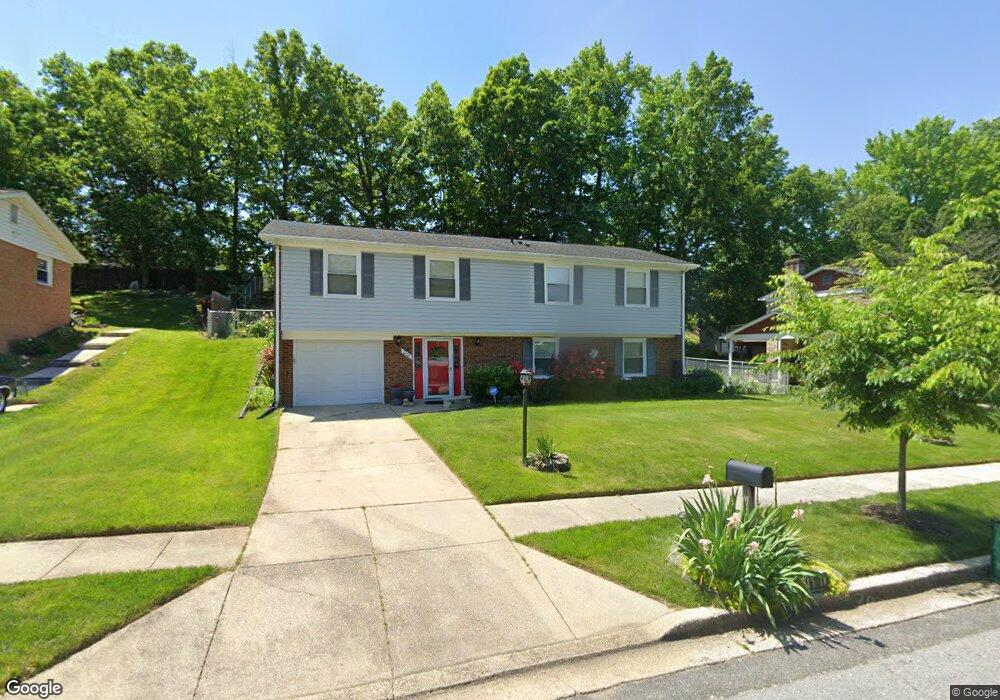
6101 Armor Dr Clinton, MD 20735
Estimated Value: $412,000 - $464,000
3
Beds
3
Baths
1,323
Sq Ft
$325/Sq Ft
Est. Value
About This Home
This home is located at 6101 Armor Dr, Clinton, MD 20735 and is currently estimated at $429,470, approximately $324 per square foot. 6101 Armor Dr is a home located in Prince George's County with nearby schools including Waldon Woods Elementary School, Stephen Decatur Middle School, and Surrattsville High School.
Ownership History
Date
Name
Owned For
Owner Type
Purchase Details
Closed on
May 10, 2011
Sold by
Deutsche Bank Natl Tr Co
Bought by
Hall Elsie
Current Estimated Value
Purchase Details
Closed on
Apr 18, 2011
Sold by
Deutsche Bank Natl Tr Co
Bought by
Hall Elsie
Purchase Details
Closed on
Jan 26, 2005
Sold by
Williams Marion L
Bought by
Habte Seare Etal
Home Financials for this Owner
Home Financials are based on the most recent Mortgage that was taken out on this home.
Original Mortgage
$234,000
Interest Rate
6.75%
Mortgage Type
Adjustable Rate Mortgage/ARM
Create a Home Valuation Report for This Property
The Home Valuation Report is an in-depth analysis detailing your home's value as well as a comparison with similar homes in the area
Home Values in the Area
Average Home Value in this Area
Purchase History
| Date | Buyer | Sale Price | Title Company |
|---|---|---|---|
| Hall Elsie | $110,250 | -- | |
| Hall Elsie | $110,250 | -- | |
| Habte Seare Etal | $260,000 | -- |
Source: Public Records
Mortgage History
| Date | Status | Borrower | Loan Amount |
|---|---|---|---|
| Previous Owner | Habte Seare Etal | $234,000 |
Source: Public Records
Tax History
| Year | Tax Paid | Tax Assessment Tax Assessment Total Assessment is a certain percentage of the fair market value that is determined by local assessors to be the total taxable value of land and additions on the property. | Land | Improvement |
|---|---|---|---|---|
| 2025 | $4,667 | $350,100 | $101,200 | $248,900 |
| 2024 | $4,667 | $331,867 | -- | -- |
| 2023 | $4,773 | $313,633 | $0 | $0 |
| 2022 | $4,549 | $295,400 | $101,200 | $194,200 |
| 2021 | $4,347 | $280,600 | $0 | $0 |
| 2020 | $4,250 | $265,800 | $0 | $0 |
| 2019 | $4,128 | $251,000 | $100,600 | $150,400 |
| 2018 | $3,971 | $240,433 | $0 | $0 |
| 2017 | $3,814 | $229,867 | $0 | $0 |
| 2016 | -- | $219,300 | $0 | $0 |
| 2015 | $3,335 | $215,800 | $0 | $0 |
| 2014 | $3,335 | $212,300 | $0 | $0 |
Source: Public Records
Map
Nearby Homes
- 10100 White Ave
- 6118 Hellen Lee Dr
- 10003 Armor Ct
- 10309 Brandywine Rd
- 6309 Gredinger Dr
- 9618 Small Dr
- 6410 Killarney St
- F Gwynndale Dr
- 9505 Pryde Dr
- 6706 Surratts Rd
- 6206 Clinton Way
- 6702 Purple Lilac Ln
- 9601 Hale Dr
- 9917 Raintree Way
- 7001 Killarney St
- 7002 Killarney St
- 7106 Firebrush Ct
- 9146 Hardesty Dr
- 6420 Brooke Jane Dr
- 9515 Piscataway Rd
- 6103 Armor Dr
- 6011 Armor Dr
- 6002 Terence Dr
- 6004 Terence Dr
- 6000 Terence Dr
- 6105 Armor Dr
- 6009 Armor Dr
- 6102 Armor Dr
- 6006 Terence Dr
- 5912 Terence Dr
- 10004 Derrick Place
- 6104 Armor Dr
- 6007 Armor Dr
- 10005 Derrick Place
- 6008 Terence Dr
- 5910 Terence Dr
- 6106 Armor Dr
- 6006 Armor Dr
- 6003 Terence Dr
- 6005 Terence Dr
Your Personal Tour Guide
Ask me questions while you tour the home.