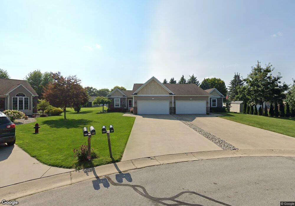
6101 Foxwood Ct Saginaw, MI 48638
Estimated Value: $168,000 - $214,000
2
Beds
2
Baths
1,376
Sq Ft
$140/Sq Ft
Est. Value
About This Home
This home is located at 6101 Foxwood Ct, Saginaw, MI 48638 and is currently estimated at $192,960, approximately $140 per square foot. 6101 Foxwood Ct is a home located in Saginaw County with nearby schools including Arrowwood Elementary School, Westdale Elementary School, and White Pine Middle School.
Ownership History
Date
Name
Owned For
Owner Type
Purchase Details
Closed on
May 11, 2009
Sold by
Mccaul Scott and Mccaul Mary Ann
Bought by
Johnson Kurt and Johnson Darla
Current Estimated Value
Home Financials for this Owner
Home Financials are based on the most recent Mortgage that was taken out on this home.
Original Mortgage
$132,750
Interest Rate
5.29%
Mortgage Type
Unknown
Purchase Details
Closed on
Oct 9, 2006
Sold by
Cjw Properties Llc
Bought by
Johnson Kurt R and Johnson Darla A
Create a Home Valuation Report for This Property
The Home Valuation Report is an in-depth analysis detailing your home's value as well as a comparison with similar homes in the area
Home Values in the Area
Average Home Value in this Area
Purchase History
| Date | Buyer | Sale Price | Title Company |
|---|---|---|---|
| Johnson Kurt | -- | -- | |
| Johnson Kurt R | -- | -- |
Source: Public Records
Mortgage History
| Date | Status | Borrower | Loan Amount |
|---|---|---|---|
| Previous Owner | Johnson Kurt | $132,750 |
Source: Public Records
Tax History Compared to Growth
Tax History
| Year | Tax Paid | Tax Assessment Tax Assessment Total Assessment is a certain percentage of the fair market value that is determined by local assessors to be the total taxable value of land and additions on the property. | Land | Improvement |
|---|---|---|---|---|
| 2025 | $4,428 | $93,300 | $0 | $0 |
| 2024 | $2,974 | $94,900 | $0 | $0 |
| 2023 | $2,831 | $85,400 | $0 | $0 |
| 2022 | $3,897 | $77,300 | $0 | $0 |
| 2021 | $3,651 | $77,000 | $0 | $0 |
| 2020 | $3,577 | $65,400 | $0 | $0 |
| 2019 | $3,450 | $64,100 | $4,200 | $59,900 |
| 2018 | $2,298 | $64,000 | $0 | $0 |
| 2017 | $3,164 | $64,300 | $0 | $0 |
| 2016 | $3,131 | $67,200 | $0 | $0 |
| 2014 | $3,016 | $65,100 | $0 | $59,400 |
| 2013 | -- | $61,200 | $0 | $0 |
Source: Public Records
Map
Nearby Homes
- 58 Deer Trail
- 73 Foxwood Dr
- 75 Foxwood Dr
- 74 Foxwood Dr
- 76 Foxwood Dr
- 79 Deer Trail
- 80 Deer Trail
- 6235 Dewhirst Dr
- 70 Bunny Trail
- 72 Bunny Trail
- 71 Bunny Trail
- 69 Bunny Trail
- 68 Bunny Trail
- 67 Bunny Trail
- 62 Bunny Trail
- 63 Bunny Trail
- 1900 Bunny Trail
- 1439 Midland Rd
- 1839 Kingston Dr
- 1607 Cranbrook Dr
- 6103 Foxwood Ct
- 6097 Foxwood Ct
- 1554 Bryn Mawr Place
- 6095 Foxwood Ct
- 6107 Normandy Dr
- 6101 Normandy Dr Unit 54
- 6105 Normandy Dr
- 6091 Foxwood Ct Unit 46
- 6099 Normandy Dr Unit 54
- 6089 Foxwood Ct
- 6108 Amanda Dr
- 6118 Amanda Dr
- 6135 Normandy Dr
- 1576 Bryn Mawr Place
- 6130 Amanda Dr Unit 78
- 6091 Normandy Dr Unit 52
- 6092 Amanda Dr
- 6089 Normandy Dr
- 6072 Amanda Dr
- 6120 Amanda Dr