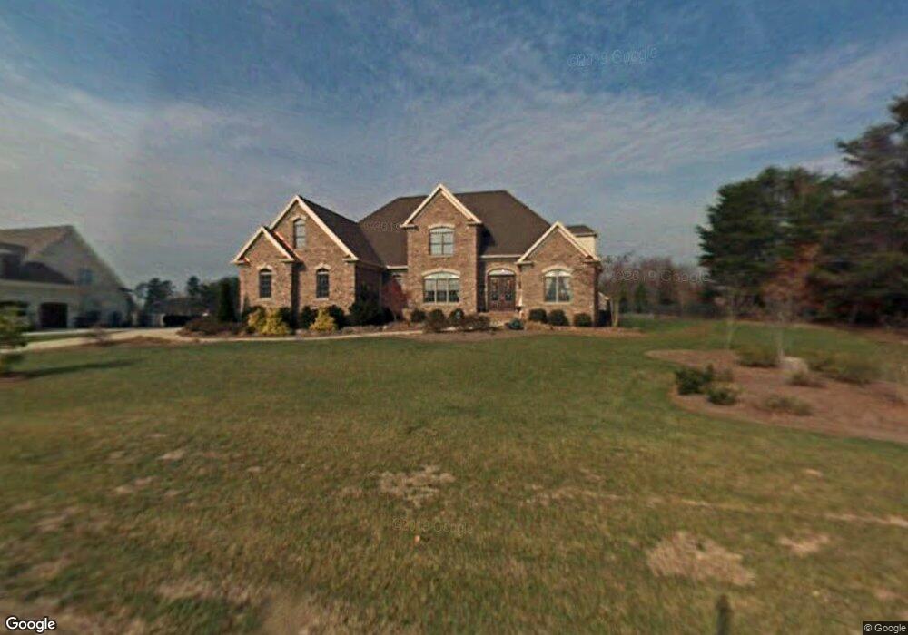
6102 Bascom Dr Summerfield, NC 27358
Estimated Value: $883,000 - $1,009,000
4
Beds
5
Baths
4,372
Sq Ft
$215/Sq Ft
Est. Value
About This Home
This home is located at 6102 Bascom Dr, Summerfield, NC 27358 and is currently estimated at $941,256, approximately $215 per square foot. 6102 Bascom Dr is a home located in Guilford County with nearby schools including Summerfield Elementary School, Northern Guilford Middle School, and Northern Guilford High School.
Ownership History
Date
Name
Owned For
Owner Type
Purchase Details
Closed on
Sep 26, 2003
Sold by
Lemly Regina
Bought by
Lemly Regina
Current Estimated Value
Purchase Details
Closed on
Sep 16, 2002
Sold by
Combs Inc
Bought by
Lemly Regina G
Home Financials for this Owner
Home Financials are based on the most recent Mortgage that was taken out on this home.
Original Mortgage
$463,200
Interest Rate
6.3%
Create a Home Valuation Report for This Property
The Home Valuation Report is an in-depth analysis detailing your home's value as well as a comparison with similar homes in the area
Home Values in the Area
Average Home Value in this Area
Purchase History
| Date | Buyer | Sale Price | Title Company |
|---|---|---|---|
| Lemly Regina | -- | -- | |
| Lemly Regina | $49,000 | -- | |
| Lemly Regina G | $579,000 | -- |
Source: Public Records
Mortgage History
| Date | Status | Borrower | Loan Amount |
|---|---|---|---|
| Previous Owner | Lemly Regina G | $463,200 |
Source: Public Records
Tax History Compared to Growth
Tax History
| Year | Tax Paid | Tax Assessment Tax Assessment Total Assessment is a certain percentage of the fair market value that is determined by local assessors to be the total taxable value of land and additions on the property. | Land | Improvement |
|---|---|---|---|---|
| 2025 | $6,508 | $732,100 | $114,000 | $618,100 |
| 2024 | $6,508 | $732,100 | $114,000 | $618,100 |
| 2023 | $6,508 | $732,100 | $114,000 | $618,100 |
| 2022 | $6,508 | $732,100 | $114,000 | $618,100 |
| 2021 | $5,164 | $580,900 | $97,800 | $483,100 |
| 2020 | $5,164 | $580,900 | $97,800 | $483,100 |
| 2019 | $5,164 | $580,900 | $0 | $0 |
| 2018 | $5,138 | $580,900 | $0 | $0 |
| 2017 | $5,164 | $580,900 | $0 | $0 |
| 2016 | $5,279 | $577,900 | $0 | $0 |
| 2015 | $5,308 | $577,900 | $0 | $0 |
| 2014 | $5,197 | $559,700 | $0 | $0 |
Source: Public Records
Map
Nearby Homes
- 7107 Lake Henson Dr
- 7020 Marseilles Ct
- 5603 Monk Ct
- 7376 Henson Forest Dr
- 7399 Henson Forest Dr
- 6981 Brandi Wood Cir
- 7004 Westfield Village Cir
- 6998 Colleen Ct
- 7291 Henson Forest Dr
- 7003 Pearson Run Ct
- 7524 Whitaker Dr
- 2327 Scalesville Rd
- 7107 Lanier Rd
- 7825 Spencer Brook Dr
- 7819 Wilson Farm Rd
- 5405 Briardenn Ct
- 5408 Briardenn Ct
- 5680 Green Dale Ct
- 7539 Shadow Creek Dr
- 7533 Shadow Creek Dr
- 6104 Bascom Dr
- 7201 Henson Farm Way
- 6103 Bascom Dr
- 7203 Henson Farm Way
- 6105 Bascom Dr
- 7111 Henson Farm Way
- 6106 Bascom Dr
- 6107 Bascom Dr
- 7205 Henson Farm Way
- 7109 Henson Farm Way
- 7200 Henson Farm Way
- 7207 Henson Farm Way
- 7104 Henson Farm Way
- 3674 Oak Ridge Rd
- 7202 Henson Farm Way
- 7107 Henson Farm Way
- 5904 Snow Hill Dr
- 7209 Henson Farm Way
- 7105 Henson Farm Way
- 3672 Oak Ridge Rd