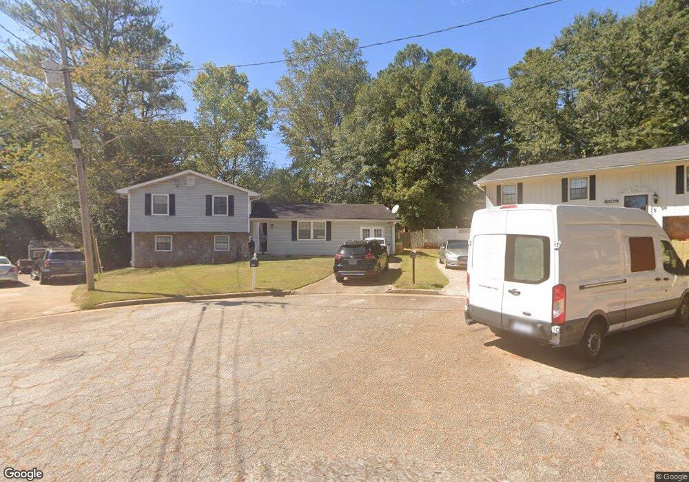
6102 Michael Rd Unit 6 Lithonia, GA 30058
Estimated Value: $211,302 - $223,000
3
Beds
2
Baths
1,556
Sq Ft
$139/Sq Ft
Est. Value
About This Home
This home is located at 6102 Michael Rd Unit 6, Lithonia, GA 30058 and is currently estimated at $216,326, approximately $139 per square foot. 6102 Michael Rd Unit 6 is a home located in DeKalb County with nearby schools including Panola Way Elementary School, Lithonia Middle School, and Lithonia High School.
Ownership History
Date
Name
Owned For
Owner Type
Purchase Details
Closed on
May 25, 2000
Sold by
Ali Rashad Z
Bought by
Hutton Angelia
Current Estimated Value
Home Financials for this Owner
Home Financials are based on the most recent Mortgage that was taken out on this home.
Original Mortgage
$102,200
Interest Rate
8.3%
Mortgage Type
FHA
Purchase Details
Closed on
Dec 21, 1999
Sold by
Collins Leon E and Collins Lois T
Bought by
Ali Rashad Z
Home Financials for this Owner
Home Financials are based on the most recent Mortgage that was taken out on this home.
Original Mortgage
$37,223
Interest Rate
7.67%
Mortgage Type
New Conventional
Create a Home Valuation Report for This Property
The Home Valuation Report is an in-depth analysis detailing your home's value as well as a comparison with similar homes in the area
Home Values in the Area
Average Home Value in this Area
Purchase History
| Date | Buyer | Sale Price | Title Company |
|---|---|---|---|
| Hutton Angelia | $102,800 | -- | |
| Ali Rashad Z | $37,300 | -- |
Source: Public Records
Mortgage History
| Date | Status | Borrower | Loan Amount |
|---|---|---|---|
| Previous Owner | Hutton Angelia | $102,200 | |
| Previous Owner | Ali Rashad Z | $37,223 |
Source: Public Records
Tax History Compared to Growth
Tax History
| Year | Tax Paid | Tax Assessment Tax Assessment Total Assessment is a certain percentage of the fair market value that is determined by local assessors to be the total taxable value of land and additions on the property. | Land | Improvement |
|---|---|---|---|---|
| 2025 | $2,831 | $87,280 | $15,000 | $72,280 |
| 2024 | $2,998 | $89,440 | $15,000 | $74,440 |
| 2023 | $2,998 | $83,360 | $15,000 | $68,360 |
| 2022 | $2,297 | $68,680 | $15,000 | $53,680 |
| 2021 | $1,877 | $56,480 | $6,000 | $50,480 |
| 2020 | $1,434 | $43,480 | $6,000 | $37,480 |
| 2019 | $1,137 | $35,160 | $6,000 | $29,160 |
| 2018 | $994 | $33,920 | $6,000 | $27,920 |
| 2017 | $954 | $29,040 | $3,360 | $25,680 |
| 2016 | $819 | $25,720 | $3,360 | $22,360 |
| 2014 | $931 | $28,920 | $3,360 | $25,560 |
Source: Public Records
Map
Nearby Homes
- 2285 Cherokee Valley Cir Unit III
- 2211 Jonathan Ave
- 2247 Cherokee Valley Dr
- 2293 Cherokee Valley Dr Unit 3
- 2169 Tiffany Ln
- 2128 Tiffany Ln
- 6126 Marbut Rd Unit II
- 6182 Saint Charles Ct
- 6047 Marbut Rd
- 6202 Saint Christophers Ct
- 6185 Marbut Farms Chase
- 6082 Raintree Bend
- 2138 Tiffany Trail
- 2039 Raintree Place
- 6248 Marbut Farms Ln
- 2360 Anne's Lake Cir
- 2067 Raintree Place
- 1882 Corners Cir
- 2158 Sara Ashley Way
- 2045 Lown Farm Trail Unit 3
- 6110 Michael Rd
- 6109 Michael Rd
- 2291 Cherokee Valley Cir
- 0 Michael Rd Unit 3129070
- 2279 Cherokee Valley Cir
- 2297 Cherokee Valley Cir
- 6116 Michael Rd
- 6115 Michael Rd
- 2273 Cherokee Valley Cir
- 2303 Cherokee Valley Cir
- 6111 Dana Ct
- 2192 Jonathan Ave
- 2204 Jonathan Ave Unit 6
- 6108 Phillip Ln
- 6114 Phillip Ln
- 2186 Jonathan Ave
- 6117 Dana Ct
- 2292 Cherokee Valley Cir
- 2269 Cherokee Valley Cir
- 2307 Cherokee Valley Cir