Estimated Value: $722,000 - $793,000
3
Beds
3
Baths
1,622
Sq Ft
$464/Sq Ft
Est. Value
About This Home
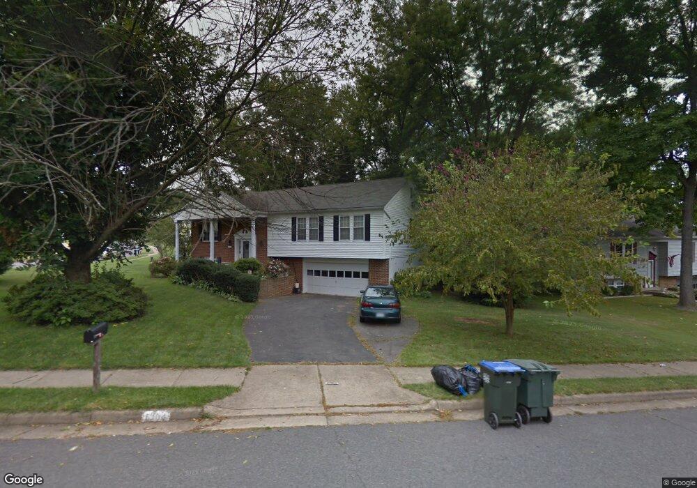
This home is located at 6104 Covered Bridge Rd, Burke, VA 22015 and is currently estimated at $752,271, approximately $463 per square foot. 6104 Covered Bridge Rd is a home located in Fairfax County with nearby schools including Lake Braddock Secondary School, Nativity Catholic School, and Fairfax Baptist Temple Academy.
Ownership History
Date
Name
Owned For
Owner Type
Purchase Details
Closed on
Aug 26, 1998
Sold by
Mitra Mihir K
Bought by
Long Lester L
Current Estimated Value
Home Financials for this Owner
Home Financials are based on the most recent Mortgage that was taken out on this home.
Original Mortgage
$202,000
Outstanding Balance
$43,150
Interest Rate
6.9%
Estimated Equity
$709,121
Create a Home Valuation Report for This Property
The Home Valuation Report is an in-depth analysis detailing your home's value as well as a comparison with similar homes in the area
Home Values in the Area
Average Home Value in this Area
Purchase History
| Date | Buyer | Sale Price | Title Company |
|---|---|---|---|
| Long Lester L | $208,000 | -- |
Source: Public Records
Mortgage History
| Date | Status | Borrower | Loan Amount |
|---|---|---|---|
| Open | Long Lester L | $202,000 |
Source: Public Records
Tax History Compared to Growth
Tax History
| Year | Tax Paid | Tax Assessment Tax Assessment Total Assessment is a certain percentage of the fair market value that is determined by local assessors to be the total taxable value of land and additions on the property. | Land | Improvement |
|---|---|---|---|---|
| 2025 | $8,118 | $717,700 | $276,000 | $441,700 |
| 2024 | $8,118 | $700,760 | $276,000 | $424,760 |
| 2023 | $7,214 | $639,290 | $246,000 | $393,290 |
| 2022 | $7,358 | $643,420 | $246,000 | $397,420 |
| 2021 | $7,031 | $599,160 | $216,000 | $383,160 |
| 2020 | $6,512 | $550,250 | $206,000 | $344,250 |
| 2019 | $6,267 | $529,490 | $206,000 | $323,490 |
| 2018 | $6,267 | $529,490 | $206,000 | $323,490 |
| 2017 | $5,977 | $514,830 | $201,000 | $313,830 |
| 2016 | $5,722 | $493,920 | $201,000 | $292,920 |
| 2015 | $5,401 | $483,920 | $191,000 | $292,920 |
| 2014 | $5,204 | $467,340 | $191,000 | $276,340 |
Source: Public Records
Map
Nearby Homes
- 9505 Scorpio Ln
- 9715 Church Way
- 9523 Cherry Oak Ct
- 9521 Cherry Oak Ct
- 6003 Lincolnwood Ct
- 6200 Erman Ct
- 9239 Sand Creek Ct
- 6314 Draco St
- 5922 New England Woods Dr
- 5838 High Bluff Ct
- 9515 Debra Spradlin Ct
- 9075 Andromeda Dr
- 9316 Lee St
- 9983 Hemlock Woods Ln
- 5947 New England Woods Dr
- 6433 Fenestra Ct Unit 56B
- 5714 Mason Bluff Dr
- 5658 Sutherland Ct
- 9662 Westport Ln
- 5808 Wood Laurel Ct
- 6102 Covered Bridge Rd
- 9602 Scorpio Ct
- 9601 Scorpio Ct
- 6105 Covered Bridge Rd
- 9604 Scorpio Ct
- 6103 Covered Bridge Rd
- 9515 Burning Branch Rd
- 9603 Scorpio Ct
- 9517 Burning Branch Rd
- 6107 Covered Bridge Rd
- 9513 Burning Branch Rd
- 6108 Covered Bridge Rd
- 6104 Mantlepiece Ct
- 9606 Scorpio Ct
- 9519 Burning Branch Rd
- 6102 Mantlepiece Ct
- 6105 Harvester Ct
- 9605 Scorpio Ct
- 9511 Scorpio Ln
- 6109 Covered Bridge Rd