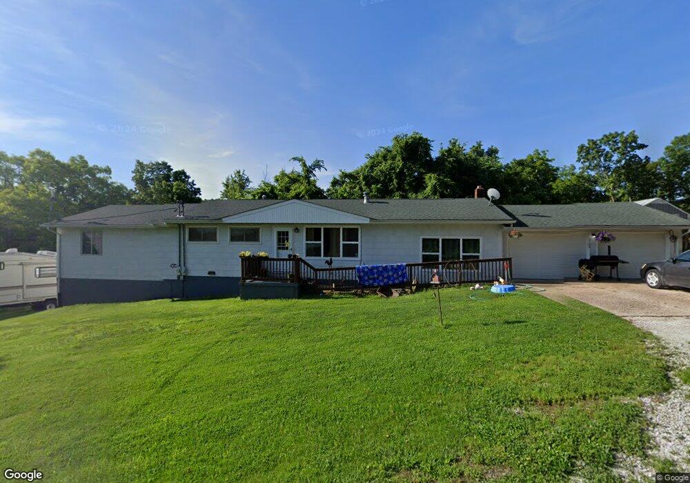
6104 Dry Branch Rd Saint Clair, MO 63077
Estimated Value: $168,000 - $274,000
4
Beds
1
Bath
1,728
Sq Ft
$128/Sq Ft
Est. Value
About This Home
This home is located at 6104 Dry Branch Rd, Saint Clair, MO 63077 and is currently estimated at $220,673, approximately $127 per square foot. 6104 Dry Branch Rd is a home located in Franklin County with nearby schools including St. Clair Elementary School, Edgar Murray Elementary School, and St. Clair Junior High School.
Ownership History
Date
Name
Owned For
Owner Type
Purchase Details
Closed on
Apr 15, 2024
Sold by
Fryer Raymond and Fryer Michaela Diane
Bought by
Fryer Raymond and Fryer Michaela Diane
Current Estimated Value
Home Financials for this Owner
Home Financials are based on the most recent Mortgage that was taken out on this home.
Original Mortgage
$83,625
Outstanding Balance
$82,063
Interest Rate
6.88%
Mortgage Type
New Conventional
Estimated Equity
$138,610
Purchase Details
Closed on
May 30, 2023
Sold by
Suntrup Mary S
Bought by
Fryer Raymond and Heembrock Diane
Home Financials for this Owner
Home Financials are based on the most recent Mortgage that was taken out on this home.
Original Mortgage
$76,830
Interest Rate
6.39%
Mortgage Type
New Conventional
Purchase Details
Closed on
Dec 29, 2020
Sold by
Suntrup Mary S
Bought by
Busby Debra and Busby Larry F
Home Financials for this Owner
Home Financials are based on the most recent Mortgage that was taken out on this home.
Original Mortgage
$69,600
Interest Rate
2.7%
Mortgage Type
New Conventional
Purchase Details
Closed on
Jun 7, 2006
Sold by
Suntrup Charlene J
Bought by
Suntrup Mary S
Create a Home Valuation Report for This Property
The Home Valuation Report is an in-depth analysis detailing your home's value as well as a comparison with similar homes in the area
Purchase History
| Date | Buyer | Sale Price | Title Company |
|---|---|---|---|
| Fryer Raymond | -- | None Listed On Document | |
| Fryer Raymond | -- | None Listed On Document | |
| Busby Debra | -- | None Available | |
| Suntrup Mary S | -- | None Available | |
| Suntrup Mary S | -- | None Available |
Source: Public Records
Mortgage History
| Date | Status | Borrower | Loan Amount |
|---|---|---|---|
| Open | Fryer Raymond | $83,625 | |
| Previous Owner | Fryer Raymond | $76,830 | |
| Previous Owner | Suntrup Mary S | $69,600 |
Source: Public Records
Tax History
| Year | Tax Paid | Tax Assessment Tax Assessment Total Assessment is a certain percentage of the fair market value that is determined by local assessors to be the total taxable value of land and additions on the property. | Land | Improvement |
|---|---|---|---|---|
| 2025 | $1,547 | $25,566 | $0 | $0 |
| 2024 | $1,547 | $28,270 | $0 | $0 |
| 2023 | $1,541 | $28,270 | $0 | $0 |
| 2022 | $1,389 | $25,388 | $0 | $0 |
| 2021 | $1,386 | $25,388 | $0 | $0 |
| 2020 | $1,365 | $23,963 | $0 | $0 |
| 2019 | $1,352 | $23,963 | $0 | $0 |
| 2018 | $1,226 | $21,458 | $0 | $0 |
| 2017 | $1,225 | $21,458 | $0 | $0 |
| 2016 | $1,137 | $19,880 | $0 | $0 |
| 2015 | $1,044 | $19,880 | $0 | $0 |
| 2014 | $1,055 | $20,039 | $0 | $0 |
Source: Public Records
Map
Nearby Homes
- 0 Perkins Rd Unit MIS26002042
- 5546 Dry Branch Rd
- 481 Family Rd
- 2707 N Service Rd W
- 3080 Westwood Rd
- 317 Fern Ct
- 0 Highland Fling
- 0 St Clair Station Ln Unit MIS25068128
- 1322 Reiker Ford Rd
- 36+/- Acres Highland Fling
- 22+/- Acres Highland Fling
- 58.74 Acres Highland Fling
- 1232 W Springfield Rd
- 000
- 0 Peacock Rd
- 1675 Peacock Rd
- 2175 Neier Rd
- 0 Oakridge Estate Block 2 Lot 40 Unit MIS25078527
- 1362 Oakwood Dr
- 0 Oakwood Dr
- 6086 Dry Branch Rd
- 0Tract 4 Dry Branch Rd
- 0Tract 2 Dry Branch Rd
- 0Tract 1 Dry Branch Rd
- 0Tract 6 Dry Branch Rd
- 0Tract 12 Dry Branch Rd
- 0Tract 5 Dry Branch Rd
- 0Tract 3 Dry Branch Rd
- 6067 Dry Branch Rd
- 754 Saint Louis Inn Rd
- 776 Saint Louis Inn Rd
- 6065 Dry Branch Rd
- 6032 Dry Branch Rd
- 6187 Dry Branch Rd
- 6028 Dry Branch Rd
- 753 Saint Louis Inn Rd
- 715 Saint Louis Inn Rd
- 6189 Dry Branch Rd
- 694 Saint Louis Inn Rd
- 697 Saint Louis Inn Rd
Your Personal Tour Guide
Ask me questions while you tour the home.