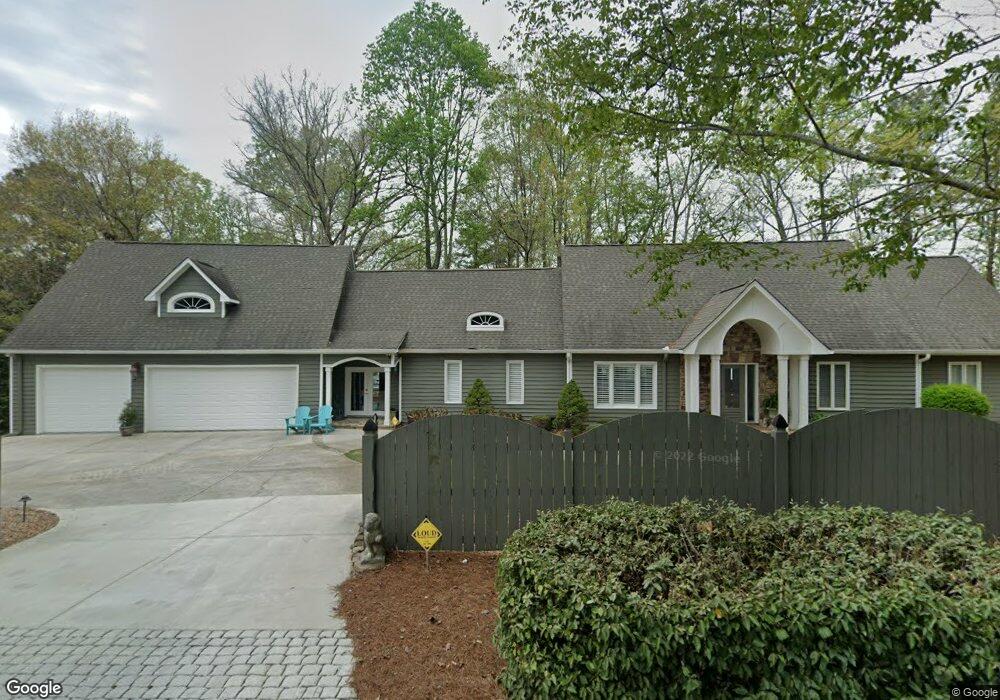
6105 Jim Crow Rd Flowery Branch, GA 30542
Estimated Value: $953,817 - $1,137,000
3
Beds
3
Baths
3,492
Sq Ft
$297/Sq Ft
Est. Value
About This Home
This home is located at 6105 Jim Crow Rd, Flowery Branch, GA 30542 and is currently estimated at $1,036,454, approximately $296 per square foot. 6105 Jim Crow Rd is a home located in Hall County with nearby schools including Flowery Branch Elementary School, West Hall Middle School, and West Hall High School.
Ownership History
Date
Name
Owned For
Owner Type
Purchase Details
Closed on
Jan 15, 2025
Sold by
Wolfe Donna M
Bought by
Wolfe Joe E
Current Estimated Value
Purchase Details
Closed on
Feb 1, 2024
Sold by
Wolfe Joseph E
Bought by
Wolfe Donna M
Purchase Details
Closed on
Feb 28, 2002
Sold by
Great Atlanta Land Company Llc
Bought by
Wolfe Joseph E
Home Financials for this Owner
Home Financials are based on the most recent Mortgage that was taken out on this home.
Original Mortgage
$130,000
Interest Rate
6.86%
Mortgage Type
New Conventional
Purchase Details
Closed on
Nov 30, 2001
Sold by
Patterson Elizabeth A
Bought by
Great Atlanta Land Company Llc
Create a Home Valuation Report for This Property
The Home Valuation Report is an in-depth analysis detailing your home's value as well as a comparison with similar homes in the area
Home Values in the Area
Average Home Value in this Area
Purchase History
| Date | Buyer | Sale Price | Title Company |
|---|---|---|---|
| Wolfe Joe E | -- | -- | |
| Wolfe Donna M | -- | -- | |
| Wolfe Joseph E | $380,000 | -- | |
| Great Atlanta Land Company Llc | $208,000 | -- |
Source: Public Records
Mortgage History
| Date | Status | Borrower | Loan Amount |
|---|---|---|---|
| Previous Owner | Wolfe Joseph E | $130,000 |
Source: Public Records
Tax History Compared to Growth
Tax History
| Year | Tax Paid | Tax Assessment Tax Assessment Total Assessment is a certain percentage of the fair market value that is determined by local assessors to be the total taxable value of land and additions on the property. | Land | Improvement |
|---|---|---|---|---|
| 2024 | $7,879 | $316,336 | $131,230 | $185,106 |
| 2023 | $8,211 | $316,336 | $161,120 | $155,216 |
| 2022 | $5,263 | $230,080 | $110,040 | $120,040 |
| 2021 | $6,054 | $230,080 | $110,040 | $120,040 |
| 2020 | $5,483 | $238,040 | $110,040 | $128,000 |
| 2019 | $5,672 | $244,120 | $120,120 | $124,000 |
| 2018 | $6,471 | $229,200 | $110,200 | $119,000 |
| 2017 | $6,252 | $223,800 | $110,200 | $113,600 |
| 2016 | $6,100 | $223,800 | $110,200 | $113,600 |
| 2015 | $5,851 | $223,800 | $110,200 | $113,600 |
| 2014 | $5,851 | $271,600 | $110,200 | $161,400 |
Source: Public Records
Map
Nearby Homes
- 6026 Jim Crow Rd
- 6137 White Oak Dr
- 6144 Scott Dr
- 6144 Scott Dr Unit 8
- 6135 White Oak Dr
- 6025 River Oaks Dr
- 6185 Old Stringer Rd
- 5514 Mainsail Way
- 5610 Point Dr W
- 5993 Overby Rd
- 5359 Point Dr S
- 5580 Point West Dr
- 5837 Meadow View Ln
- 5867 Meadow View Ln
- 5729 Jim Crow Rd
- 5704 Sallee Cir
- 5540 Stone Trace
- 5411 Mayflower Ct
- 6095 Jim Crow Rd
- 6117 Jim Crow Rd
- 6098 Jim Crow Rd
- 6090 Jim Crow Rd
- 6068 Jim Crow Rd
- 6133 Jim Crow Rd
- 6136 Jim Crow Rd
- 6079 Jim Crow Rd
- 6438 Cannon Dr
- 6141 Jim Crow Rd
- 6198 Lakeside Dr
- 6146 Jim Crow Rd
- 61197 Lakeside Dr
- 6424 Cannon Dr
- 6446 Cannon Dr
- 6442 Cannon Dr
- 6196 Lakeside Dr
- 6197 Lakeside Dr
- 6050 Jim Crow Rd
- 6147 Jim Crow Rd