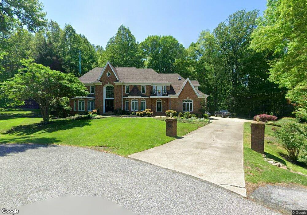
6105 Whittemore Ct Upper Marlboro, MD 20772
Queensland NeighborhoodEstimated Value: $783,350 - $1,028,000
--
Bed
6
Baths
4,629
Sq Ft
$187/Sq Ft
Est. Value
About This Home
This home is located at 6105 Whittemore Ct, Upper Marlboro, MD 20772 and is currently estimated at $866,450, approximately $187 per square foot. 6105 Whittemore Ct is a home located in Prince George's County with nearby schools including Marlton Elementary School, Gwynn Park Middle School, and Dr. Henry A. Wise Jr. High School.
Ownership History
Date
Name
Owned For
Owner Type
Purchase Details
Closed on
Jan 7, 1998
Sold by
Patterson Mark F and Patterson Teraisa K
Bought by
Mckenney Sherman P and Mckenney Fostina
Current Estimated Value
Purchase Details
Closed on
Sep 1, 1995
Sold by
Community Reserve Lp
Bought by
Patterson Mark F
Home Financials for this Owner
Home Financials are based on the most recent Mortgage that was taken out on this home.
Original Mortgage
$60,800
Interest Rate
7.61%
Create a Home Valuation Report for This Property
The Home Valuation Report is an in-depth analysis detailing your home's value as well as a comparison with similar homes in the area
Home Values in the Area
Average Home Value in this Area
Purchase History
| Date | Buyer | Sale Price | Title Company |
|---|---|---|---|
| Mckenney Sherman P | $81,000 | -- | |
| Patterson Mark F | $76,000 | -- |
Source: Public Records
Mortgage History
| Date | Status | Borrower | Loan Amount |
|---|---|---|---|
| Previous Owner | Patterson Mark F | $60,800 |
Source: Public Records
Tax History Compared to Growth
Tax History
| Year | Tax Paid | Tax Assessment Tax Assessment Total Assessment is a certain percentage of the fair market value that is determined by local assessors to be the total taxable value of land and additions on the property. | Land | Improvement |
|---|---|---|---|---|
| 2024 | $9,456 | $621,600 | $136,000 | $485,600 |
| 2023 | $9,455 | $621,600 | $136,000 | $485,600 |
| 2022 | $9,948 | $655,800 | $138,700 | $517,100 |
| 2021 | $9,948 | $655,800 | $138,700 | $517,100 |
| 2020 | $9,948 | $655,800 | $138,700 | $517,100 |
| 2019 | $10,803 | $715,000 | $108,800 | $606,200 |
| 2018 | $10,229 | $675,233 | $0 | $0 |
| 2017 | $9,655 | $635,467 | $0 | $0 |
| 2016 | -- | $595,700 | $0 | $0 |
| 2015 | $7,974 | $587,767 | $0 | $0 |
| 2014 | $7,974 | $579,833 | $0 | $0 |
Source: Public Records
Map
Nearby Homes
- 6500 Green Holly Way
- 6205 Curtis Rd
- 5431 Old Crain Hwy
- 14605 Van Wagner Rd
- 0 Robert Crain Hwy Unit MDPG2140262
- 0 Robert Crain Hwy Unit MDPG2138350
- 5823 Old Crain Hwy
- 6101 Gold Yarrow Ln
- 14101 Old Marlboro Pike
- 14100 Old Marlboro Pike
- 14404 Marlborough Dr
- 14257 Hampshire Hall Ct
- Parcel 121 Marlboro Pike
- 14523 Hampshire Hall Ct
- 4905 Colonel Addison Place
- 13500 Old Marlboro Pike
- 5200 Mapleshade Ln W
- 13800 Farnsworth Ln Unit 5403
- 14100 Farnsworth Ln Unit 2108
- 4817 Clirieden Ln
- 6109 Whittemore Ct
- 6106 Whittemore Ct
- 14308 Waynesford Dr
- 14304 Waynesford Dr
- 6006 Strathmore Way
- 6108 Whittemore Ct
- 14400 Waynesford Dr
- 6004 Strathmore Way
- 6008 Strathmore Way
- 6101 Whittemore Ct
- 14307 Waynesford Dr
- 14311 Waynesford Dr
- 14404 Waynesford Dr
- 6104 Whittemore Ct
- 14405 Waynesford Dr
- 14401 Waynesford Dr
- 6000 Strathmore Way
- 6003 Strathmore Way
- 6007 Strathmore Way
- 14205 Waynesford Dr