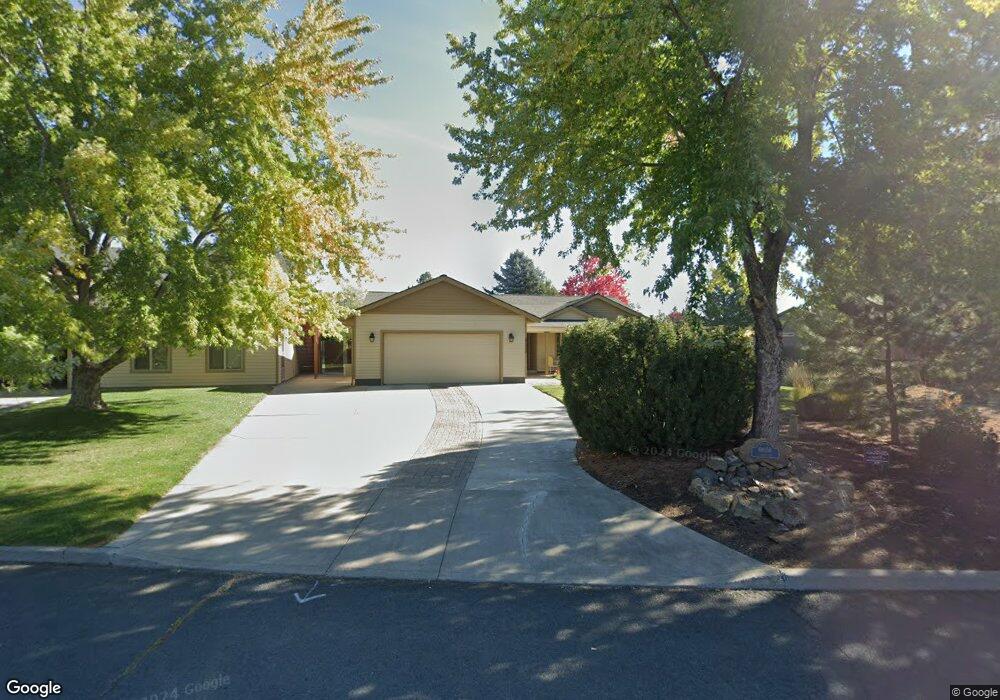
61058 Ladera Rd Bend, OR 97702
Old Farm District NeighborhoodEstimated Value: $838,000 - $917,000
3
Beds
2
Baths
2,209
Sq Ft
$394/Sq Ft
Est. Value
About This Home
This home is located at 61058 Ladera Rd, Bend, OR 97702 and is currently estimated at $870,364, approximately $394 per square foot. 61058 Ladera Rd is a home located in Deschutes County with nearby schools including Silver Rail Elementary School, High Desert Middle School, and Bend Senior High School.
Ownership History
Date
Name
Owned For
Owner Type
Purchase Details
Closed on
Aug 30, 2016
Sold by
Hinshaw Steven R and Hinshaw Beverly A
Bought by
Sexton Albert Lee and Sexton Josephine Ann
Current Estimated Value
Home Financials for this Owner
Home Financials are based on the most recent Mortgage that was taken out on this home.
Original Mortgage
$195,000
Outstanding Balance
$155,013
Interest Rate
3.45%
Mortgage Type
New Conventional
Estimated Equity
$715,351
Create a Home Valuation Report for This Property
The Home Valuation Report is an in-depth analysis detailing your home's value as well as a comparison with similar homes in the area
Home Values in the Area
Average Home Value in this Area
Purchase History
| Date | Buyer | Sale Price | Title Company |
|---|---|---|---|
| Sexton Albert Lee | -- | Amerititle |
Source: Public Records
Mortgage History
| Date | Status | Borrower | Loan Amount |
|---|---|---|---|
| Open | Sexton Albert Lee | $195,000 |
Source: Public Records
Tax History Compared to Growth
Tax History
| Year | Tax Paid | Tax Assessment Tax Assessment Total Assessment is a certain percentage of the fair market value that is determined by local assessors to be the total taxable value of land and additions on the property. | Land | Improvement |
|---|---|---|---|---|
| 2025 | $7,483 | $442,900 | -- | -- |
| 2024 | $7,200 | $430,000 | -- | -- |
| 2023 | $6,674 | $417,480 | $0 | $0 |
| 2022 | $6,227 | $393,530 | $0 | $0 |
| 2021 | $6,236 | $382,070 | $0 | $0 |
| 2020 | $5,917 | $382,070 | $0 | $0 |
| 2019 | $5,752 | $370,950 | $0 | $0 |
| 2018 | $5,485 | $353,430 | $0 | $0 |
| 2017 | $5,324 | $343,140 | $0 | $0 |
| 2016 | $5,078 | $333,150 | $0 | $0 |
| 2015 | $4,937 | $323,450 | $0 | $0 |
| 2014 | $4,791 | $314,030 | $0 | $0 |
Source: Public Records
Map
Nearby Homes
- 20984 Via Sierra
- 61100 SE Stari Most Loop
- 61076 Manhae Loop
- 20864 SE Sunniberg Ln
- 61160 Hilmer Creek Dr
- 20921 Sage Creek Dr
- 61159 Ladera Rd
- 61132 SE Ambassador Dr
- 20870 SE Delta Dr
- 20878 SE Delta Dr
- 20882 SE Delta Dr
- 20874 SE Delta Dr
- 20883 SE Delta Dr
- 20879 SE Delta Dr
- 20871 SE Delta Dr
- 20875 SE Delta Dr
- 20887 SE Delta Dr
- 20891 SE Delta Dr
- 20888 SE Caldera Dr
- 20890 SE Caldera Dr
- 61052 Ladera Rd
- 61075 Sky Harbor Dr
- 20929 Fireside Trail
- 20926 Clearview Ct
- 20926 Clear View Ct
- 20939 Fireside Trail
- 61057 Sky Harbor Dr
- 61043 Ladera Rd
- 61029 Sky Harbor Dr
- 61065 Sky Harbor Dr
- 20940 Fireside Trail
- 61037 Sky Harbor Dr
- 20920 Fireside Trail
- 61065 Ladera Rd
- 61038 Sky Harbor Dr
- 20930 Fireside Trail
- 20914 Clearview Ct
- 20914 Clear View Ct
- 61081 Sky Harbor Dr
- 61071 Ladera Rd