Estimated Value: $355,000 - $515,000
4
Beds
3
Baths
2,943
Sq Ft
$155/Sq Ft
Est. Value
About This Home
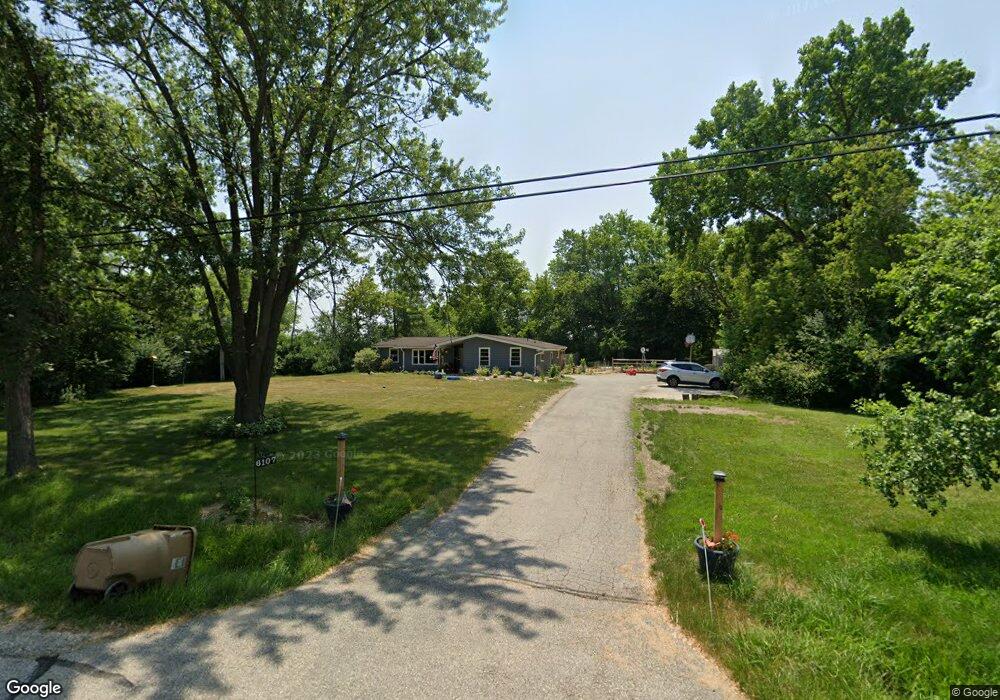
This home is located at 6107 116th St, Pleasant Prairie, WI 53158 and is currently estimated at $457,436, approximately $155 per square foot. 6107 116th St is a home located in Kenosha County with nearby schools including Whittier Elementary School, Mahone Middle School, and Indian Trail High School And Academy.
Ownership History
Date
Name
Owned For
Owner Type
Purchase Details
Closed on
Aug 27, 2021
Sold by
Labelle Ellen M
Bought by
Labelle Darrin E and Labelle Sarah K
Current Estimated Value
Home Financials for this Owner
Home Financials are based on the most recent Mortgage that was taken out on this home.
Original Mortgage
$173,000
Outstanding Balance
$157,417
Interest Rate
2.8%
Mortgage Type
New Conventional
Estimated Equity
$300,019
Purchase Details
Closed on
Aug 17, 2020
Sold by
Labelle Ellen M
Bought by
Labelle Dennis J and Labelle Darren E
Create a Home Valuation Report for This Property
The Home Valuation Report is an in-depth analysis detailing your home's value as well as a comparison with similar homes in the area
Home Values in the Area
Average Home Value in this Area
Purchase History
| Date | Buyer | Sale Price | Title Company |
|---|---|---|---|
| Labelle Darrin E | $216,300 | None Available | |
| Labelle Dennis J | -- | None Available |
Source: Public Records
Mortgage History
| Date | Status | Borrower | Loan Amount |
|---|---|---|---|
| Open | Labelle Darrin E | $173,000 |
Source: Public Records
Tax History Compared to Growth
Tax History
| Year | Tax Paid | Tax Assessment Tax Assessment Total Assessment is a certain percentage of the fair market value that is determined by local assessors to be the total taxable value of land and additions on the property. | Land | Improvement |
|---|---|---|---|---|
| 2024 | $4,694 | $413,000 | $111,200 | $301,800 |
| 2023 | $4,435 | $342,100 | $100,800 | $241,300 |
| 2022 | $4,158 | $316,100 | $100,800 | $215,300 |
| 2021 | $3,885 | $216,300 | $85,600 | $130,700 |
| 2020 | $3,980 | $216,300 | $85,600 | $130,700 |
| 2019 | $3,642 | $216,300 | $85,600 | $130,700 |
| 2018 | $3,720 | $216,300 | $85,600 | $130,700 |
| 2017 | $4,120 | $190,900 | $80,600 | $110,300 |
| 2016 | $4,068 | $190,900 | $80,600 | $110,300 |
| 2015 | $3,478 | $176,200 | $75,600 | $100,600 |
| 2014 | -- | $176,200 | $75,600 | $100,600 |
Source: Public Records
Map
Nearby Homes
- 11449 61st Ave
- Lt5 113th St
- Lt6 113th St
- 6612 110th St
- Lt12 113th St
- Lt19 Cedar Ridge Ct
- Lt18 Cedar Ridge Ct
- 6430 109th St
- Lt35 113th St
- Lt17 Cedar Ridge Ct
- Lt30 Cedar Ridge Ct
- Lt32 Cedar Ridge Ct
- Lt15 113th St
- Lt34 Cedar Ridge Ct
- Lt24 Cedar Ridge Ct
- Lt2 113th St
- Lt14 113th St
- Lt10 113th St
- 6006 107th St
- Lt7 113th St
- 6018 Springbrook Rd
- 6121 116th St
- 6100 Springbrook Rd
- 6217 116th St
- 6020 116th St
- 6106 Springbrook Rd
- 6223 116th St
- 6303 116th St
- 6112 Springbrook Rd
- 11509 61st Ave
- 11516 61st Ave
- 5901 Springbrook Rd
- 6311 116th St
- 6329 116th St
- 11462 61st Ave
- 6124 Springbrook Rd
- 6401 116th St
- 6413 116th St
- 6406 116th St
- 11550 61st Ave