Estimated Value: $302,000 - $336,000
3
Beds
2
Baths
1,543
Sq Ft
$203/Sq Ft
Est. Value
About This Home
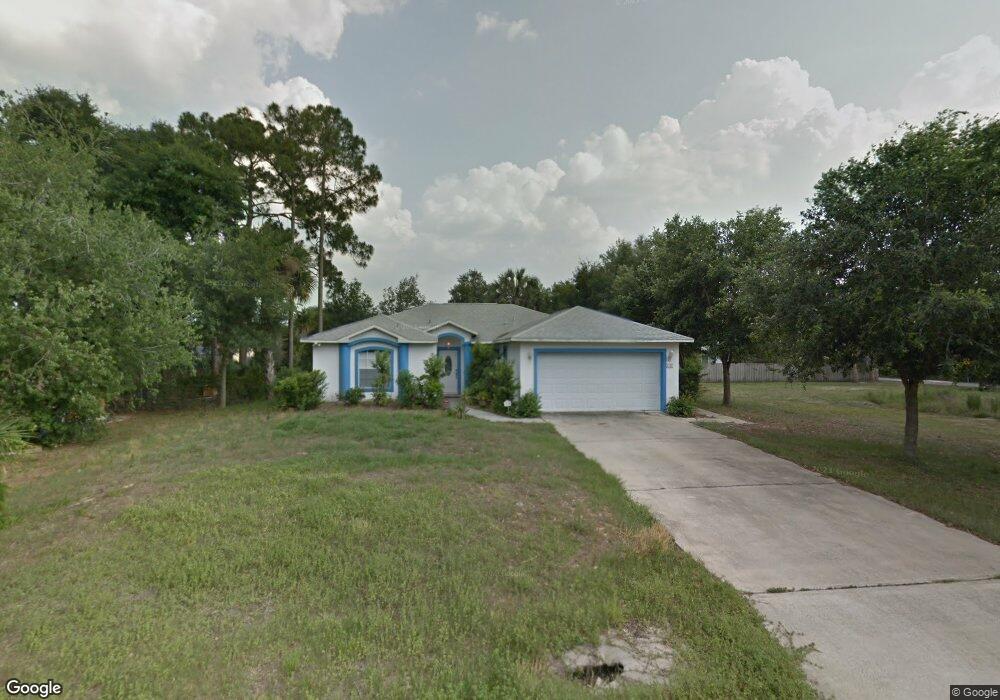
This home is located at 6109 Dees Rd, Cocoa, FL 32927 and is currently estimated at $312,661, approximately $202 per square foot. 6109 Dees Rd is a home located in Brevard County with nearby schools including Enterprise Elementary School, Space Coast Junior/Senior High School, and East Atlantic Prep of Brevard County.
Ownership History
Date
Name
Owned For
Owner Type
Purchase Details
Closed on
Dec 11, 2002
Sold by
Mitropoulos Peter J and Mitropoulos Arthur
Bought by
Mitropoulos Arthur
Current Estimated Value
Home Financials for this Owner
Home Financials are based on the most recent Mortgage that was taken out on this home.
Original Mortgage
$101,500
Outstanding Balance
$43,097
Interest Rate
6.08%
Estimated Equity
$269,564
Purchase Details
Closed on
Feb 12, 2002
Sold by
The Garnett Family Ptnr
Bought by
Mitropoulos Arthur and Mitropoulos Peter J
Home Financials for this Owner
Home Financials are based on the most recent Mortgage that was taken out on this home.
Original Mortgage
$16,500
Interest Rate
7.12%
Create a Home Valuation Report for This Property
The Home Valuation Report is an in-depth analysis detailing your home's value as well as a comparison with similar homes in the area
Home Values in the Area
Average Home Value in this Area
Purchase History
| Date | Buyer | Sale Price | Title Company |
|---|---|---|---|
| Mitropoulos Arthur | $130,000 | -- | |
| Mitropoulos Arthur | $17,500 | -- |
Source: Public Records
Mortgage History
| Date | Status | Borrower | Loan Amount |
|---|---|---|---|
| Open | Mitropoulos Arthur | $101,500 | |
| Previous Owner | Mitropoulos Arthur | $16,500 |
Source: Public Records
Tax History
| Year | Tax Paid | Tax Assessment Tax Assessment Total Assessment is a certain percentage of the fair market value that is determined by local assessors to be the total taxable value of land and additions on the property. | Land | Improvement |
|---|---|---|---|---|
| 2025 | $1,320 | $95,240 | -- | -- |
| 2024 | $1,283 | $92,560 | -- | -- |
| 2023 | $1,283 | $89,870 | $0 | $0 |
| 2022 | $1,195 | $87,260 | $0 | $0 |
| 2021 | $1,187 | $84,720 | $0 | $0 |
| 2020 | $1,122 | $83,560 | $0 | $0 |
| 2019 | $1,057 | $81,690 | $0 | $0 |
| 2018 | $1,047 | $80,170 | $0 | $0 |
| 2017 | $1,036 | $78,530 | $0 | $0 |
| 2016 | $1,033 | $76,920 | $18,000 | $58,920 |
| 2015 | $1,040 | $76,390 | $15,000 | $61,390 |
| 2014 | $1,039 | $75,790 | $11,000 | $64,790 |
Source: Public Records
Map
Nearby Homes
- 6150 Baltimore Ave
- 00000 Golfview Ave
- 6230 Balsam St
- 6085 Edison St
- 6180 Balboa St
- 6215 Balboa St
- 6220 Golfview Ave
- 5812 Homestead Ave
- 6250 Ainsworth Rd
- 6510 Aspen Ln
- 23-35-21-JX-B-2 Aruin St
- 6460 Homestead Ave
- 0 Aruin St Unit 1222557
- 6460 Ainsworth Rd
- 6545 Addie Ave
- 6490 Addax Ave
- 6115 Allmont St
- 6135 Allmont St
- 5721 Beaverbrook St
- 5680 Banos Ave
- 6117 Dees Rd
- 6106 Corning Rd
- 6100 Corning Rd
- 6112 Corning Rd
- 6110 Dees Rd
- 6102 Dees Rd
- 6126 Dees Rd
- 6129 Dees Rd
- 6050 Baltimore Ave
- 6060 Baltimore Ave
- 6124 Corning Rd
- 6040 Baltimore Ave
- 6107 Corning Rd
- 6115 Degan Rd
- 6105 Degan Rd
- 6113 Corning Rd
- 6125 Degan Rd
- 6101 Corning Rd
- 6030 Baltimore Ave
- 6134 Dees Rd
Your Personal Tour Guide
Ask me questions while you tour the home.