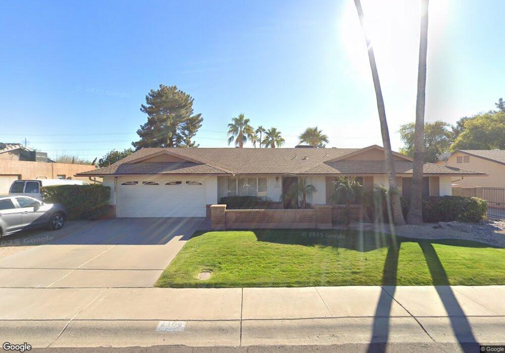
6109 W Charter Oak Rd Glendale, AZ 85304
Estimated Value: $393,740 - $514,000
--
Bed
3
Baths
2,053
Sq Ft
$227/Sq Ft
Est. Value
About This Home
This home is located at 6109 W Charter Oak Rd, Glendale, AZ 85304 and is currently estimated at $465,435, approximately $226 per square foot. 6109 W Charter Oak Rd is a home located in Maricopa County with nearby schools including Desert Valley Elementary School, Ironwood High School, and Legacy Traditional School - Glendale.
Ownership History
Date
Name
Owned For
Owner Type
Purchase Details
Closed on
Apr 25, 2002
Sold by
Anderson Kevin L and Anderson Holly B
Bought by
Anderson Kevin L and Anderson Holly B
Current Estimated Value
Purchase Details
Closed on
May 13, 1998
Sold by
Anderson Kevin L and Anderson Holly B
Bought by
Anderson Kevin L and Anderson Holly B
Create a Home Valuation Report for This Property
The Home Valuation Report is an in-depth analysis detailing your home's value as well as a comparison with similar homes in the area
Home Values in the Area
Average Home Value in this Area
Purchase History
| Date | Buyer | Sale Price | Title Company |
|---|---|---|---|
| Anderson Kevin L | -- | -- | |
| Anderson Kevin L | -- | -- |
Source: Public Records
Tax History Compared to Growth
Tax History
| Year | Tax Paid | Tax Assessment Tax Assessment Total Assessment is a certain percentage of the fair market value that is determined by local assessors to be the total taxable value of land and additions on the property. | Land | Improvement |
|---|---|---|---|---|
| 2025 | $1,807 | $23,705 | -- | -- |
| 2024 | $1,844 | $22,576 | -- | -- |
| 2023 | $1,844 | $34,120 | $6,820 | $27,300 |
| 2022 | $1,827 | $26,410 | $5,280 | $21,130 |
| 2021 | $1,961 | $24,070 | $4,810 | $19,260 |
| 2020 | $1,990 | $23,670 | $4,730 | $18,940 |
| 2019 | $1,935 | $21,960 | $4,390 | $17,570 |
| 2018 | $1,890 | $20,350 | $4,070 | $16,280 |
| 2017 | $1,902 | $17,310 | $3,460 | $13,850 |
| 2016 | $1,891 | $16,970 | $3,390 | $13,580 |
| 2015 | $1,773 | $17,000 | $3,400 | $13,600 |
Source: Public Records
Map
Nearby Homes
- 6128 W Columbine Dr
- 6131 W Desert Hills Dr
- 6210 W Desert Hills Dr
- 11840 N 59th Ln
- 12316 N 58th Dr
- 12334 N 58th Dr
- 6409 W Riviera Dr
- 6409 W Poinsettia Dr
- 12021 N 65th Ave
- 12327 N 57th Dr
- 6504 W Corrine Dr
- 6218 W Surrey Ave
- 12748 N 57th Dr
- 6415 W Surrey Ave
- 5534 W Riviera Dr
- 6102 W Shangri la Rd
- 11227 N 59th Dr
- 6746 W Wethersfield Rd
- 6749 W Charter Oak Rd
- 6739 W Cactus Rd
- 6115 W Charter Oak Rd
- 6103 W Charter Oak Rd
- 6108 W Wethersfield Rd
- 6102 W Wethersfield Rd
- 6110 W Charter Oak Rd
- 6121 W Charter Oak Rd
- 6114 W Wethersfield Rd
- 6116 W Charter Oak Rd
- 6104 W Charter Oak Rd
- 6122 W Charter Oak Rd
- 6058 W Wethersfield Dr
- 6127 W Charter Oak Rd
- 6057 W Charter Oak Rd
- 12211 N 62nd Ave
- 6113 W Wethersfield Rd
- 6107 W Bloomfield Rd
- 6228 W Charter Oak Rd
- 6107 W Wethersfield Rd
- 6101 W Wethersfield Rd Unit 1
- 6101 W Wethersfield Rd