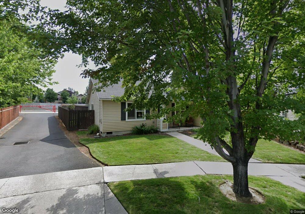
61097 Larkspur Loop Bend, OR 97702
Old Farm District NeighborhoodEstimated Value: $613,000 - $692,000
4
Beds
3
Baths
1,818
Sq Ft
$358/Sq Ft
Est. Value
About This Home
This home is located at 61097 Larkspur Loop, Bend, OR 97702 and is currently estimated at $651,209, approximately $358 per square foot. 61097 Larkspur Loop is a home located in Deschutes County with nearby schools including R.E. Jewell Elementary School, High Desert Middle School, and Deschutes River Montessori School.
Ownership History
Date
Name
Owned For
Owner Type
Purchase Details
Closed on
Jun 21, 2022
Sold by
Harms Darryl L and Harms Amy R
Bought by
Darryl L And Amy R Harms Family Revocabl
Current Estimated Value
Home Financials for this Owner
Home Financials are based on the most recent Mortgage that was taken out on this home.
Original Mortgage
$106,150
Outstanding Balance
$100,704
Interest Rate
5.1%
Mortgage Type
New Conventional
Estimated Equity
$550,505
Purchase Details
Closed on
Aug 25, 2016
Sold by
Harms Darryl L and Harms Amy R
Bought by
Harms Darryl I and Harms Amy R
Home Financials for this Owner
Home Financials are based on the most recent Mortgage that was taken out on this home.
Original Mortgage
$262,700
Interest Rate
3.42%
Mortgage Type
VA
Purchase Details
Closed on
Nov 10, 2014
Sold by
Harms Darryl L and Harms Amy R
Bought by
Darryl L & Amy R Harms Family Revocable
Home Financials for this Owner
Home Financials are based on the most recent Mortgage that was taken out on this home.
Original Mortgage
$261,349
Interest Rate
4.16%
Mortgage Type
VA
Purchase Details
Closed on
Dec 13, 2013
Sold by
Harms Susan
Bought by
Harms Darryl
Purchase Details
Closed on
Aug 30, 2013
Sold by
The Hollman Company Inc
Bought by
Harms Susan and Jeanett G Harms Of The Peter C Harms & J
Purchase Details
Closed on
Dec 29, 2005
Sold by
Harms Jeanett G
Bought by
Harms Jeanett G and Peter C & Jeanett Harms Survivors Trust
Purchase Details
Closed on
Oct 14, 2003
Sold by
The Hollman Co Inc
Bought by
Harms Jeanett
Home Financials for this Owner
Home Financials are based on the most recent Mortgage that was taken out on this home.
Original Mortgage
$188,025
Interest Rate
5.57%
Mortgage Type
Purchase Money Mortgage
Create a Home Valuation Report for This Property
The Home Valuation Report is an in-depth analysis detailing your home's value as well as a comparison with similar homes in the area
Home Values in the Area
Average Home Value in this Area
Purchase History
| Date | Buyer | Sale Price | Title Company |
|---|---|---|---|
| Darryl L And Amy R Harms Family Revocabl | -- | None Listed On Document | |
| Harms Darryl L | -- | None Listed On Document | |
| Harms Darryl I | -- | Accommodation | |
| Harms Darryl L | -- | Amerititle | |
| Darryl L & Amy R Harms Family Revocable | -- | Western Title & Escrow | |
| Harms Darryl L | -- | Western Title & Escrow | |
| Harms Darryl | -- | None Available | |
| Harms Susan | -- | Amerititle | |
| Harms Jeanett G | -- | None Available | |
| Harms Jeanett | $235,032 | Amerititle |
Source: Public Records
Mortgage History
| Date | Status | Borrower | Loan Amount |
|---|---|---|---|
| Open | Harms Darryl L | $106,150 | |
| Previous Owner | Harms Darryl L | $262,700 | |
| Previous Owner | Harms Darryl L | $261,349 | |
| Previous Owner | Harms Jeanett | $188,025 |
Source: Public Records
Tax History
| Year | Tax Paid | Tax Assessment Tax Assessment Total Assessment is a certain percentage of the fair market value that is determined by local assessors to be the total taxable value of land and additions on the property. | Land | Improvement |
|---|---|---|---|---|
| 2025 | $4,060 | $240,270 | -- | -- |
| 2024 | $3,906 | $233,280 | -- | -- |
| 2023 | $3,621 | $226,490 | $0 | $0 |
| 2022 | $3,378 | $213,500 | $0 | $0 |
| 2021 | $3,383 | $207,290 | $0 | $0 |
| 2020 | $3,210 | $207,290 | $0 | $0 |
| 2019 | $3,121 | $201,260 | $0 | $0 |
| 2018 | $3,033 | $195,400 | $0 | $0 |
| 2017 | $2,944 | $189,710 | $0 | $0 |
| 2016 | $2,807 | $184,190 | $0 | $0 |
| 2015 | $2,730 | $178,830 | $0 | $0 |
| 2014 | $2,649 | $173,630 | $0 | $0 |
Source: Public Records
Map
Nearby Homes
- 20640 SE Cougar Peak Dr
- 60069 SE Ruby Peak Loop
- 61089 SE Echo Lake Ct
- 61142 Brookhollow Dr
- 20596 Button Brush Ave
- 20627 White Dove Ln
- 61166 SE Berkshire Way Unit Lot 107
- 61170 SE Berkshire Way Unit Lot 108
- 20688 White Dove Ln
- 20606 Songbird Ln
- 20622 SE Boer Place SE Unit Lot 115
- 61209 Dayspring Dr
- 20657 Wild Goose Ln
- 20509 SE Dorset Place Unit 98
- 20615 SE Boer Place SE Unit Lot 130
- 61145 SE Wagyu Dr
- 61189 SE Wagyu Dr
- 61177 SE Wagyu Dr Unit Lot 124
- 61185 SE Wagyu Dr Unit Lot 126
- 20414 Murphy Rd
- 61101 Larkspur Loop
- 61093 Larkspur Loop
- 61092 Larkspur Loop
- 20604 SE Cougar Peak Dr
- 20600 SE Cougar Peak Dr
- 20608 SE Cougar Peak Dr
- 61109 Larkspur Loop
- 61112 Brown Trout Place
- 61108 Brown Trout Place
- 61085 SE Larkspur Dr
- 61085 Larkspur Loop
- 61088 Larkspur Loop
- 20612 SE Cougar Peak Dr
- 20616 SE Cougar Peak Dr
- 61084 Larkspur Loop
- 20605 Daisy Ln
- 61081 Larkspur Loop
- 61093 SE Ruby Peak Ln
- 61104 Brown Trout Place
Your Personal Tour Guide
Ask me questions while you tour the home.