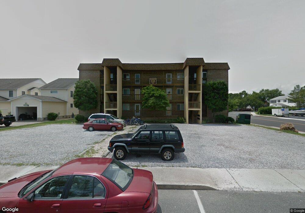
611 142nd St Unit 302 Ocean City, MD 21842
Estimated Value: $243,450 - $300,000
--
Bed
1
Bath
836
Sq Ft
$323/Sq Ft
Est. Value
About This Home
This home is located at 611 142nd St Unit 302, Ocean City, MD 21842 and is currently estimated at $269,863, approximately $322 per square foot. 611 142nd St Unit 302 is a home located in Worcester County with nearby schools including Ocean City Elementary School, Stephen Decatur Middle School, and Berlin Intermediate School.
Ownership History
Date
Name
Owned For
Owner Type
Purchase Details
Closed on
Dec 2, 2022
Sold by
Dea Dick
Bought by
Dea Ann and Sandusky Jane Dea
Current Estimated Value
Purchase Details
Closed on
Mar 18, 1987
Sold by
Russell Robert W
Bought by
Dea Dick
Purchase Details
Closed on
Jan 30, 1981
Sold by
Megee Douglas L
Bought by
Russell Robert W
Home Financials for this Owner
Home Financials are based on the most recent Mortgage that was taken out on this home.
Original Mortgage
$31,500
Interest Rate
15.07%
Create a Home Valuation Report for This Property
The Home Valuation Report is an in-depth analysis detailing your home's value as well as a comparison with similar homes in the area
Home Values in the Area
Average Home Value in this Area
Purchase History
| Date | Buyer | Sale Price | Title Company |
|---|---|---|---|
| Dea Ann | -- | None Listed On Document | |
| Dea Dick | $50,000 | -- | |
| Russell Robert W | $39,500 | -- |
Source: Public Records
Mortgage History
| Date | Status | Borrower | Loan Amount |
|---|---|---|---|
| Previous Owner | Russell Robert W | $31,500 |
Source: Public Records
Tax History Compared to Growth
Tax History
| Year | Tax Paid | Tax Assessment Tax Assessment Total Assessment is a certain percentage of the fair market value that is determined by local assessors to be the total taxable value of land and additions on the property. | Land | Improvement |
|---|---|---|---|---|
| 2025 | $2,720 | $199,200 | $0 | $0 |
| 2024 | $2,177 | $156,000 | $0 | $0 |
| 2023 | $1,585 | $112,800 | $56,400 | $56,400 |
| 2022 | $1,585 | $112,800 | $56,400 | $56,400 |
| 2021 | $1,594 | $112,800 | $56,400 | $56,400 |
| 2020 | $1,594 | $112,800 | $56,400 | $56,400 |
| 2019 | $1,605 | $112,800 | $56,400 | $56,400 |
| 2018 | $1,589 | $112,800 | $56,400 | $56,400 |
| 2017 | $1,677 | $118,700 | $0 | $0 |
| 2016 | $1,736 | $118,700 | $0 | $0 |
| 2015 | $1,776 | $118,700 | $0 | $0 |
| 2014 | $1,776 | $118,700 | $0 | $0 |
Source: Public Records
Map
Nearby Homes
- 14125 Sea Captain Rd
- 717 142nd St
- 702A Kelly Rd
- 14211 Dukes Ave Unit 203
- 14109 Dukes Ave
- 14311 Tunnel Ave Unit 101
- 14311 Tunnel Ave Unit 304
- 403 143rd St Unit 6
- 731 Anchor Chain Rd
- 14405 Tunnel Ave
- 14401 Tunnel Ave Unit 263
- 14401 Tunnel Ave Unit 262
- 411 146th St Unit 145
- 411 146th St Unit 225
- 14009 N Ocean Rd
- 404 141st St Unit 19
- 400 141st St Unit 24
- 312 141st St
- 703 Loop Rd
- 14409 Lighthouse Ave
- 611 142nd St Unit 201
- 611 142nd St Unit 101
- 611 142nd St Unit 104
- 611 142nd St Unit 203
- 611 142nd St Unit 303
- 611 142nd St Unit 204
- 611 142nd St Unit 103
- 611 142nd St Unit 304
- 604 Seaweed Ln Unit 2
- 604 Seaweed Ln Unit 3
- 604 Seaweed Ln
- 604 Seaweed Ln
- 604 Seaweed Ln Unit 1
- 604 Seaweed Ln Unit 1 COCONUT GROVE
- 602 Seaweed Ln Unit 1
- 602 Seaweed Ln Unit 1a & 1b
- 602 Seaweed Ln
- 602 Seaweed Ln Unit 1A
- 602 Seaweed Ln Unit 2A
- 602 Seaweed Ln Unit 3B