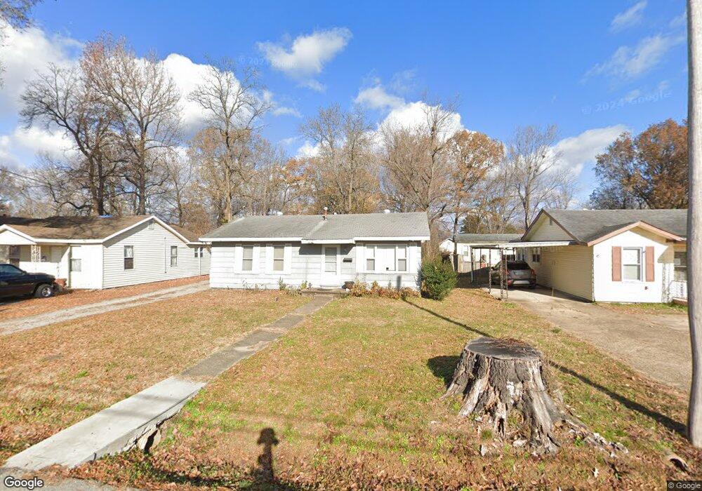
611 Arthur St Poplar Bluff, MO 63901
Estimated Value: $94,741 - $119,000
3
Beds
--
Bath
1,156
Sq Ft
$90/Sq Ft
Est. Value
About This Home
This home is located at 611 Arthur St, Poplar Bluff, MO 63901 and is currently estimated at $104,185, approximately $90 per square foot. 611 Arthur St is a home located in Butler County with nearby schools including Eugene Field Elementary School, Poplar Bluff Fifth & Sixth Grade Center, and Poplar Bluff Junior High School.
Ownership History
Date
Name
Owned For
Owner Type
Purchase Details
Closed on
May 21, 2012
Sold by
Knuckles Emily
Bought by
Ivy Jeramie W and Ivyivy Stacie L
Current Estimated Value
Home Financials for this Owner
Home Financials are based on the most recent Mortgage that was taken out on this home.
Original Mortgage
$50,408
Outstanding Balance
$34,300
Interest Rate
3.9%
Mortgage Type
New Conventional
Estimated Equity
$69,885
Create a Home Valuation Report for This Property
The Home Valuation Report is an in-depth analysis detailing your home's value as well as a comparison with similar homes in the area
Home Values in the Area
Average Home Value in this Area
Purchase History
| Date | Buyer | Sale Price | Title Company |
|---|---|---|---|
| Ivy Jeramie W | -- | None Available |
Source: Public Records
Mortgage History
| Date | Status | Borrower | Loan Amount |
|---|---|---|---|
| Open | Ivy Jeramie W | $50,408 |
Source: Public Records
Tax History
| Year | Tax Paid | Tax Assessment Tax Assessment Total Assessment is a certain percentage of the fair market value that is determined by local assessors to be the total taxable value of land and additions on the property. | Land | Improvement |
|---|---|---|---|---|
| 2025 | $383 | $8,110 | $0 | $0 |
| 2024 | $4 | $7,510 | $0 | $0 |
| 2023 | $363 | $7,510 | $0 | $0 |
| 2022 | $351 | $7,270 | $0 | $0 |
| 2021 | $351 | $7,270 | $0 | $0 |
| 2020 | $336 | $6,860 | $0 | $0 |
| 2019 | $335 | $6,860 | $0 | $0 |
| 2018 | $335 | $6,860 | $0 | $0 |
| 2017 | -- | $6,860 | $0 | $0 |
| 2016 | -- | $6,860 | $0 | $0 |
| 2015 | -- | $6,860 | $0 | $0 |
| 2014 | -- | $4,780 | $0 | $0 |
| 2012 | $204 | $4,780 | $0 | $0 |
Source: Public Records
Map
Nearby Homes
Your Personal Tour Guide
Ask me questions while you tour the home.