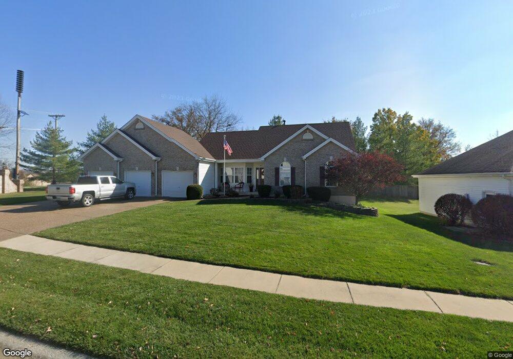
611 Avondale Dr Saint Peters, MO 63376
Estimated Value: $430,629 - $470,000
3
Beds
2
Baths
1,770
Sq Ft
$254/Sq Ft
Est. Value
About This Home
This home is located at 611 Avondale Dr, Saint Peters, MO 63376 and is currently estimated at $450,407, approximately $254 per square foot. 611 Avondale Dr is a home located in St. Charles County with nearby schools including Progress South Elementary School, Fort Zumwalt South Middle School, and Fort Zumwalt South High School.
Ownership History
Date
Name
Owned For
Owner Type
Purchase Details
Closed on
Nov 17, 2004
Sold by
Estey Barks Contracting Inc
Bought by
Jones Dean and Jones Julia
Current Estimated Value
Home Financials for this Owner
Home Financials are based on the most recent Mortgage that was taken out on this home.
Original Mortgage
$183,100
Outstanding Balance
$90,763
Interest Rate
5.68%
Mortgage Type
Purchase Money Mortgage
Estimated Equity
$359,644
Create a Home Valuation Report for This Property
The Home Valuation Report is an in-depth analysis detailing your home's value as well as a comparison with similar homes in the area
Home Values in the Area
Average Home Value in this Area
Purchase History
| Date | Buyer | Sale Price | Title Company |
|---|---|---|---|
| Jones Dean | $228,900 | Atc |
Source: Public Records
Mortgage History
| Date | Status | Borrower | Loan Amount |
|---|---|---|---|
| Open | Jones Dean | $183,100 | |
| Closed | Jones Dean | $45,800 |
Source: Public Records
Tax History Compared to Growth
Tax History
| Year | Tax Paid | Tax Assessment Tax Assessment Total Assessment is a certain percentage of the fair market value that is determined by local assessors to be the total taxable value of land and additions on the property. | Land | Improvement |
|---|---|---|---|---|
| 2025 | $4,279 | $70,553 | -- | -- |
| 2023 | $4,283 | $65,054 | $0 | $0 |
| 2022 | $3,987 | $56,469 | $0 | $0 |
| 2021 | $3,997 | $56,469 | $0 | $0 |
| 2020 | $3,878 | $52,669 | $0 | $0 |
| 2019 | $3,887 | $52,669 | $0 | $0 |
| 2018 | $3,568 | $46,227 | $0 | $0 |
| 2017 | $3,516 | $46,227 | $0 | $0 |
| 2016 | $3,183 | $40,196 | $0 | $0 |
| 2015 | $2,967 | $40,196 | $0 | $0 |
| 2014 | $2,959 | $39,530 | $0 | $0 |
Source: Public Records
Map
Nearby Homes
- 661 Clifton Hill Dr
- 120 Glenallen Dr
- 213 Black Oak Dr
- 1017 Windsor Crest Ct
- 1700 Birdie Hills Rd
- 421 Jacobs Place Dr
- 212 Jacobs Way
- 225 Jacobs Way
- 201 Dardenne Farms Dr
- 0 the Rainier@weiss Rd
- 0 the Indigo@weiss Rd
- New Build Forest "J"@weiss Rd
- New Build Forest "H"@weiss Rd
- 511 Roaring Fork Ct
- 1 Pauley Cir
- 4033 Treeshadow Dr
- 60 Loganberry Ct
- 619 Turtle Creek Ct
- 6355 Sprucefield Dr
- 100 Country Crossing Estates Ct
- 613 Avondale Dr
- 610 Avondale Dr
- 2 High Trail
- 2 High Trail Unit 2-F
- 2 High Trail Unit 2-D
- 2 High Trail
- 615 Avondale Dr
- 612 Avondale Dr
- 628 Avondale Dr
- 617 Avondale Dr
- 607 Knaust Rd
- 503 Auburn Trace Ln
- 614 Avondale Dr
- 501 Auburn Trace Ln
- 505 Auburn Trace Ln
- 4 High Trail
- 4 High Trail Unit 4-F
- 4 High Trail
- 619 Avondale Dr
- 507 Auburn Trace Ln