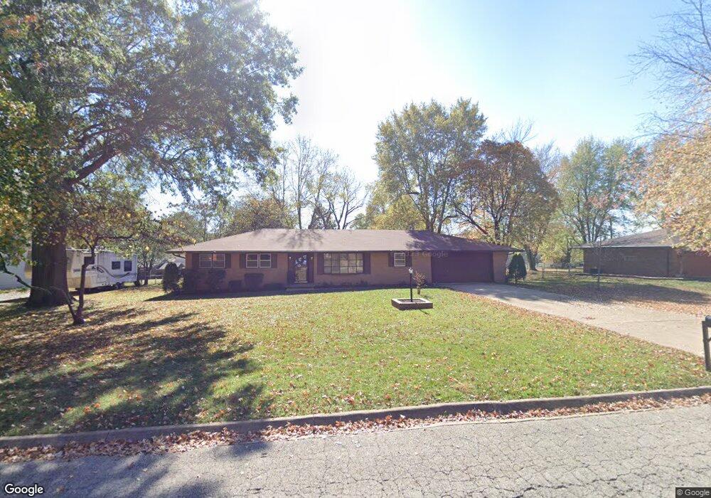
611 Birchbark Ln Lebanon, MO 65536
Estimated Value: $207,000 - $286,000
3
Beds
2
Baths
2,176
Sq Ft
$109/Sq Ft
Est. Value
About This Home
This home is located at 611 Birchbark Ln, Lebanon, MO 65536 and is currently estimated at $237,375, approximately $109 per square foot. 611 Birchbark Ln is a home located in Laclede County with nearby schools including Joe D. Esther Elementary School, Boswell Elementary School, and Maplecrest Elementary School.
Ownership History
Date
Name
Owned For
Owner Type
Purchase Details
Closed on
Feb 20, 2009
Sold by
Bechtel Roy
Bought by
639 S Washington Llc
Current Estimated Value
Home Financials for this Owner
Home Financials are based on the most recent Mortgage that was taken out on this home.
Original Mortgage
$66,800
Outstanding Balance
$41,795
Interest Rate
4.91%
Mortgage Type
Future Advance Clause Open End Mortgage
Estimated Equity
$195,580
Create a Home Valuation Report for This Property
The Home Valuation Report is an in-depth analysis detailing your home's value as well as a comparison with similar homes in the area
Home Values in the Area
Average Home Value in this Area
Purchase History
| Date | Buyer | Sale Price | Title Company |
|---|---|---|---|
| 639 S Washington Llc | -- | None Available |
Source: Public Records
Mortgage History
| Date | Status | Borrower | Loan Amount |
|---|---|---|---|
| Open | 639 S Washington Llc | $66,800 |
Source: Public Records
Tax History Compared to Growth
Tax History
| Year | Tax Paid | Tax Assessment Tax Assessment Total Assessment is a certain percentage of the fair market value that is determined by local assessors to be the total taxable value of land and additions on the property. | Land | Improvement |
|---|---|---|---|---|
| 2025 | $948 | $18,640 | $0 | $0 |
| 2024 | $948 | $16,630 | $0 | $0 |
| 2023 | $977 | $16,630 | $0 | $0 |
| 2022 | $910 | $16,630 | $0 | $0 |
| 2021 | $1,003 | $16,625 | $2,622 | $14,003 |
| 2020 | $1,008 | $16,625 | $2,622 | $14,003 |
| 2019 | $965 | $16,620 | $2,620 | $14,000 |
| 2018 | $906 | $16,620 | $2,620 | $14,000 |
| 2017 | $820 | $16,630 | $0 | $0 |
| 2016 | $820 | $16,630 | $0 | $0 |
| 2015 | $820 | $16,630 | $0 | $0 |
| 2014 | $820 | $15,870 | $0 | $0 |
| 2013 | -- | $15,870 | $0 | $0 |
Source: Public Records
Map
Nearby Homes
- 605 Hunters Creek Dr
- 600 Hunters Creek Dr
- 708 Herndon Rd
- 100 S Bend Rd
- 376 Sunset Dr
- 750 Lynn St
- 1075 Lynn St
- TBD Honeysuckle Cir
- 460 Sunset Dr
- 470 Sunset Dr
- 829 Lynn St
- 231 Raef Rd
- 1540 Woodhill Dr
- 740 Bennett St
- 1250 N Jefferson Ave
- 282 Brice St
- 328 Driftwood Dr
- 1040 Daytona Dr
- 175 Walser St
- 1491 Brice St
- 613 Birchbark Ln
- 609 Birchbark Ln
- 610 Hunters Creek Dr
- 612 Hunters Creek Dr
- 608 Hunters Creek Dr
- 610 Birchbark Ln
- 607 Birchbark Ln
- 612 Birchbark Ln
- 615 Birchbark Ln
- 608 Birchbark Ln
- 614 Hunters Creek Dr
- 606 Birchbark Ln
- 614 Birchbark Ln
- 605 Birchbark Ln
- 611 Hunters Creek Dr
- 424 Brook St
- 609 Hunters Creek Dr
- 416 Brook St
- 432 Brook St
- 604 Hunters Creek Dr