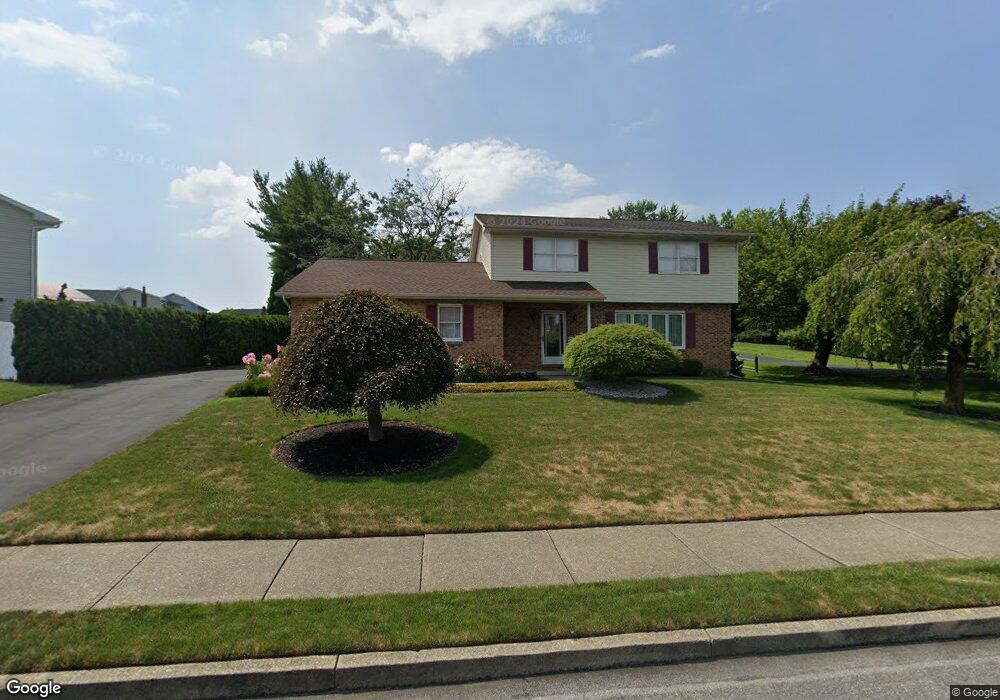
611 Buckingham Dr Northampton, PA 18067
Estimated Value: $364,000 - $466,000
3
Beds
2
Baths
2,122
Sq Ft
$190/Sq Ft
Est. Value
About This Home
This home is located at 611 Buckingham Dr, Northampton, PA 18067 and is currently estimated at $402,313, approximately $189 per square foot. 611 Buckingham Dr is a home located in Northampton County with nearby schools including Colonel John Siegfried Elementary School, Northampton Area Middle School, and Northampton Area High School.
Ownership History
Date
Name
Owned For
Owner Type
Purchase Details
Closed on
Apr 1, 1987
Bought by
Kosman Alfred R and Kosman Elizabeth R
Current Estimated Value
Purchase Details
Closed on
Oct 1, 1986
Bought by
Not Provided
Create a Home Valuation Report for This Property
The Home Valuation Report is an in-depth analysis detailing your home's value as well as a comparison with similar homes in the area
Home Values in the Area
Average Home Value in this Area
Purchase History
| Date | Buyer | Sale Price | Title Company |
|---|---|---|---|
| Kosman Alfred R | $98,900 | -- | |
| Not Provided | $800,000 | -- |
Source: Public Records
Tax History Compared to Growth
Tax History
| Year | Tax Paid | Tax Assessment Tax Assessment Total Assessment is a certain percentage of the fair market value that is determined by local assessors to be the total taxable value of land and additions on the property. | Land | Improvement |
|---|---|---|---|---|
| 2025 | $829 | $76,800 | $23,300 | $53,500 |
| 2024 | $6,145 | $76,800 | $23,300 | $53,500 |
| 2023 | $6,068 | $76,800 | $23,300 | $53,500 |
| 2022 | $5,991 | $76,800 | $23,300 | $53,500 |
| 2021 | $6,005 | $76,800 | $23,300 | $53,500 |
| 2020 | $5,928 | $76,800 | $23,300 | $53,500 |
| 2019 | $5,808 | $76,800 | $23,300 | $53,500 |
| 2018 | $5,727 | $76,800 | $23,300 | $53,500 |
| 2017 | $5,609 | $76,800 | $23,300 | $53,500 |
| 2016 | -- | $76,800 | $23,300 | $53,500 |
| 2015 | -- | $76,800 | $23,300 | $53,500 |
| 2014 | -- | $76,800 | $23,300 | $53,500 |
Source: Public Records
Map
Nearby Homes
- 426 E 12th St
- 1328 Adams St
- 624 E 8th St
- 1309 Adams St
- 649 Walker Dr
- 642 Walker Dr
- 119 Gray Dr
- 1339 Washington Ave
- 705 Main St
- 325 Kingsbarns Ln
- 4140 Pine Hurst Dr
- 320 Bendelow Ln
- 314 Kingsbarns Ln
- 1529 Dewey Ave
- 1309 Newport Ave
- 1510 Washington Ave
- 1466 Main St
- 1613 Main St
- 518 E 2nd St
- 1809 Lincoln Ave
- 609 Buckingham Dr
- 613 Buckingham Dr
- 615 Buckingham Dr
- 607 Buckingham Dr
- 616 Buckingham Dr
- 614 Buckingham Dr
- 618 Buckingham Dr
- 605 Buckingham Dr
- 612 Buckingham Dr
- 1309 Atlas Ln
- 1307 Atlas Ln
- 610 Buckingham Dr
- 608 Buckingham Dr
- 620 Buckingham Dr
- 1311 Atlas Ln
- 1028 Wynnewood Dr
- 1305 Atlas Ln
- 1026 Wynnewood Dr
- 606 Buckingham Dr
- 617 Buckingham Dr