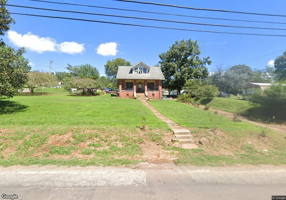
611 Emma Rd Asheville, NC 28806
West Asheville NeighborhoodEstimated Value: $201,000 - $347,103
4
Beds
1
Bath
1,491
Sq Ft
$185/Sq Ft
Est. Value
About This Home
This home is located at 611 Emma Rd, Asheville, NC 28806 and is currently estimated at $275,276, approximately $184 per square foot. 611 Emma Rd is a home located in Buncombe County with nearby schools including Clyde A. Erwin High School, Emma Elementary School, and Clyde A. Erwin Middle School.
Ownership History
Date
Name
Owned For
Owner Type
Purchase Details
Closed on
Mar 13, 2012
Sold by
Lowe Debra Owens and Lowe Phillip N
Bought by
Owens Michael Anthony and Owens Tina
Current Estimated Value
Home Financials for this Owner
Home Financials are based on the most recent Mortgage that was taken out on this home.
Original Mortgage
$63,630
Outstanding Balance
$44,799
Interest Rate
4.4%
Mortgage Type
FHA
Estimated Equity
$230,477
Purchase Details
Closed on
Mar 18, 2009
Sold by
Woody James B
Bought by
Owens Michael Anthony and Owens Tina C
Home Financials for this Owner
Home Financials are based on the most recent Mortgage that was taken out on this home.
Original Mortgage
$41,256
Interest Rate
5.29%
Mortgage Type
Seller Take Back
Purchase Details
Closed on
Oct 24, 2008
Sold by
Owens Lee Kathy
Bought by
Woody James B
Create a Home Valuation Report for This Property
The Home Valuation Report is an in-depth analysis detailing your home's value as well as a comparison with similar homes in the area
Home Values in the Area
Average Home Value in this Area
Purchase History
| Date | Buyer | Sale Price | Title Company |
|---|---|---|---|
| Owens Michael Anthony | $75,000 | None Available | |
| Owens Michael Anthony | $41,500 | None Available | |
| Woody James B | $36,000 | None Available |
Source: Public Records
Mortgage History
| Date | Status | Borrower | Loan Amount |
|---|---|---|---|
| Open | Owens Michael Anthony | $63,630 | |
| Previous Owner | Owens Michael Anthony | $41,256 |
Source: Public Records
Tax History Compared to Growth
Tax History
| Year | Tax Paid | Tax Assessment Tax Assessment Total Assessment is a certain percentage of the fair market value that is determined by local assessors to be the total taxable value of land and additions on the property. | Land | Improvement |
|---|---|---|---|---|
| 2025 | $1,209 | $185,300 | $42,800 | $142,500 |
| 2024 | $1,209 | $185,300 | $42,800 | $142,500 |
| 2023 | $1,209 | $185,300 | $42,800 | $142,500 |
| 2022 | $1,154 | $185,300 | $0 | $0 |
| 2021 | $1,154 | $185,300 | $0 | $0 |
| 2020 | $861 | $128,700 | $0 | $0 |
| 2019 | $861 | $128,700 | $0 | $0 |
| 2018 | $848 | $128,700 | $0 | $0 |
| 2017 | $848 | $104,200 | $0 | $0 |
| 2016 | $754 | $104,200 | $0 | $0 |
| 2015 | $754 | $104,200 | $0 | $0 |
| 2014 | $734 | $104,200 | $0 | $0 |
Source: Public Records
Map
Nearby Homes
- 658 Emma Rd
- 379 N Louisiana Ave
- 238 Brickyard Rd
- 108 Lager Ln Unit 108/110/112/103/105/
- 16 Oak Hill Dr
- 9 Sunridge Rd
- 815 Emma Rd
- 307 Hazel Mill Rd
- 99999 Emma Rd Unit 3
- 99999 Emma Rd Unit 2
- 304 Hazel Mill Rd
- 14 & 24 Oakmoss Ln
- 131 Bellamy Rd
- 128 Bellamy Rd Unit 14
- 123 Bellamy Rd
- 121 Bellamy Rd Unit 26
- 119 Bellamy Rd Unit 27
- 23 Laurel Loop
- 0000 New Leicester Hwy
- 378 Emma Rd