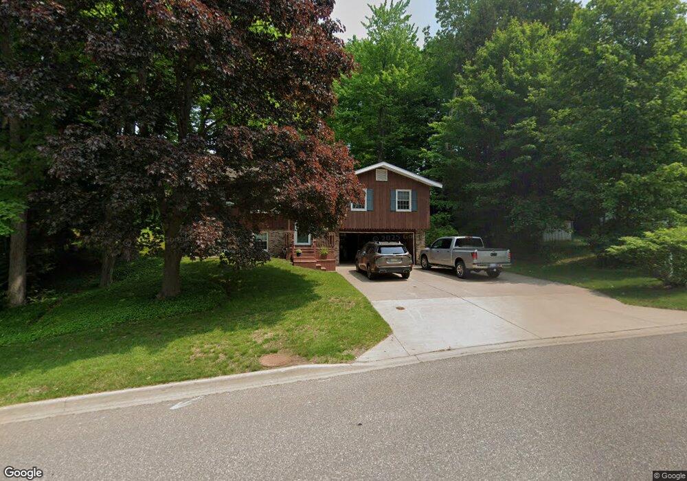
611 Forest Park Dr Marquette, MI 49855
Estimated Value: $327,709 - $381,000
4
Beds
3
Baths
2,490
Sq Ft
$145/Sq Ft
Est. Value
About This Home
This home is located at 611 Forest Park Dr, Marquette, MI 49855 and is currently estimated at $359,903, approximately $144 per square foot. 611 Forest Park Dr is a home located in Marquette County with nearby schools including Superior Hills Elementary School, Bothwell Middle School, and Marquette Senior High School.
Ownership History
Date
Name
Owned For
Owner Type
Purchase Details
Closed on
Nov 18, 2011
Bought by
Vanlinden Joseph E
Current Estimated Value
Create a Home Valuation Report for This Property
The Home Valuation Report is an in-depth analysis detailing your home's value as well as a comparison with similar homes in the area
Home Values in the Area
Average Home Value in this Area
Purchase History
| Date | Buyer | Sale Price | Title Company |
|---|---|---|---|
| Vanlinden Joseph E | $125,000 | -- |
Source: Public Records
Tax History Compared to Growth
Tax History
| Year | Tax Paid | Tax Assessment Tax Assessment Total Assessment is a certain percentage of the fair market value that is determined by local assessors to be the total taxable value of land and additions on the property. | Land | Improvement |
|---|---|---|---|---|
| 2025 | $31 | $126,700 | $0 | $0 |
| 2024 | $31 | $114,900 | $0 | $0 |
| 2023 | $2,937 | $100,100 | $0 | $0 |
| 2022 | $2,867 | $73,100 | $0 | $0 |
| 2021 | $2,414 | $75,100 | $0 | $0 |
| 2020 | $2,381 | $73,100 | $0 | $0 |
| 2019 | $2,514 | $72,000 | $0 | $0 |
| 2018 | $2,361 | $72,900 | $0 | $0 |
| 2017 | $166 | $72,100 | $0 | $0 |
| 2016 | $2,452 | $74,200 | $0 | $0 |
| 2015 | -- | $74,200 | $0 | $0 |
| 2014 | -- | $74,200 | $0 | $0 |
| 2012 | -- | $74,200 | $0 | $0 |
Source: Public Records
Map
Nearby Homes
- 737 Grove St
- 914 Wilson St
- 713 Grove St
- 450 Mcmillan St
- 1301 Tierney St
- 2001 Wilson St
- 617 W Baraga Ave
- 615 W Baraga Ave
- 347 Blemhuber Ave
- 1750 Harbour View Dr
- 1050 Vistanna Dr
- 301 Garfield Ave
- TBD Grandview Dr Unit TBD Pioneer Road
- 710 W Bluff St
- 735 W Ridge St
- 217 Mesnard St
- 1212 Division St
- 1917 Langford Dr
- 516 W Ridge St
- 600 Rd
- 601 Forest Park Dr
- 621 Forest Park Dr
- 4 Grove Hill Ct
- 5 Grove Hill Ct
- 600 Forest Park Dr
- 608 Forest Park Dr
- 631 Forest Park Dr
- 614 Forest Park Dr
- 6 Grove Hill Ct
- 551 Forest Park Dr
- 2 Grove Hill Ct
- 3 Westland Dr
- 2 Westland Dr
- 1 Westland Dr
- 8 Westland Dr
- 9 Westland Dr
- 10 Westland Dr
- 4 Westland Dr
- 5 Westland Dr
- 4-5 Westland Dr Unit Double Lot 4 and 5