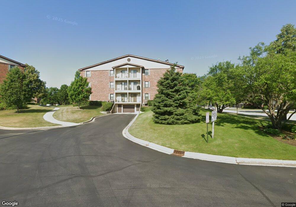
611 Hapsfield Ln Unit 611207 Buffalo Grove, IL 60089
South Buffalo Grove NeighborhoodEstimated Value: $232,000 - $249,000
2
Beds
2
Baths
1,150
Sq Ft
$210/Sq Ft
Est. Value
About This Home
This home is located at 611 Hapsfield Ln Unit 611207, Buffalo Grove, IL 60089 and is currently estimated at $241,549, approximately $210 per square foot. 611 Hapsfield Ln Unit 611207 is a home located in Cook County with nearby schools including Henry W Longfellow Elementary School, Cooper Middle School, and Buffalo Grove High School.
Ownership History
Date
Name
Owned For
Owner Type
Purchase Details
Closed on
Oct 15, 2003
Sold by
Us Bank Na
Bought by
Olsen Roger L
Current Estimated Value
Home Financials for this Owner
Home Financials are based on the most recent Mortgage that was taken out on this home.
Original Mortgage
$161,950
Interest Rate
6.1%
Mortgage Type
FHA
Create a Home Valuation Report for This Property
The Home Valuation Report is an in-depth analysis detailing your home's value as well as a comparison with similar homes in the area
Home Values in the Area
Average Home Value in this Area
Purchase History
| Date | Buyer | Sale Price | Title Company |
|---|---|---|---|
| Olsen Roger L | $167,000 | Pntn |
Source: Public Records
Mortgage History
| Date | Status | Borrower | Loan Amount |
|---|---|---|---|
| Previous Owner | Olsen Roger L | $161,950 |
Source: Public Records
Tax History Compared to Growth
Tax History
| Year | Tax Paid | Tax Assessment Tax Assessment Total Assessment is a certain percentage of the fair market value that is determined by local assessors to be the total taxable value of land and additions on the property. | Land | Improvement |
|---|---|---|---|---|
| 2024 | $4,016 | $15,863 | $526 | $15,337 |
| 2023 | $3,831 | $15,863 | $526 | $15,337 |
| 2022 | $3,831 | $15,863 | $526 | $15,337 |
| 2021 | $3,762 | $13,978 | $116 | $13,862 |
| 2020 | $3,739 | $13,978 | $116 | $13,862 |
| 2019 | $3,734 | $15,489 | $116 | $15,373 |
| 2018 | $2,292 | $10,091 | $102 | $9,989 |
| 2017 | $2,270 | $10,091 | $102 | $9,989 |
| 2016 | $2,385 | $10,091 | $102 | $9,989 |
| 2015 | $2,082 | $8,752 | $248 | $8,504 |
| 2014 | $2,066 | $8,752 | $248 | $8,504 |
| 2013 | $1,891 | $8,752 | $248 | $8,504 |
Source: Public Records
Map
Nearby Homes
- 665 Thornwood Dr
- 820 Weidner Rd Unit 409
- 813 Stradford Cir Unit 21B2
- 859 Beechwood Rd
- 535 Estate Dr
- 3300 N Carriageway Dr Unit 317
- 561 Park View Terrace Unit 153
- 455 Mayfair Ln
- 410 Chatham Cir
- 1127 Miller Ln Unit 107
- 476 Raupp Blvd
- 972 Thornton Ln Unit 102
- 1115 Miller Ln Unit 104
- 408 Indian Hill Dr
- 3157 N Daniels Ct Unit 1502
- 18 E Heritage Ct
- 250 Old Oak Dr Unit 275
- 234 Mohawk Trail
- 310 Rosewood Ave
- 3227 N Heritage Ln
- 611 Hapsfield Ln Unit 307
- 611 Hapsfield Ln Unit 306
- 611 Hapsfield Ln Unit 107
- 611 Hapsfield Ln Unit 611206
- 611 Hapsfield Ln Unit 611104
- 611 Hapsfield Ln Unit 611204
- 611 Hapsfield Ln Unit 611303
- 611 Hapsfield Ln Unit 611307
- 611 Hapsfield Ln Unit 611102
- 611 Hapsfield Ln Unit 611301
- 611 Hapsfield Ln Unit 611105
- 611 Hapsfield Ln Unit 611302
- 611 Hapsfield Ln Unit 611306
- 611 Hapsfield Ln Unit 611203
- 611 Hapsfield Ln Unit 611106
- 611 Hapsfield Ln Unit 611201
- 611 Hapsfield Ln Unit 611200
- 611 Hapsfield Ln Unit 611300
- 611 Hapsfield Ln Unit 611103
- 611 Hapsfield Ln Unit 611101