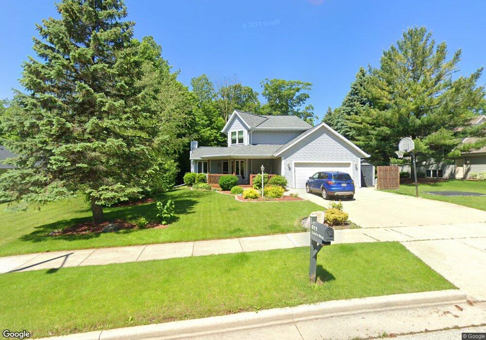
611 Lous Way Slinger, WI 53086
Estimated Value: $473,539 - $526,000
3
Beds
2
Baths
1,988
Sq Ft
$250/Sq Ft
Est. Value
About This Home
This home is located at 611 Lous Way, Slinger, WI 53086 and is currently estimated at $496,885, approximately $249 per square foot. 611 Lous Way is a home located in Washington County with nearby schools including Slinger High School and St Peter Elementary School.
Ownership History
Date
Name
Owned For
Owner Type
Purchase Details
Closed on
Apr 14, 2018
Sold by
Heser Steven E and Heser Ann M
Bought by
Cyper Peter M and Cyper Teresa E
Current Estimated Value
Home Financials for this Owner
Home Financials are based on the most recent Mortgage that was taken out on this home.
Original Mortgage
$260,000
Outstanding Balance
$221,283
Interest Rate
4.46%
Mortgage Type
New Conventional
Estimated Equity
$275,602
Create a Home Valuation Report for This Property
The Home Valuation Report is an in-depth analysis detailing your home's value as well as a comparison with similar homes in the area
Home Values in the Area
Average Home Value in this Area
Purchase History
| Date | Buyer | Sale Price | Title Company |
|---|---|---|---|
| Cyper Peter M | $300,000 | None Available |
Source: Public Records
Mortgage History
| Date | Status | Borrower | Loan Amount |
|---|---|---|---|
| Open | Cyper Peter M | $260,000 |
Source: Public Records
Tax History
| Year | Tax Paid | Tax Assessment Tax Assessment Total Assessment is a certain percentage of the fair market value that is determined by local assessors to be the total taxable value of land and additions on the property. | Land | Improvement |
|---|---|---|---|---|
| 2024 | $4,885 | $434,000 | $97,200 | $336,800 |
| 2023 | $4,301 | $324,200 | $74,800 | $249,400 |
| 2022 | $4,407 | $324,200 | $74,800 | $249,400 |
| 2021 | $4,206 | $324,200 | $74,800 | $249,400 |
| 2020 | $4,198 | $283,500 | $72,500 | $211,000 |
| 2019 | $4,141 | $283,500 | $72,500 | $211,000 |
| 2018 | $4,107 | $283,500 | $72,500 | $211,000 |
| 2017 | $3,937 | $259,500 | $69,000 | $190,500 |
| 2016 | $3,954 | $235,600 | $69,000 | $166,600 |
| 2015 | $4,155 | $235,600 | $69,000 | $166,600 |
| 2014 | $4,155 | $235,600 | $69,000 | $166,600 |
| 2013 | $4,954 | $277,600 | $88,600 | $189,000 |
Source: Public Records
Map
Nearby Homes
- 322 Sandstone Dr
- 1151 Glacier Pass
- 231 Nordic Ln
- 401 Slinger Rd Unit 1
- 565 Slinger Rd Unit C3
- 301 E Commerce Blvd Unit 45
- 4451 Hartstone Dr
- 308 Oak St Unit 201
- 308 Oak St Unit 101
- 308 Oak St Unit 102
- 308 Oak St Unit 202
- 731 Hidden View Ct
- 420 Cobblestone Ct
- 1709 Woodland Way
- 326 Kettle Moraine Dr N Unit 1
- 114 Manor Ct
- 1795 Woodland Way
- 1820 Horseshoe Ln Unit 423-1
- 1793 Cedar Ridge Dr Unit 215-1
- 1822 Horseshoe Ln Unit 423-2
Your Personal Tour Guide
Ask me questions while you tour the home.