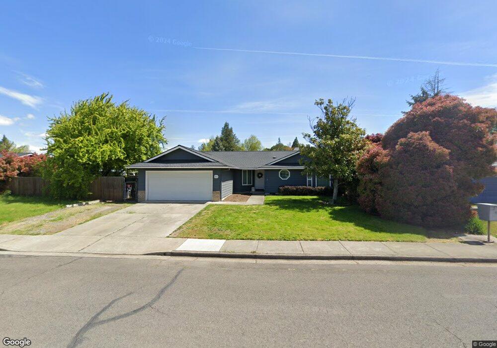
611 Malabar St Central Point, OR 97502
Estimated Value: $349,000 - $382,000
3
Beds
2
Baths
1,424
Sq Ft
$258/Sq Ft
Est. Value
About This Home
This home is located at 611 Malabar St, Central Point, OR 97502 and is currently estimated at $367,033, approximately $257 per square foot. 611 Malabar St is a home located in Jackson County with nearby schools including Richardson Elementary School, Scenic Middle School, and Crater High School.
Ownership History
Date
Name
Owned For
Owner Type
Purchase Details
Closed on
Apr 10, 2017
Sold by
Mcirvin Cary M and Mcirvin Glenn T
Bought by
Hulin Tommie Joe and Hulin Peggy L
Current Estimated Value
Purchase Details
Closed on
May 16, 2008
Sold by
Lile Karen J
Bought by
Mcirvin Cary M and Mcirvin Glenn T
Home Financials for this Owner
Home Financials are based on the most recent Mortgage that was taken out on this home.
Original Mortgage
$221,523
Interest Rate
5.88%
Mortgage Type
FHA
Purchase Details
Closed on
Mar 30, 2001
Sold by
Meunier Michael Laval and Meunier Anna Darlene
Bought by
Lile Richard L and Lile Karen J
Home Financials for this Owner
Home Financials are based on the most recent Mortgage that was taken out on this home.
Original Mortgage
$123,500
Interest Rate
7.06%
Create a Home Valuation Report for This Property
The Home Valuation Report is an in-depth analysis detailing your home's value as well as a comparison with similar homes in the area
Purchase History
| Date | Buyer | Sale Price | Title Company |
|---|---|---|---|
| Hulin Tommie Joe | $181,000 | None Available | |
| Mcirvin Cary M | $225,000 | First American Title Ins | |
| Lile Richard L | $130,000 | Amerititle |
Source: Public Records
Mortgage History
| Date | Status | Borrower | Loan Amount |
|---|---|---|---|
| Previous Owner | Mcirvin Cary M | $221,523 | |
| Previous Owner | Lile Richard L | $123,500 |
Source: Public Records
Tax History
| Year | Tax Paid | Tax Assessment Tax Assessment Total Assessment is a certain percentage of the fair market value that is determined by local assessors to be the total taxable value of land and additions on the property. | Land | Improvement |
|---|---|---|---|---|
| 2026 | $3,475 | $210,010 | -- | -- |
| 2025 | $3,390 | $203,900 | $59,130 | $144,770 |
| 2024 | $3,390 | $197,970 | $57,410 | $140,560 |
| 2023 | $3,281 | $192,210 | $55,740 | $136,470 |
| 2022 | $3,205 | $192,210 | $55,740 | $136,470 |
| 2021 | $3,113 | $186,620 | $54,120 | $132,500 |
| 2020 | $3,022 | $181,190 | $52,540 | $128,650 |
| 2019 | $2,948 | $170,800 | $49,530 | $121,270 |
| 2018 | $2,858 | $165,830 | $48,090 | $117,740 |
| 2017 | $2,786 | $165,830 | $48,090 | $117,740 |
| 2016 | $2,705 | $156,320 | $45,330 | $110,990 |
| 2015 | $2,592 | $156,320 | $45,330 | $110,990 |
| 2014 | $2,420 | $147,350 | $42,730 | $104,620 |
Source: Public Records
Map
Nearby Homes
- 1189 Lindsey Ct
- 827 Isherwood Dr
- 436 Cheney Loop
- 887 Silver Fox Dr
- 871 Holley Way
- 895 Holley Way
- 185 Logan Ave
- 755 S 4th St
- 114 Cedar St
- 209 Corcoran Ln
- 349 W Pine St
- 220 S 3rd St
- 350 Alder St
- 166 Nadine Ln
- 736 Hemlock Ave
- 3364 Bursell Rd
- 3358 Bursell Rd
- 555 Freeman Rd Unit 73
- 555 Freeman Rd Unit 254
- 555 Freeman Rd Unit 105
- 619 Malabar St
- 603 Malabar St
- 1425 Timothy St Unit 2
- 626 Farnsworth Dr
- 627 Malabar St
- 618 Farnsworth Dr
- 1421 Timothy St
- 634 Farnsworth Dr
- 610 Malabar St
- 618 Malabar St
- 635 Malabar St
- 610 Farnsworth Dr
- 624 Malabar St
- 1575 Timothy St
- 1417 Timothy St
- 632 Malabar St
- 643 Malabar St
- 1496 Timothy St
- 642 Farnsworth Dr
- 1570 Timothy St
Your Personal Tour Guide
Ask me questions while you tour the home.