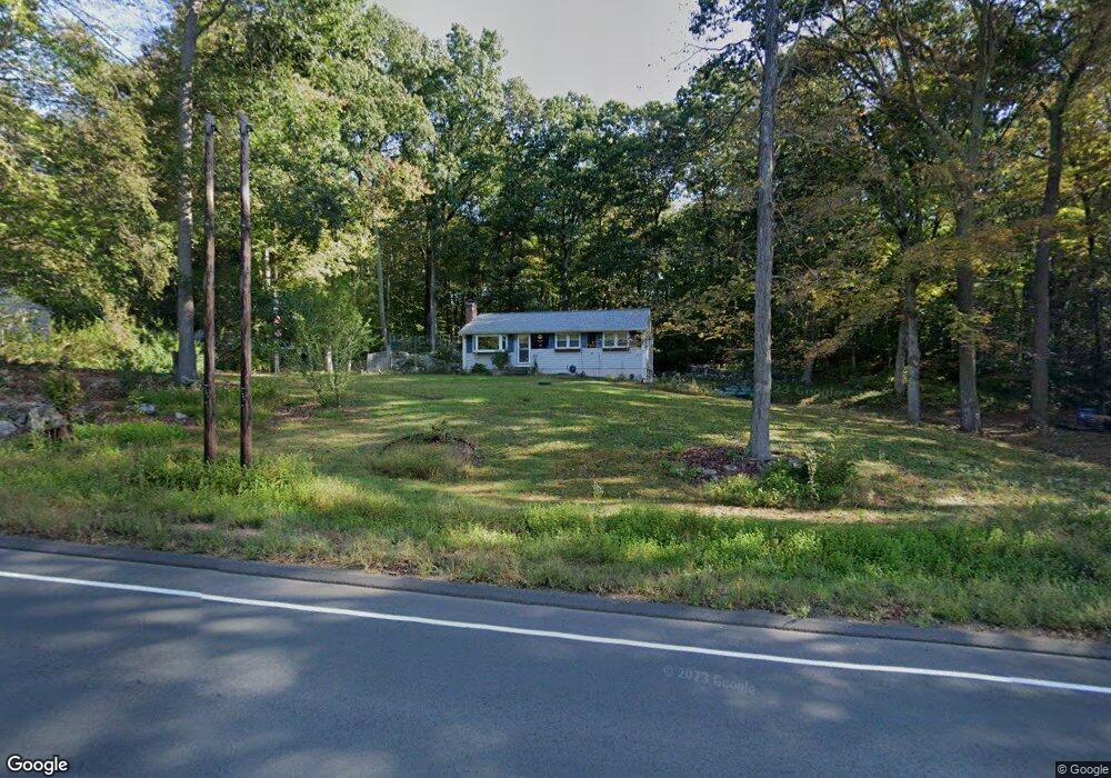
611 Merrow Rd Tolland, CT 06084
Estimated Value: $298,000 - $317,686
3
Beds
1
Bath
1,008
Sq Ft
$307/Sq Ft
Est. Value
About This Home
This home is located at 611 Merrow Rd, Tolland, CT 06084 and is currently estimated at $309,172, approximately $306 per square foot. 611 Merrow Rd is a home located in Tolland County with nearby schools including Birch Grove Primary School, Tolland Intermediate School, and Tolland Middle School.
Ownership History
Date
Name
Owned For
Owner Type
Purchase Details
Closed on
Feb 13, 1991
Sold by
Fleet Mtg Corp
Bought by
Secretary Veterans Aff
Current Estimated Value
Purchase Details
Closed on
Mar 23, 1989
Sold by
Sullivan Steven
Bought by
Oborski Walter
Home Financials for this Owner
Home Financials are based on the most recent Mortgage that was taken out on this home.
Original Mortgage
$137,750
Interest Rate
10.49%
Mortgage Type
Purchase Money Mortgage
Create a Home Valuation Report for This Property
The Home Valuation Report is an in-depth analysis detailing your home's value as well as a comparison with similar homes in the area
Home Values in the Area
Average Home Value in this Area
Purchase History
| Date | Buyer | Sale Price | Title Company |
|---|---|---|---|
| Secretary Veterans Aff | $111,573 | -- | |
| Secretary Veterans Aff | $111,573 | -- | |
| Oborski Walter | $136,400 | -- |
Source: Public Records
Mortgage History
| Date | Status | Borrower | Loan Amount |
|---|---|---|---|
| Closed | Oborski Walter | $106,500 | |
| Previous Owner | Oborski Walter | $137,750 | |
| Previous Owner | Oborski Walter | $67,000 |
Source: Public Records
Tax History Compared to Growth
Tax History
| Year | Tax Paid | Tax Assessment Tax Assessment Total Assessment is a certain percentage of the fair market value that is determined by local assessors to be the total taxable value of land and additions on the property. | Land | Improvement |
|---|---|---|---|---|
| 2025 | $4,897 | $180,100 | $67,500 | $112,600 |
| 2024 | $4,721 | $125,000 | $64,500 | $60,500 |
| 2023 | $4,666 | $125,000 | $64,500 | $60,500 |
| 2022 | $4,573 | $125,000 | $64,500 | $60,500 |
| 2021 | $4,639 | $125,000 | $64,500 | $60,500 |
| 2020 | $4,506 | $125,000 | $64,500 | $60,500 |
| 2019 | $4,376 | $121,400 | $66,500 | $54,900 |
| 2018 | $4,249 | $121,400 | $66,500 | $54,900 |
| 2017 | $4,151 | $121,400 | $66,500 | $54,900 |
| 2016 | $4,151 | $121,400 | $66,500 | $54,900 |
| 2015 | $4,050 | $121,400 | $66,500 | $54,900 |
| 2014 | $4,130 | $133,000 | $73,700 | $59,300 |
Source: Public Records
Map
Nearby Homes
- 49 Walbridge Hill Rd
- 8 Walbridge Hill Rd
- 159 Anthony Rd
- 137 Anthony Rd
- 312 Merrow Rd
- 124 River Rd
- 226 Goose Ln
- 20 Barlow Dr
- 28 Barlow Dr
- 40 Deborah Dr
- 284 Merrow Rd
- 317 Merrow Rd
- 471 Goose Ln
- 248 Merrow Rd
- 240 Merrow Rd
- 167 Baxter Rd
- 45 Crystal Ln Unit D
- 12 Stone Pond Rd
- 745 Merrow Rd Unit 102
- 19 Thomas Dr