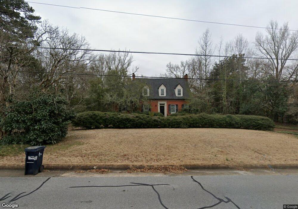
611 Milledge Cir Athens, GA 30606
Five Points NeighborhoodEstimated Value: $1,130,000 - $1,570,000
--
Bed
1
Bath
3,422
Sq Ft
$407/Sq Ft
Est. Value
About This Home
This home is located at 611 Milledge Cir, Athens, GA 30606 and is currently estimated at $1,392,381, approximately $406 per square foot. 611 Milledge Cir is a home located in Clarke County with nearby schools including Barrow Elementary School, Clarke Middle School, and Clarke Central High School.
Ownership History
Date
Name
Owned For
Owner Type
Purchase Details
Closed on
Aug 7, 1994
Sold by
Brewer Joseph F
Bought by
Brewer Patsy Bryan
Current Estimated Value
Purchase Details
Closed on
Mar 1, 1994
Sold by
Ulm William L
Bought by
Brewer Joseph F
Purchase Details
Closed on
Dec 29, 1992
Sold by
Daniel Harold T and Laurie Webb Daniel
Bought by
Ulm William L
Create a Home Valuation Report for This Property
The Home Valuation Report is an in-depth analysis detailing your home's value as well as a comparison with similar homes in the area
Home Values in the Area
Average Home Value in this Area
Purchase History
| Date | Buyer | Sale Price | Title Company |
|---|---|---|---|
| Brewer Patsy Bryan | -- | -- | |
| Brewer Joseph F | $190,000 | -- | |
| Ulm William L | -- | -- |
Source: Public Records
Tax History Compared to Growth
Tax History
| Year | Tax Paid | Tax Assessment Tax Assessment Total Assessment is a certain percentage of the fair market value that is determined by local assessors to be the total taxable value of land and additions on the property. | Land | Improvement |
|---|---|---|---|---|
| 2025 | $13,151 | $596,708 | $178,200 | $418,508 |
| 2024 | $13,151 | $541,048 | $178,200 | $362,848 |
| 2023 | $13,254 | $490,832 | $178,200 | $312,632 |
| 2022 | $12,239 | $422,921 | $178,200 | $244,721 |
| 2021 | $12,579 | $373,260 | $178,200 | $195,060 |
| 2020 | $7,589 | $326,630 | $178,200 | $148,430 |
| 2019 | $7,594 | $321,332 | $178,200 | $143,132 |
| 2018 | $7,594 | $321,332 | $178,200 | $143,132 |
| 2017 | $7,594 | $321,332 | $178,200 | $143,132 |
| 2016 | $7,513 | $315,502 | $178,200 | $137,302 |
| 2015 | $7,250 | $296,653 | $162,000 | $134,653 |
| 2014 | $7,140 | $288,705 | $162,000 | $126,705 |
Source: Public Records
Map
Nearby Homes
- 590 Highland Ave
- 589 W Lake Dr
- 490 Mcwhorter Dr
- 104 W Lake Ct
- 275 Westview Dr
- 495 Woodlawn Ave
- 164 Plum Nelly Rd
- 2019 S Lumpkin St
- 175 Tillman Ln
- 169 Fortson Cir
- 577 W Cloverhurst Ave
- 224 Fortson Dr
- 206 Fortson Dr
- 997 S Milledge Ave Unit 2
- 997 S Milledge Ave Unit 3
- 997 S Milledge Ave Unit 1
- 997 S Milledge Ave Unit 4
- 1055 Baxter St Unit 504
- 265 Springdale St
- 338 Springdale St
- 633 Milledge Cir
- 595 Milledge Cir
- 0 Milledge Cir Unit CM916632
- 0 Milledge Cir Unit 8860359
- 0 Milledge Cir Unit 8595160
- 0 Milledge Cir Unit 8418309
- 0 Milledge Cir Unit 8345120
- 0 Milledge Cir Unit 8196635
- 0 Milledge Cir Unit 8122302
- 0 Milledge Cir Unit 7573622
- 0 Milledge Cir Unit 8399517
- 0 Milledge Cir Unit 7293558
- 0 Milledge Cir Unit 7108445
- 0 Milledge Cir Unit 8458819
- 0 Milledge Cir
- 600 Milledge Cir
- 579 Milledge Cir
- 655 Milledge Cir
- 580 Milledge Cir
- 634 Milledge Cir