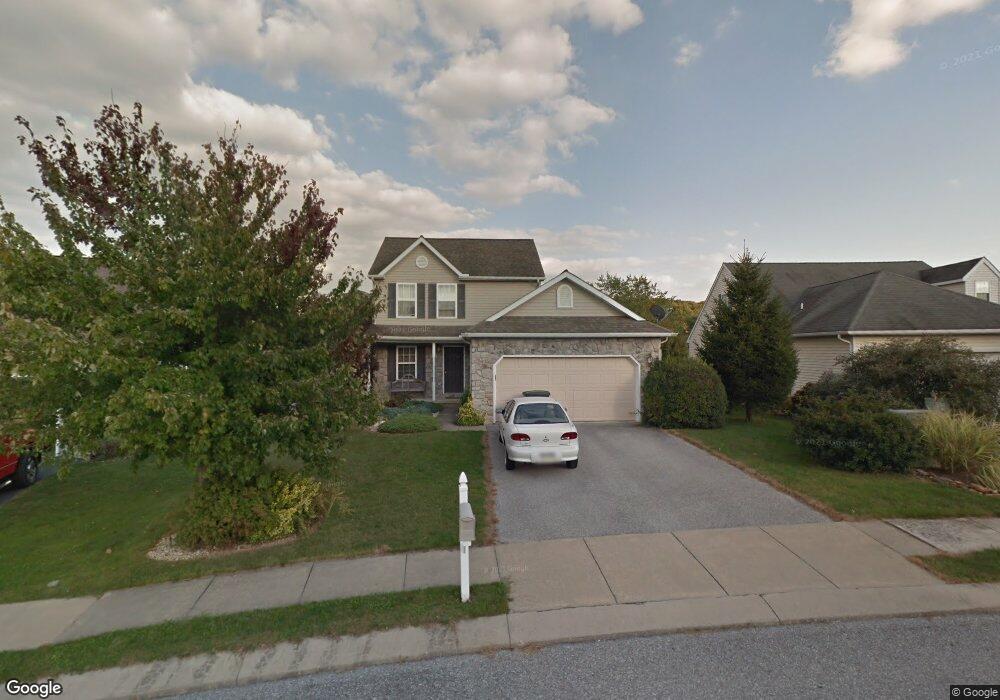
611 Misty Hill Ln Dallastown, PA 17313
Estimated Value: $302,000 - $324,000
4
Beds
3
Baths
1,350
Sq Ft
$234/Sq Ft
Est. Value
About This Home
This home is located at 611 Misty Hill Ln, Dallastown, PA 17313 and is currently estimated at $315,877, approximately $233 per square foot. 611 Misty Hill Ln is a home located in York County with nearby schools including Ore Valley Elementary School, Dallastown Area Middle School, and Dallastown Area High School.
Ownership History
Date
Name
Owned For
Owner Type
Purchase Details
Closed on
Oct 16, 2006
Sold by
Way Andrew P and Way Kim Lyn
Bought by
Way Andrew P
Current Estimated Value
Purchase Details
Closed on
Apr 17, 2002
Sold by
First Avalong Ltd Partnership
Bought by
Way Andrew P and Way Kim Lyn
Home Financials for this Owner
Home Financials are based on the most recent Mortgage that was taken out on this home.
Original Mortgage
$142,272
Outstanding Balance
$59,147
Interest Rate
6.85%
Mortgage Type
FHA
Estimated Equity
$256,730
Create a Home Valuation Report for This Property
The Home Valuation Report is an in-depth analysis detailing your home's value as well as a comparison with similar homes in the area
Home Values in the Area
Average Home Value in this Area
Purchase History
| Date | Buyer | Sale Price | Title Company |
|---|---|---|---|
| Way Andrew P | -- | None Available | |
| Way Andrew P | $144,506 | -- |
Source: Public Records
Mortgage History
| Date | Status | Borrower | Loan Amount |
|---|---|---|---|
| Open | Way Andrew P | $142,272 |
Source: Public Records
Tax History Compared to Growth
Tax History
| Year | Tax Paid | Tax Assessment Tax Assessment Total Assessment is a certain percentage of the fair market value that is determined by local assessors to be the total taxable value of land and additions on the property. | Land | Improvement |
|---|---|---|---|---|
| 2025 | $5,110 | $148,880 | $35,450 | $113,430 |
| 2024 | $5,036 | $148,880 | $35,450 | $113,430 |
| 2023 | $5,036 | $148,880 | $35,450 | $113,430 |
| 2022 | $4,871 | $148,880 | $35,450 | $113,430 |
| 2021 | $4,641 | $148,880 | $35,450 | $113,430 |
| 2020 | $4,641 | $148,880 | $35,450 | $113,430 |
| 2019 | $4,626 | $148,880 | $35,450 | $113,430 |
| 2018 | $4,594 | $148,880 | $35,450 | $113,430 |
| 2017 | $4,411 | $148,880 | $35,450 | $113,430 |
| 2016 | $0 | $148,880 | $35,450 | $113,430 |
| 2015 | -- | $148,880 | $35,450 | $113,430 |
| 2014 | -- | $148,880 | $35,450 | $113,430 |
Source: Public Records
Map
Nearby Homes
- 774 Blossom Hill Ln
- 732 Blossom Hill Ln
- 428 W Main St
- 355 W Main St
- 0 S Franklin St
- 74 S Main St
- 106 Teila Dr
- 64 S Pleasant Ave
- 122 S Pleasant Ave
- 246 Hudson Blvd
- 234 Hudson Blvd
- 136 Teila Dr
- 27 Steeple Ave
- 350 Avon Dr Unit 270
- 362 Avon Dr Unit 276
- 376 Avon Dr Unit 283
- 433 Bradford Dr Unit 188
- 435 Bradford Dr Unit 187
- 437 Bradford Dr Unit 186
- 439 Bradford Dr Unit 185
- 617 Misty Hill Ln
- 615 Misty Hill Ln
- 792 Franlyn Dr
- 619 Misty Hill Ln
- 701 Franlyn Dr
- 788 Franlyn Dr
- 621 Misty Hill Ln
- 609 Misty Hill Ln
- 784 Franlyn Dr
- 623 Misty Hill Ln
- 154 Oak Rd
- 700 Franlyn Dr
- 618 Misty Hill Ln
- 607 Misty Hill Ln
- 614 Misty Hill Ln
- 625 Misty Hill Ln
- 780 Franlyn Dr
- 610 Misty Hill Ln
- 753 Franlyn Dr
- 704 Franlyn Dr