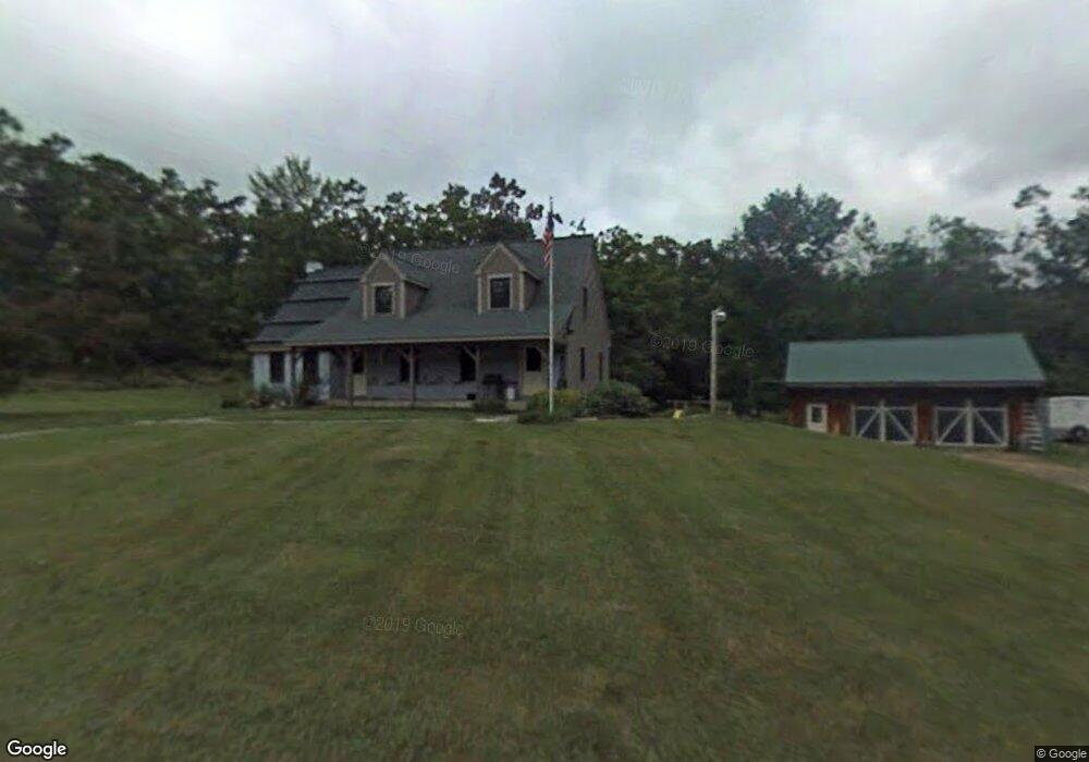
611 Moore Rd New Braintree, MA 01531
Estimated Value: $458,000 - $559,714
5
Beds
3
Baths
2,136
Sq Ft
$246/Sq Ft
Est. Value
About This Home
This home is located at 611 Moore Rd, New Braintree, MA 01531 and is currently estimated at $524,429, approximately $245 per square foot. 611 Moore Rd is a home located in Worcester County with nearby schools including Quabbin Regional Middle School and Quabbin Regional High School.
Ownership History
Date
Name
Owned For
Owner Type
Purchase Details
Closed on
Sep 3, 2021
Sold by
Dwelly Raymond C and Dwelly Catherine A
Bought by
Motyka Thomas and Motyka Elaine
Current Estimated Value
Home Financials for this Owner
Home Financials are based on the most recent Mortgage that was taken out on this home.
Original Mortgage
$255,500
Outstanding Balance
$231,110
Interest Rate
2.7%
Mortgage Type
Purchase Money Mortgage
Estimated Equity
$293,319
Purchase Details
Closed on
Oct 8, 1999
Sold by
Klymus Mary Louise and Kalin Nancy Jean
Bought by
Dwelly Raymond C and Dwelly Catherine A
Home Financials for this Owner
Home Financials are based on the most recent Mortgage that was taken out on this home.
Original Mortgage
$112,000
Interest Rate
7.81%
Mortgage Type
Purchase Money Mortgage
Create a Home Valuation Report for This Property
The Home Valuation Report is an in-depth analysis detailing your home's value as well as a comparison with similar homes in the area
Home Values in the Area
Average Home Value in this Area
Purchase History
| Date | Buyer | Sale Price | Title Company |
|---|---|---|---|
| Motyka Thomas | $455,500 | None Available | |
| Dwelly Raymond C | $142,500 | -- | |
| Dwelly Raymond C | $142,500 | -- |
Source: Public Records
Mortgage History
| Date | Status | Borrower | Loan Amount |
|---|---|---|---|
| Open | Motyka Thomas | $255,500 | |
| Closed | Motyka Thomas | $255,500 | |
| Previous Owner | Dwelly Raymond C | $120,000 | |
| Previous Owner | Dwelly Raymond C | $112,000 |
Source: Public Records
Tax History
| Year | Tax Paid | Tax Assessment Tax Assessment Total Assessment is a certain percentage of the fair market value that is determined by local assessors to be the total taxable value of land and additions on the property. | Land | Improvement |
|---|---|---|---|---|
| 2025 | $67 | $450,900 | $100,700 | $350,200 |
| 2024 | $6,556 | $450,900 | $100,700 | $350,200 |
| 2023 | $5,644 | $384,500 | $100,700 | $283,800 |
| 2022 | $5,090 | $313,200 | $80,200 | $233,000 |
| 2021 | $5,222 | $298,900 | $75,600 | $223,300 |
| 2020 | $5,217 | $301,200 | $75,300 | $225,900 |
| 2019 | $874 | $301,200 | $75,300 | $225,900 |
| 2018 | $5,129 | $292,100 | $80,000 | $212,100 |
| 2017 | $4,894 | $271,000 | $83,200 | $187,800 |
| 2016 | $4,715 | $271,000 | $83,200 | $187,800 |
| 2015 | $4,687 | $288,600 | $89,800 | $198,800 |
| 2014 | $4,717 | $288,700 | $89,900 | $198,800 |
Source: Public Records
Map
Nearby Homes
- 241 N Brookfield Rd
- 1109 New Braintree Rd
- 16 Mill Rd
- 80 New Braintree Rd
- 1380 N Brookfield Rd
- 10 Rufus Putnam Rd
- Lot 0 N Brookfield Rd
- 48 Mill Rd Lot 2e
- 67 Maple St
- 716 Hardwick Rd
- 101 School St
- 250 N Main St
- 111 Northwest Rd
- 1940 Barre Rd
- 8 Elm St
- 47 Elm St
- 95 S Main St
- 60 Gilbert St
- 926 Old Turnpike Rd
- 4 E Brookfield Rd
- 0 Charles Lane Rd Unit 72240906
- 0 Charles Lane Rd Unit 72003700
- 0 Charles Lane Rd Unit 73086669
- 0 Charles Lane Rd Unit 72549184
- 329 Igoe Rd
- 660 Moore Rd
- 0 Igoe Rd Unit 72017912
- 356 Igoe Rd
- 775 Moore Rd
- 823 Moore Rd
- 214 Charles Lane Rd
- 122 Igoe Rd
- 841 Moore Rd
- 325 Moore Rd
- 1138 Worcester Rd
- 1026 Worcester Rd
- 0 Worcester Rd
- Lot 406-43 Charles Lane Rd
- 1051 Worcester Rd
- 1115 Worcester Rd
Your Personal Tour Guide
Ask me questions while you tour the home.