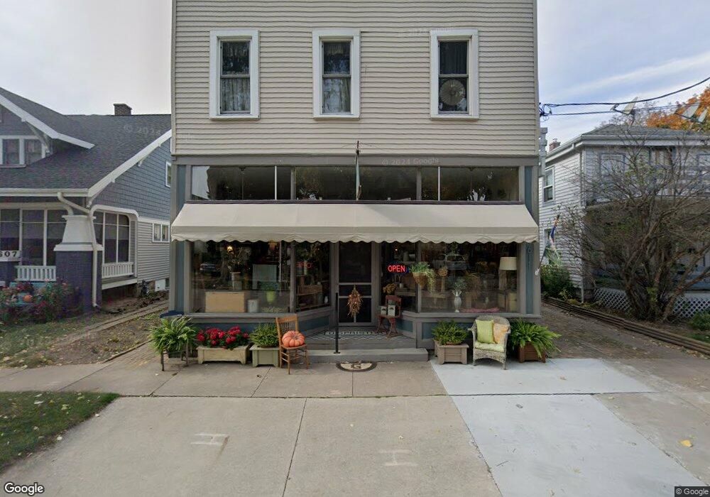
611 N Morrison St Appleton, WI 54911
Historic Central Neighborhood NeighborhoodEstimated Value: $150,179
5
Beds
2
Baths
2,560
Sq Ft
$59/Sq Ft
Est. Value
About This Home
This home is located at 611 N Morrison St, Appleton, WI 54911 and is currently estimated at $150,179, approximately $58 per square foot. 611 N Morrison St is a home located in Outagamie County with nearby schools including Edison Elementary School, Appleton North High School, and Appleton Bilingual School.
Ownership History
Date
Name
Owned For
Owner Type
Purchase Details
Closed on
Jan 29, 2019
Sold by
Peterson Irrevoc Trust
Bought by
Gavronski Lisa M
Current Estimated Value
Purchase Details
Closed on
Mar 28, 2017
Sold by
Peterson Elayne
Bought by
Peterson Peter P
Purchase Details
Closed on
May 30, 2008
Sold by
The Housing Partnership Of The Fox Citie
Bought by
Peterson Peter P and Peterson Elayne A
Create a Home Valuation Report for This Property
The Home Valuation Report is an in-depth analysis detailing your home's value as well as a comparison with similar homes in the area
Home Values in the Area
Average Home Value in this Area
Purchase History
| Date | Buyer | Sale Price | Title Company |
|---|---|---|---|
| Gavronski Lisa M | -- | -- | |
| Peterson Peter P | -- | -- | |
| Peterson Peter P | $64,400 | -- |
Source: Public Records
Tax History
| Year | Tax Paid | Tax Assessment Tax Assessment Total Assessment is a certain percentage of the fair market value that is determined by local assessors to be the total taxable value of land and additions on the property. | Land | Improvement |
|---|---|---|---|---|
| 2024 | $1,940 | $129,800 | $16,600 | $113,200 |
| 2023 | $2,051 | $129,800 | $16,600 | $113,200 |
| 2022 | $2,269 | $106,500 | $14,600 | $91,900 |
| 2021 | $2,172 | $106,500 | $14,600 | $91,900 |
| 2020 | $2,071 | $103,700 | $14,600 | $89,100 |
| 2019 | $2,024 | $103,700 | $14,600 | $89,100 |
| 2018 | $2,312 | $103,700 | $14,600 | $89,100 |
| 2017 | $2,270 | $103,700 | $14,600 | $89,100 |
| 2016 | $2,238 | $103,700 | $14,600 | $89,100 |
| 2015 | $2,263 | $103,700 | $14,600 | $89,100 |
| 2014 | $2,247 | $103,700 | $14,600 | $89,100 |
| 2013 | $2,251 | $103,700 | $14,600 | $89,100 |
Source: Public Records
Map
Nearby Homes
- 526 N Ida St
- 221 E Winnebago St
- 324 E Commercial St
- 431 E Summer St
- 425 E Summer St
- 501 W Winnebago St
- 913 N Harriman St
- 1223 N Harriman St
- 400 N Richmond St Unit 328
- 400 N Richmond St Unit 417
- 1314 N Harriman St
- 731 W Elsie St
- 1525 N Clark St
- 730 W Oklahoma St
- 827 E Washington St
- 1426 N Meade St
- 823 W Oklahoma St
- 507 E Roosevelt St
- 1606 S Carver Ln
- 726 W Summer St
- 614 N Morrison St
- 607 N Morrison St
- 602 N Morrison St
- 608 N Morrison St
- 124 E Pacific St
- 601 N Morrison St
- 120 E Pacific St
- 619 N Morrison St
- 121 E Atlantic St
- 125 E Atlantic St
- 621 N Morrison St
- 126 E Atlantic St
- 721 N Morrison St
- 709 N Morrison St
- 109 E Atlantic St
- 703 N Morrison St
- 120 E Atlantic St
- 220 E Atlantic St
- 714 N Morrison St
- 214 E Atlantic St
Your Personal Tour Guide
Ask me questions while you tour the home.