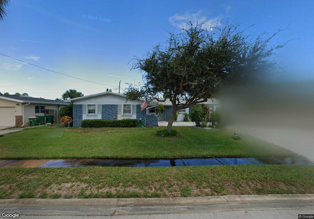
611 N Robert Way Satellite Beach, FL 32937
Estimated Value: $516,555 - $601,000
3
Beds
2
Baths
1,492
Sq Ft
$374/Sq Ft
Est. Value
About This Home
This home is located at 611 N Robert Way, Satellite Beach, FL 32937 and is currently estimated at $557,389, approximately $373 per square foot. 611 N Robert Way is a home located in Brevard County with nearby schools including Ocean Breeze Elementary School, Satellite Senior High School, and DeLaura Middle School.
Ownership History
Date
Name
Owned For
Owner Type
Purchase Details
Closed on
Oct 14, 2021
Sold by
Bond Ronald E and Bond Theresa M
Bought by
Bond Ronald E and Bond Theresa M
Current Estimated Value
Purchase Details
Closed on
Aug 27, 1993
Sold by
Jennings Donald T and Jennings Sharon K
Bought by
Bond Ronald E and Bond Theresa M
Home Financials for this Owner
Home Financials are based on the most recent Mortgage that was taken out on this home.
Original Mortgage
$100,700
Interest Rate
7.18%
Create a Home Valuation Report for This Property
The Home Valuation Report is an in-depth analysis detailing your home's value as well as a comparison with similar homes in the area
Home Values in the Area
Average Home Value in this Area
Purchase History
| Date | Buyer | Sale Price | Title Company |
|---|---|---|---|
| Bond Ronald E | -- | Accommodation | |
| Bond Ronald E | $106,000 | -- |
Source: Public Records
Mortgage History
| Date | Status | Borrower | Loan Amount |
|---|---|---|---|
| Closed | Bond Ronald E | $100,700 |
Source: Public Records
Tax History Compared to Growth
Tax History
| Year | Tax Paid | Tax Assessment Tax Assessment Total Assessment is a certain percentage of the fair market value that is determined by local assessors to be the total taxable value of land and additions on the property. | Land | Improvement |
|---|---|---|---|---|
| 2025 | $270 | $155,400 | -- | -- |
| 2024 | $266 | $151,030 | -- | -- |
| 2023 | $266 | $146,640 | $0 | $0 |
| 2022 | $262 | $142,370 | $0 | $0 |
| 2021 | $257 | $138,230 | $0 | $0 |
| 2020 | $1,664 | $136,330 | $0 | $0 |
| 2019 | $1,647 | $133,270 | $0 | $0 |
| 2018 | $1,642 | $130,790 | $0 | $0 |
| 2017 | $1,499 | $128,100 | $0 | $0 |
| 2016 | $1,476 | $125,470 | $85,000 | $40,470 |
| 2015 | $1,982 | $124,600 | $75,000 | $49,600 |
| 2014 | $1,982 | $123,620 | $70,000 | $53,620 |
Source: Public Records
Map
Nearby Homes
- 210 Lynn Ave
- 105 Carissa Dr
- 589 Coconut St
- 235 S Marco Way
- 110 Desoto Pkwy Unit 5
- 155 Elm Ave
- 215 S Robert Way
- 730 Hibiscus Dr
- 699 Bimini Rd
- 712 Sea Palm Ln
- 484 Greenway Ave
- 199 Skyline Ct
- 620 Jamaica Blvd
- 431 E Amherst Cir
- 1455 Highway A1a Unit 507
- 435 Desoto Pkwy
- 210 Queens Ct
- 305 Wimico Dr
- 690 Trinidad Ct
- 43 Anchor Dr
- 615 N Robert Way
- 609 N Robert Way
- 620 Verbenia Dr
- 618 Verbenia Dr
- 628 Verbenia Dr
- 610 N Robert Way
- 619 N Robert Way
- 614 Verbenia Dr
- 614 N Robert Way
- 608 N Robert Way
- 630 Verbenia Dr
- 607 N Robert Way
- 618 N Robert Way
- 621 N Robert Way
- 610 Verbenia Dr
- 605 N Robert Way
- 625 Verbenia Dr
- 640 Verbenia Dr
- 619 Rosada St
- 619 Verbenia Dr