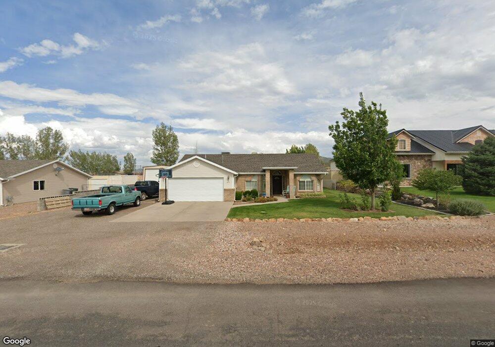
611 S 200 St E Enterprise, UT 84725
Estimated Value: $333,000 - $367,000
3
Beds
2
Baths
1,690
Sq Ft
$207/Sq Ft
Est. Value
About This Home
This home is located at 611 S 200 St E, Enterprise, UT 84725 and is currently estimated at $349,491, approximately $206 per square foot. 611 S 200 St E is a home located in Washington County with nearby schools including Enterprise School and Enterprise High School.
Ownership History
Date
Name
Owned For
Owner Type
Purchase Details
Closed on
Feb 25, 2011
Sold by
Fancy Teresa M
Bought by
Dacus Randall L and Dacus Trisha
Current Estimated Value
Home Financials for this Owner
Home Financials are based on the most recent Mortgage that was taken out on this home.
Original Mortgage
$97,465
Outstanding Balance
$67,220
Interest Rate
4.87%
Mortgage Type
FHA
Estimated Equity
$282,271
Purchase Details
Closed on
Aug 23, 2005
Sold by
Wallin Caroline
Bought by
Fancy Teresa M
Home Financials for this Owner
Home Financials are based on the most recent Mortgage that was taken out on this home.
Original Mortgage
$120,800
Interest Rate
7.5%
Mortgage Type
Adjustable Rate Mortgage/ARM
Create a Home Valuation Report for This Property
The Home Valuation Report is an in-depth analysis detailing your home's value as well as a comparison with similar homes in the area
Purchase History
| Date | Buyer | Sale Price | Title Company |
|---|---|---|---|
| Dacus Randall L | -- | Sun West Title | |
| Fancy Teresa M | -- | None Available | |
| Wallin Caroline | -- | Southern Utah Title Co |
Source: Public Records
Mortgage History
| Date | Status | Borrower | Loan Amount |
|---|---|---|---|
| Open | Dacus Randall L | $97,465 | |
| Previous Owner | Wallin Caroline | $120,800 |
Source: Public Records
Tax History
| Year | Tax Paid | Tax Assessment Tax Assessment Total Assessment is a certain percentage of the fair market value that is determined by local assessors to be the total taxable value of land and additions on the property. | Land | Improvement |
|---|---|---|---|---|
| 2025 | $1,188 | $170,995 | $46,200 | $124,795 |
| 2023 | $1,133 | $160,380 | $33,000 | $127,380 |
| 2022 | $1,577 | $171,380 | $33,000 | $138,380 |
| 2021 | $1,172 | $231,600 | $44,000 | $187,600 |
| 2020 | $1,048 | $194,900 | $34,000 | $160,900 |
| 2019 | $1,073 | $193,600 | $25,000 | $168,600 |
| 2018 | $945 | $88,275 | $0 | $0 |
| 2017 | $834 | $74,855 | $0 | $0 |
| 2016 | $873 | $72,545 | $0 | $0 |
| 2015 | $894 | $71,720 | $0 | $0 |
| 2014 | $747 | $59,895 | $0 | $0 |
Source: Public Records
Map
Nearby Homes
Your Personal Tour Guide
Ask me questions while you tour the home.