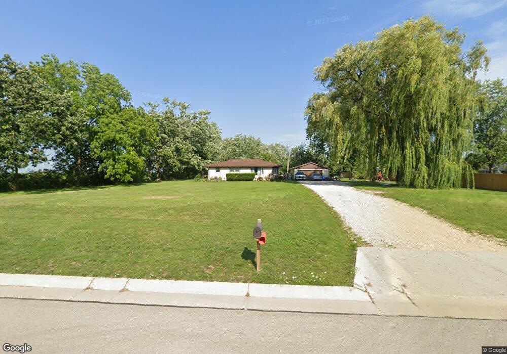
611 S Colony Ave Union Grove, WI 53182
Estimated Value: $326,618 - $528,000
--
Bed
--
Bath
--
Sq Ft
1.5
Acres
About This Home
This home is located at 611 S Colony Ave, Union Grove, WI 53182 and is currently estimated at $418,405. 611 S Colony Ave is a home located in Racine County with nearby schools including Yorkville Elementary School, Union Grove High School, and Union Grove Christian School.
Ownership History
Date
Name
Owned For
Owner Type
Purchase Details
Closed on
Nov 22, 2017
Sold by
Phillbrick Darlene A
Bought by
Roussel Ross D and Phillbrick Samantha R
Current Estimated Value
Home Financials for this Owner
Home Financials are based on the most recent Mortgage that was taken out on this home.
Original Mortgage
$136,000
Outstanding Balance
$114,142
Interest Rate
3.91%
Mortgage Type
New Conventional
Estimated Equity
$304,263
Purchase Details
Closed on
Oct 20, 2016
Sold by
Philbrick Samantha R
Bought by
Philbrick Darlene A
Home Financials for this Owner
Home Financials are based on the most recent Mortgage that was taken out on this home.
Original Mortgage
$263,250
Interest Rate
4.82%
Mortgage Type
Reverse Mortgage Home Equity Conversion Mortgage
Purchase Details
Closed on
Aug 3, 2012
Sold by
Philbrick Darlene and Philbrick Darlene A
Bought by
Philbrick Darlene A and Philbrick Samantha R
Create a Home Valuation Report for This Property
The Home Valuation Report is an in-depth analysis detailing your home's value as well as a comparison with similar homes in the area
Home Values in the Area
Average Home Value in this Area
Purchase History
| Date | Buyer | Sale Price | Title Company |
|---|---|---|---|
| Roussel Ross D | $170,000 | Landmark Title | |
| Philbrick Darlene A | $87,500 | Landmark Title Of Racine | |
| Philbrick Darlene A | $93,200 | Landmark Title Of Racine Inc |
Source: Public Records
Mortgage History
| Date | Status | Borrower | Loan Amount |
|---|---|---|---|
| Open | Roussel Ross D | $136,000 | |
| Previous Owner | Philbrick Darlene A | $263,250 |
Source: Public Records
Tax History Compared to Growth
Tax History
| Year | Tax Paid | Tax Assessment Tax Assessment Total Assessment is a certain percentage of the fair market value that is determined by local assessors to be the total taxable value of land and additions on the property. | Land | Improvement |
|---|---|---|---|---|
| 2024 | $3,000 | $215,100 | $77,500 | $137,600 |
| 2023 | $2,894 | $215,100 | $77,500 | $137,600 |
| 2022 | $2,999 | $215,100 | $77,500 | $137,600 |
| 2021 | $2,892 | $215,100 | $77,500 | $137,600 |
| 2020 | $2,467 | $178,200 | $49,500 | $128,700 |
| 2019 | $2,957 | $178,200 | $49,500 | $128,700 |
| 2018 | $2,821 | $178,200 | $49,500 | $128,700 |
| 2017 | $2,708 | $178,200 | $49,500 | $128,700 |
| 2016 | $2,803 | $178,200 | $49,500 | $128,700 |
| 2015 | $3,176 | $178,200 | $49,500 | $128,700 |
| 2014 | $3,101 | $178,200 | $49,500 | $128,700 |
| 2013 | $3,254 | $178,200 | $49,500 | $128,700 |
Source: Public Records
Map
Nearby Homes
- Lt89 W Kiddle Ln
- Lt99 W Kiddle Ln
- Lt106 W Kiddle Ln
- Lt101 W Kiddle Ln
- Lt103 W Kiddle Ln
- Lt87 W Kiddle Ln
- Lt91 W Kiddle Ln
- Lt93 W Kiddle Ln
- Lt84 Valley Hill Ln
- Lt116 Hill Dr
- Lt83 Valley Hill Ln
- 1034 58th Rd
- 1036 58th Rd
- 1044 58th Rd Unit 23
- 1038 58th Rd
- Lt2 Plank Rd
- 1042 58th Rd Unit 24
- 1048 58th Rd
- 1046 58th Rd Unit 45
- 1042 58th Rd
- 19220 Savage Rd
- 19128 Savage Rd
- 19207 Savage Rd
- 19221 Savage Rd
- 19110 Savage Rd
- 706 Log Cabin Dr
- 19102 Savage Rd
- 720 Log Cabin Dr
- 524 S Colony Ave
- 19028 Savage Rd
- 707 Log Cabin Dr
- 19014 Savage Rd
- 721 Log Cabin Dr
- 804 Log Cabin Dr
- 19006 Savage Rd
- 733 Log Cabin Dr
- 816 Log Cabin Dr
- 19214 52nd Rd
- 19224 52nd Rd
- 803 Log Cabin Dr