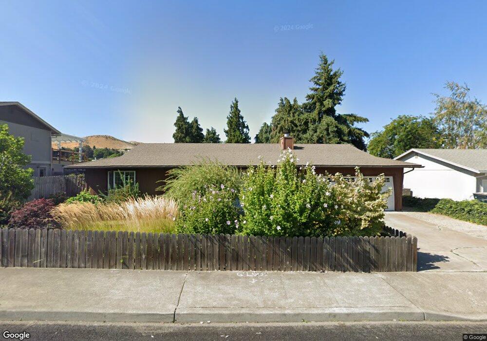
611 Sherman Dr the Dalles, OR 97058
Estimated Value: $384,511 - $485,000
3
Beds
2
Baths
1,176
Sq Ft
$377/Sq Ft
Est. Value
About This Home
This home is located at 611 Sherman Dr, the Dalles, OR 97058 and is currently estimated at $442,878, approximately $376 per square foot. 611 Sherman Dr is a home located in Wasco County with nearby schools including Dry Hollow Elementary School, The Dalles Middle School, and The Dalles High School.
Ownership History
Date
Name
Owned For
Owner Type
Purchase Details
Closed on
Mar 31, 2016
Sold by
Niles Aaron and Niles Lindsay R
Bought by
Hansen Heidi
Current Estimated Value
Purchase Details
Closed on
Jul 9, 2014
Sold by
Probstfield William R and William R Probstfield Trust
Bought by
Niles Aaron and Niles Lindsay R
Home Financials for this Owner
Home Financials are based on the most recent Mortgage that was taken out on this home.
Original Mortgage
$186,760
Interest Rate
4.07%
Mortgage Type
VA
Create a Home Valuation Report for This Property
The Home Valuation Report is an in-depth analysis detailing your home's value as well as a comparison with similar homes in the area
Home Values in the Area
Average Home Value in this Area
Purchase History
| Date | Buyer | Sale Price | Title Company |
|---|---|---|---|
| Hansen Heidi | -- | None Available | |
| Niles Aaron | $194,000 | None Available |
Source: Public Records
Mortgage History
| Date | Status | Borrower | Loan Amount |
|---|---|---|---|
| Previous Owner | Niles Aaron | $186,760 |
Source: Public Records
Tax History Compared to Growth
Tax History
| Year | Tax Paid | Tax Assessment Tax Assessment Total Assessment is a certain percentage of the fair market value that is determined by local assessors to be the total taxable value of land and additions on the property. | Land | Improvement |
|---|---|---|---|---|
| 2024 | $3,203 | $177,927 | -- | -- |
| 2023 | $3,109 | $172,745 | $0 | $0 |
| 2022 | $3,040 | $14,402 | $0 | $0 |
| 2021 | $2,947 | $13,983 | $0 | $0 |
| 2020 | $2,874 | $13,576 | $0 | $0 |
| 2019 | $3,035 | $13,181 | $0 | $0 |
| 2018 | $2,951 | $149,012 | $0 | $0 |
| 2017 | $2,857 | $144,672 | $0 | $0 |
| 2016 | $2,766 | $140,458 | $0 | $0 |
| 2015 | $2,682 | $136,367 | $0 | $0 |
| 2014 | $2,539 | $132,395 | $0 | $0 |
Source: Public Records
Map
Nearby Homes
- 679 Brentwood Dr E
- 500 E Knoll Ct
- 512 E Knoll Ct
- 3103 Fremont St
- 936 Richmond St
- 1700 Lone Pine Blvd
- 192 Honeysuckle Ln
- 1300 Lone Pine Blvd
- 0 Lone Pine Ln
- 1400 Lone Pine Blvd
- 1500 Lone Pine Blvd
- 260 Lone Pine Ln Unit 2
- 240 Lone Pine Ln Unit 2
- 2718 E 2nd St
- 155 Southshore Ave
- 2803 E 12th St
- 112 Southshore Ave
- 125 Southshore Ln
- 122 123 Southshore Ln
- 3564 E 2nd St Unit 33
- 617 Sherman Dr
- 618 Wasco Dr
- 612 Wasco Dr
- 624 Wasco Dr
- 623 Sherman Dr
- 3302 Royal Crest Dr E
- 614 Sherman Dr
- 606 Sherman Dr
- 630 Wasco Dr
- 606 Wasco Dr
- 629 Sherman Dr
- 626 Sherman Dr
- 636 Wasco Dr
- 633 Sherman Dr
- 630 Sherman Dr
- 611 Brentwood Dr E
- 3308 Royal Crest Dr E
- 611 Wasco Dr
- 617 Brentwood Dr E
- 632 Sherman Dr