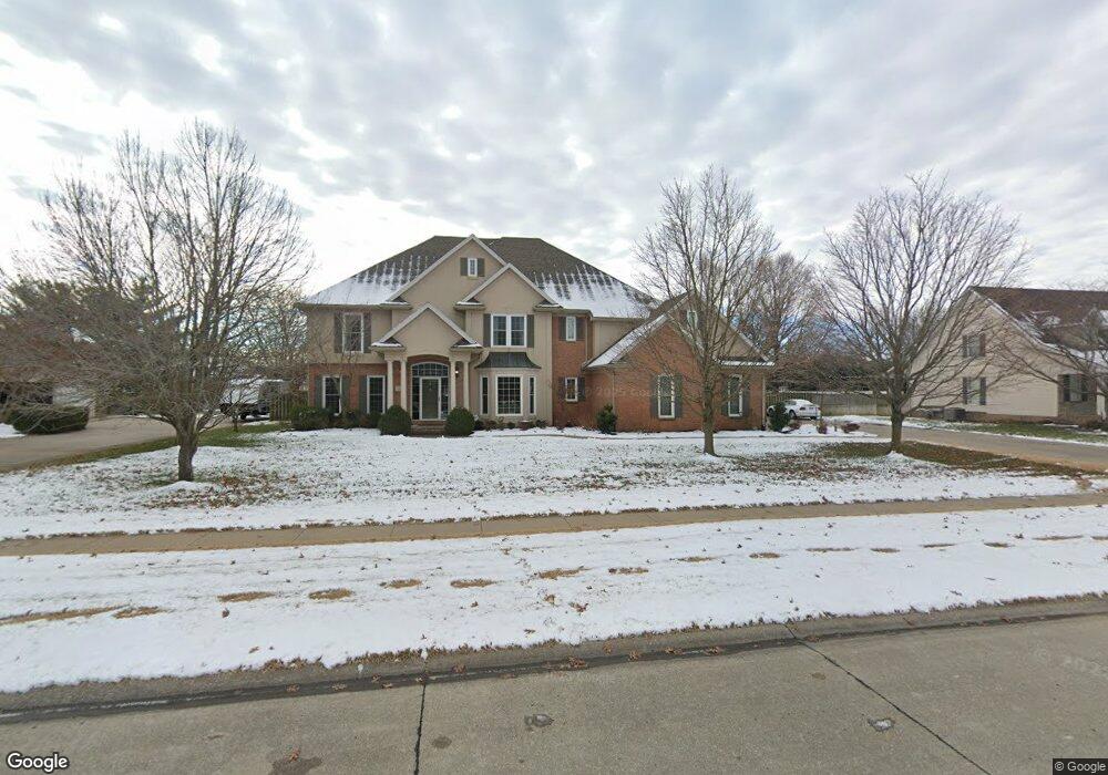
611 Thornwood Ave Sikeston, MO 63801
Estimated Value: $351,000 - $546,000
4
Beds
--
Bath
4,414
Sq Ft
$105/Sq Ft
Est. Value
About This Home
This home is located at 611 Thornwood Ave, Sikeston, MO 63801 and is currently estimated at $464,460, approximately $105 per square foot. 611 Thornwood Ave is a home with nearby schools including Sikeston Senior High School, St. Francis Xavier School, and The Christian Academy.
Ownership History
Date
Name
Owned For
Owner Type
Purchase Details
Closed on
Jan 20, 2021
Sold by
Blanton Kevin J
Bought by
Blanton Kevin J and Blanton Amy N
Current Estimated Value
Purchase Details
Closed on
Jun 3, 2013
Sold by
Blanton Kevin J and Blanton Amy N
Bought by
Kevin J Blanton Revocable Trust
Home Financials for this Owner
Home Financials are based on the most recent Mortgage that was taken out on this home.
Original Mortgage
$266,000
Outstanding Balance
$59,352
Interest Rate
3.38%
Estimated Equity
$405,108
Create a Home Valuation Report for This Property
The Home Valuation Report is an in-depth analysis detailing your home's value as well as a comparison with similar homes in the area
Home Values in the Area
Average Home Value in this Area
Purchase History
| Date | Buyer | Sale Price | Title Company |
|---|---|---|---|
| Blanton Kevin J | -- | None Available | |
| Kevin J Blanton Revocable Trust | -- | -- | |
| Blanton Kevin J | -- | -- |
Source: Public Records
Mortgage History
| Date | Status | Borrower | Loan Amount |
|---|---|---|---|
| Open | Blanton Kevin J | $266,000 |
Source: Public Records
Tax History Compared to Growth
Tax History
| Year | Tax Paid | Tax Assessment Tax Assessment Total Assessment is a certain percentage of the fair market value that is determined by local assessors to be the total taxable value of land and additions on the property. | Land | Improvement |
|---|---|---|---|---|
| 2025 | $3,280 | $75,420 | $0 | $0 |
| 2024 | $3,280 | $67,600 | $0 | $0 |
| 2023 | $3,268 | $67,600 | $0 | $0 |
| 2022 | $3,274 | $65,010 | $0 | $0 |
| 2021 | $3,272 | $65,010 | $0 | $0 |
| 2020 | $2,760 | $61,810 | $0 | $0 |
| 2019 | -- | $61,810 | $0 | $0 |
| 2018 | -- | $61,810 | $0 | $0 |
| 2017 | -- | $61,810 | $0 | $0 |
| 2014 | -- | $61,810 | $0 | $0 |
| 2011 | -- | $60,020 | $0 | $0 |
Source: Public Records
Map
Nearby Homes
- 305 Ridge Dr
- 511 W Lindenwood Ave
- 217 Foust Dr
- 208 Foust Dr
- 1009 N West St
- 111 Linda Dr
- 123 Holmes Dr
- 630 Euclid Dr
- 103 Groves Estates Ct
- 1405 N Main St
- 1403 N Main St
- 1401 N Main St
- 4 N West St
- 918 Hawthorn Dr
- 1040 N Kingshighway St
- 817 N Kingshighway St
- 1011 N Ranney St
- 202 College St
- 0 Ellen Ave
- 216 Sherrie Dr
- 609 Thornwood Ave
- 613 Thornwood Ave
- 612 Thornwood Ave
- 610 Tanglewood Ave
- 614 Thornwood Ave
- 607 Thornwood Ave
- 615 Thornwood Ave
- 610 Thornwood Ave
- 620 Tanglewood Ave
- 616 Thornwood Ave
- 608 Thornwood Ave
- 608 Tanglewood Ave
- 605 Thornwood Ave
- 611 Laurelwood Ave
- 609 Laurelwood Ave
- 618 Thornwood Ave
- 606 Tanglewood Ave
- 613 Laurelwood Ave
- 606 Thornwood Ave
- 611 Tanglewood Ave