Estimated Value: $141,000 - $157,000
2
Beds
1
Bath
1,368
Sq Ft
$108/Sq Ft
Est. Value
About This Home
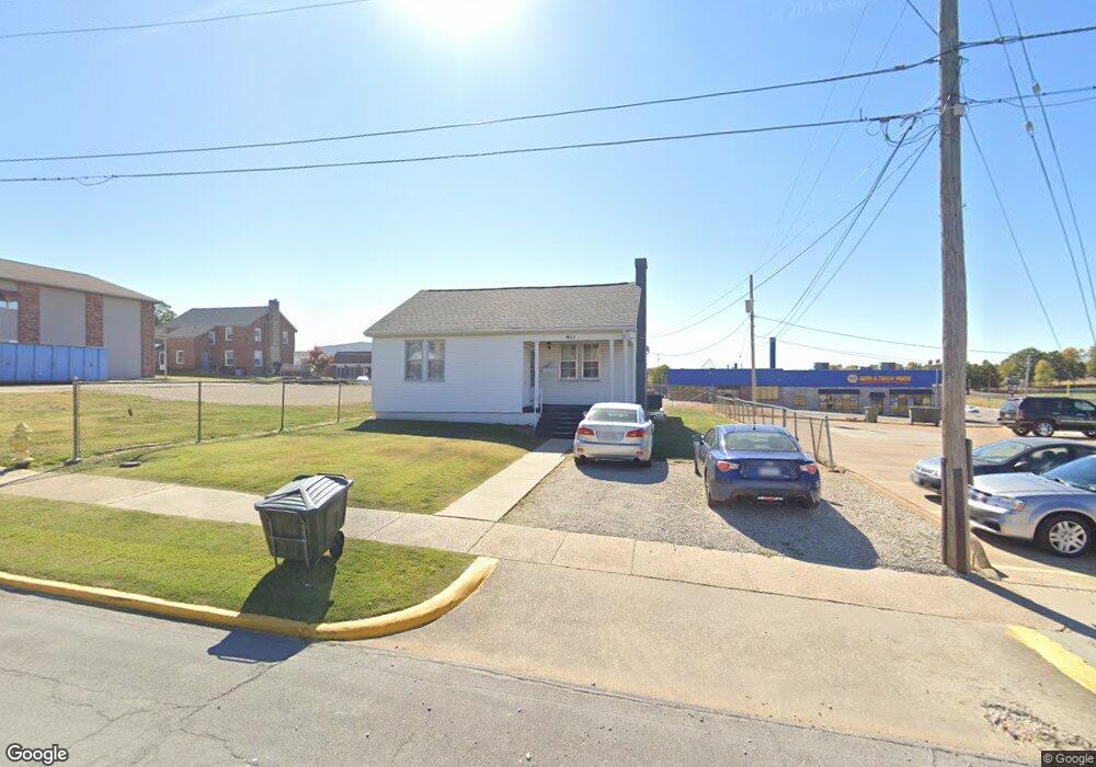
This home is located at 611 W 8th St, Rolla, MO 65401 and is currently estimated at $148,142, approximately $108 per square foot. 611 W 8th St is a home located in Phelps County with nearby schools including Rolla Junior High School, Rolla Senior High School, and Immanuel Lutheran School.
Ownership History
Date
Name
Owned For
Owner Type
Purchase Details
Closed on
Aug 7, 2023
Sold by
Denny Properties Inc
Bought by
Heavin Gary W
Current Estimated Value
Home Financials for this Owner
Home Financials are based on the most recent Mortgage that was taken out on this home.
Original Mortgage
$200,000
Outstanding Balance
$65,242
Interest Rate
6.43%
Mortgage Type
Construction
Estimated Equity
$82,900
Purchase Details
Closed on
Oct 28, 2013
Purchase Details
Closed on
Nov 30, 1971
Create a Home Valuation Report for This Property
The Home Valuation Report is an in-depth analysis detailing your home's value as well as a comparison with similar homes in the area
Home Values in the Area
Average Home Value in this Area
Purchase History
| Date | Buyer | Sale Price | Title Company |
|---|---|---|---|
| Heavin Gary W | $250,000 | -- | |
| -- | -- | -- | |
| -- | -- | -- |
Source: Public Records
Mortgage History
| Date | Status | Borrower | Loan Amount |
|---|---|---|---|
| Open | Heavin Gary W | $200,000 |
Source: Public Records
Tax History
| Year | Tax Paid | Tax Assessment Tax Assessment Total Assessment is a certain percentage of the fair market value that is determined by local assessors to be the total taxable value of land and additions on the property. | Land | Improvement |
|---|---|---|---|---|
| 2025 | $649 | $12,430 | $4,020 | $8,410 |
| 2024 | $596 | $11,090 | $3,440 | $7,650 |
| 2023 | $600 | $11,090 | $3,440 | $7,650 |
| 2022 | $510 | $11,090 | $3,440 | $7,650 |
| 2021 | $513 | $11,090 | $3,440 | $7,650 |
| 2020 | $478 | $10,090 | $3,440 | $6,650 |
| 2019 | $476 | $10,090 | $3,440 | $6,650 |
| 2018 | $471 | $10,090 | $3,440 | $6,650 |
| 2017 | $471 | $10,090 | $3,440 | $6,650 |
| 2016 | $455 | $10,090 | $3,440 | $6,650 |
| 2015 | -- | $10,090 | $3,440 | $6,650 |
| 2014 | -- | $10,090 | $3,440 | $6,650 |
| 2013 | -- | $10,090 | $0 | $0 |
Source: Public Records
Map
Nearby Homes
- 1000 N Pine St
- 400 N Oak St
- 104 E 3rd St
- 303 E 7th St
- 0.25 +/- ac N Olive St
- 1022 Lynwood Dr
- 100 N Walnut St
- 507 E 13th St
- 5 Rolla Gardens Dr
- 403 S Adrian Ave
- 711 E 10th St
- 401 Fort Wyman Rd
- 403 Fort Wyman Rd
- TBD Bluebird Ln
- 63 Rose Ct
- 35 Green Acres Dr
- 305 Mossman Ln
- 600 S Rolla St
- 708 E State Route 72
- 1400 Nagogami Rd
- 604 W 7th St
- 604 W 7th St
- 702 N Bishop & 604 W 7th St
- 704 N Bishop Ave
- 702 N Bishop Ave
- 608 W 8th St
- 600 W 7th St
- 606 W 8th St
- 157 Hc 33 Box 157
- 707 N State St
- 613 W 9th St
- 701 N State St
- 609 W 9th St
- 607 W 9th St
- 602 N Bishop Ave
- 801 N State St
- 604 W 6th St
- 807 N State St
- 5242PD Us Highway 63
- 605 N State St
Your Personal Tour Guide
Ask me questions while you tour the home.