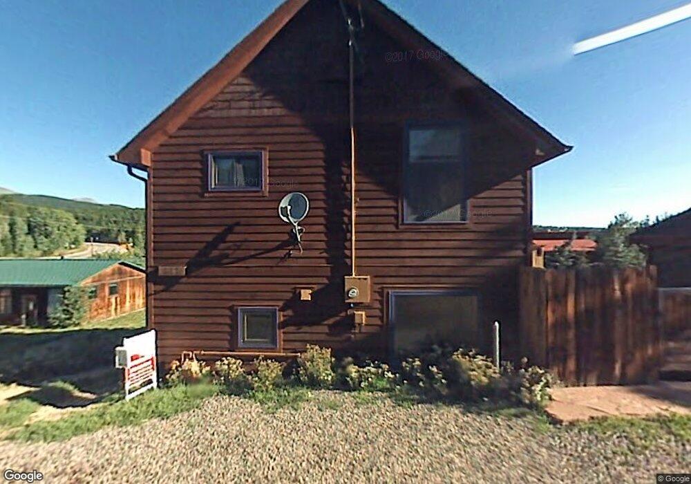
611 W Rollinsville St Nederland, CO 80466
Estimated Value: $614,542 - $751,000
3
Beds
2
Baths
1,440
Sq Ft
$465/Sq Ft
Est. Value
About This Home
This home is located at 611 W Rollinsville St, Nederland, CO 80466 and is currently estimated at $669,136, approximately $464 per square foot. 611 W Rollinsville St is a home located in Boulder County with nearby schools including Nederland Elementary School and Nederland Middle-Senior High School.
Ownership History
Date
Name
Owned For
Owner Type
Purchase Details
Closed on
Apr 29, 2016
Sold by
Evertsen Karina Ella and Luscher Karina Ella
Bought by
Karina And Marcus Luscher Living Trust
Current Estimated Value
Purchase Details
Closed on
Dec 19, 2007
Sold by
Stoddard Sally L
Bought by
Evertsen Karina Ella
Home Financials for this Owner
Home Financials are based on the most recent Mortgage that was taken out on this home.
Original Mortgage
$306,375
Outstanding Balance
$193,220
Interest Rate
6.23%
Mortgage Type
Purchase Money Mortgage
Estimated Equity
$475,916
Purchase Details
Closed on
Aug 10, 2001
Sold by
Hochhauser Mark
Bought by
Stoddard John F and Stoddard Sally L
Home Financials for this Owner
Home Financials are based on the most recent Mortgage that was taken out on this home.
Original Mortgage
$220,000
Interest Rate
7.07%
Purchase Details
Closed on
Oct 27, 2000
Sold by
Buchanan Hillary B and Buchanan Patrick
Bought by
Hochhauser Mark
Home Financials for this Owner
Home Financials are based on the most recent Mortgage that was taken out on this home.
Original Mortgage
$214,600
Interest Rate
7.89%
Purchase Details
Closed on
Jul 2, 1999
Sold by
Tollette Hillary B and Tollette Patrick Buchanan
Bought by
Buchanan Patrick
Home Financials for this Owner
Home Financials are based on the most recent Mortgage that was taken out on this home.
Original Mortgage
$71,900
Interest Rate
7.39%
Purchase Details
Closed on
Jun 27, 1997
Sold by
Mcneill Michelle R
Bought by
Tollette Hillary B and Buchanan Patrick
Home Financials for this Owner
Home Financials are based on the most recent Mortgage that was taken out on this home.
Original Mortgage
$70,000
Interest Rate
7.93%
Purchase Details
Closed on
Aug 2, 1996
Sold by
Sparling Bruce Walker
Bought by
Mcneill Michelle R
Home Financials for this Owner
Home Financials are based on the most recent Mortgage that was taken out on this home.
Original Mortgage
$80,215
Interest Rate
8.32%
Mortgage Type
FHA
Create a Home Valuation Report for This Property
The Home Valuation Report is an in-depth analysis detailing your home's value as well as a comparison with similar homes in the area
Home Values in the Area
Average Home Value in this Area
Purchase History
| Date | Buyer | Sale Price | Title Company |
|---|---|---|---|
| Karina And Marcus Luscher Living Trust | -- | None Available | |
| Evertsen Karina Ella | $322,500 | Vista Title Llc | |
| Stoddard John F | $275,000 | -- | |
| Hochhauser Mark | $268,272 | Land Title | |
| Buchanan Patrick | -- | First American Heritage Titl | |
| Tollette Hillary B | $89,500 | Land Title | |
| Mcneill Michelle R | $80,500 | -- |
Source: Public Records
Mortgage History
| Date | Status | Borrower | Loan Amount |
|---|---|---|---|
| Open | Evertsen Karina Ella | $306,375 | |
| Previous Owner | Stoddard John F | $220,000 | |
| Previous Owner | Hochhauser Mark | $214,600 | |
| Previous Owner | Buchanan Patrick | $71,900 | |
| Previous Owner | Tollette Hillary B | $70,000 | |
| Previous Owner | Mcneill Michelle R | $80,215 |
Source: Public Records
Tax History Compared to Growth
Tax History
| Year | Tax Paid | Tax Assessment Tax Assessment Total Assessment is a certain percentage of the fair market value that is determined by local assessors to be the total taxable value of land and additions on the property. | Land | Improvement |
|---|---|---|---|---|
| 2025 | $3,820 | $37,563 | $3,275 | $34,288 |
| 2024 | $3,820 | $37,563 | $3,275 | $34,288 |
| 2023 | $3,719 | $33,259 | $3,035 | $33,909 |
| 2022 | $3,414 | $29,191 | $2,752 | $26,439 |
| 2021 | $3,366 | $30,031 | $2,831 | $27,200 |
| 2020 | $2,936 | $25,927 | $3,361 | $22,566 |
| 2019 | $2,901 | $25,927 | $3,361 | $22,566 |
| 2018 | $2,753 | $24,336 | $4,464 | $19,872 |
| 2017 | $2,696 | $26,905 | $4,935 | $21,970 |
| 2016 | $2,549 | $22,424 | $5,652 | $16,772 |
| 2015 | $2,443 | $21,484 | $6,288 | $15,196 |
| 2014 | $2,446 | $21,484 | $6,288 | $15,196 |
Source: Public Records
Map
Nearby Homes
- 590 W Pine St
- 710 Mcmillen Way
- 550 W Breed St
- 470 W Spring St
- 105 S Caribou St
- 24333 Peak To Peak Hwy
- 11650 Peak To Peak Hwy
- 0 Peak To Peak Hwy Unit REC2002177
- 0 Peak To Peak Hwy Unit 1040129
- 0 Peak To Peak Hwy Unit 1042718
- 850 W 5th St
- 252 5th St
- 135 E 2nd St
- 87 Sundance Cir
- 0 E 5th St Unit 1034288
- 242 E 5th St
- 546 Haul Rd
- 239 Big Springs Dr
- 5 Ridge View Rd
- 46 Pinecliff Trail
- 619 W Rollinsville St
- 605 W Rollinsville St
- 639 W Rollinsville St
- 601 W Rollinsville St
- 752 S Hendricks St
- 706 S Hendricks St
- 612 Peak To Peak Hwy
- 626 Highway 72
- 626 Peak To Peak Hwy
- 701 S Hendricks St
- 630 Peak To Peak Hwy
- 504 S Peak To Peak Hwy
- 600 S Peak To Peak Hwy
- 580 Highway 72
- 751 S Hendricks St
- 650 W Rollinsville St
- 502 S Peak To Peak Hwy
- 662 Rollinsville Rd
- 710 S Highway 119 Hwy S
- 630 W Spruce St