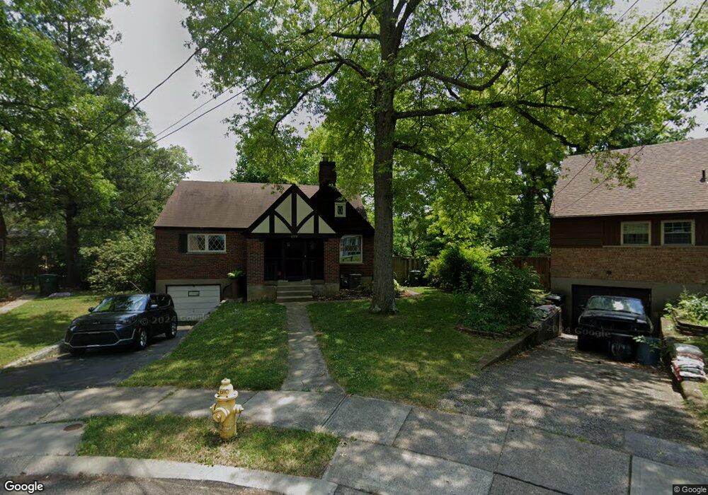
6110 Faircrest Ct Cincinnati, OH 45224
College Hill NeighborhoodEstimated Value: $193,000 - $247,000
4
Beds
1
Bath
1,044
Sq Ft
$220/Sq Ft
Est. Value
About This Home
This home is located at 6110 Faircrest Ct, Cincinnati, OH 45224 and is currently estimated at $229,581, approximately $219 per square foot. 6110 Faircrest Ct is a home located in Hamilton County with nearby schools including Pleasant Hill Elementary School, Robert A. Taft Information Technology High School, and Western Hills High School.
Ownership History
Date
Name
Owned For
Owner Type
Purchase Details
Closed on
Jan 27, 1997
Sold by
Eloff Andrew W and Eloff Heather R
Bought by
Stachowski Kevin B and Stachowski Alissa A
Current Estimated Value
Home Financials for this Owner
Home Financials are based on the most recent Mortgage that was taken out on this home.
Original Mortgage
$86,912
Outstanding Balance
$10,146
Interest Rate
7.92%
Mortgage Type
FHA
Estimated Equity
$219,435
Purchase Details
Closed on
Aug 23, 1996
Sold by
Ries Scott Allen and Ries Mary Huesman
Bought by
Eloff Andrew W and Eloff Heather R
Home Financials for this Owner
Home Financials are based on the most recent Mortgage that was taken out on this home.
Original Mortgage
$78,300
Interest Rate
8.47%
Create a Home Valuation Report for This Property
The Home Valuation Report is an in-depth analysis detailing your home's value as well as a comparison with similar homes in the area
Home Values in the Area
Average Home Value in this Area
Purchase History
| Date | Buyer | Sale Price | Title Company |
|---|---|---|---|
| Stachowski Kevin B | $87,000 | -- | |
| Eloff Andrew W | $87,000 | -- |
Source: Public Records
Mortgage History
| Date | Status | Borrower | Loan Amount |
|---|---|---|---|
| Open | Stachowski Kevin B | $86,912 | |
| Previous Owner | Eloff Andrew W | $78,300 |
Source: Public Records
Tax History Compared to Growth
Tax History
| Year | Tax Paid | Tax Assessment Tax Assessment Total Assessment is a certain percentage of the fair market value that is determined by local assessors to be the total taxable value of land and additions on the property. | Land | Improvement |
|---|---|---|---|---|
| 2024 | $3,639 | $60,939 | $12,040 | $48,899 |
| 2023 | $3,721 | $60,939 | $12,040 | $48,899 |
| 2022 | $2,684 | $39,383 | $9,776 | $29,607 |
| 2021 | $2,583 | $39,383 | $9,776 | $29,607 |
| 2020 | $2,658 | $39,383 | $9,776 | $29,607 |
| 2019 | $2,549 | $34,545 | $8,575 | $25,970 |
| 2018 | $2,553 | $34,545 | $8,575 | $25,970 |
| 2017 | $2,426 | $34,545 | $8,575 | $25,970 |
| 2016 | $2,452 | $34,437 | $9,167 | $25,270 |
| 2015 | $2,211 | $34,437 | $9,167 | $25,270 |
| 2014 | $2,227 | $34,437 | $9,167 | $25,270 |
| 2013 | $2,335 | $35,501 | $9,450 | $26,051 |
Source: Public Records
Map
Nearby Homes
- 6123 Faircrest Ct
- 1137 Homeside Ave
- 1147 Homeside Ave
- 1205 Wionna Ave
- 1428 Ambrose Ave
- 5923 Lantana Ave
- 1437 Ambrose Ave
- 6014 Argus Rd
- 1090 Elda Ln
- 1417 Cedar Ave
- 1127 Cedar Ave
- 5773 Lantana Ave
- 5839 Argus Rd
- 1406 Wittekind Terrace
- 1453 Larrywood Ln
- 6000 Capri Dr
- 1541 Wittekind Terrace
- 5687 Folchi Dr
- 6029 Waldway Ln
- 5679 Folchi Dr
- 6108 Faircrest Ct
- 6109 Faircrest Dr
- 6112 Faircrest Ct
- 6103 Faircrest Dr
- 1210 Homeside Ave
- 6116 Faircrest Ct
- 1194 Homeside Ave
- 1214 Homeside Ave
- 6109 Faircrest Ct
- 1192 Homeside Ave
- 1218 Homeside Ave
- 6120 Faircrest Ct
- 6121 Faircrest Dr
- 6115 Faircrest Ct
- 1188 Homeside Ave
- 6100 Faircrest Dr
- 1222 Homeside Ave
- 6119 Faircrest Ct
- 6124 Faircrest Ct
- 1184 Homeside Ave