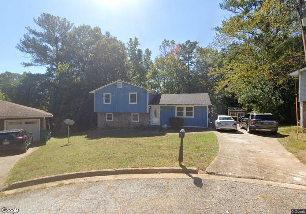
6110 Michael Rd Lithonia, GA 30058
Estimated Value: $204,000 - $213,000
3
Beds
2
Baths
1,530
Sq Ft
$135/Sq Ft
Est. Value
About This Home
This home is located at 6110 Michael Rd, Lithonia, GA 30058 and is currently estimated at $206,824, approximately $135 per square foot. 6110 Michael Rd is a home located in DeKalb County with nearby schools including Panola Way Elementary School, Lithonia Middle School, and Lithonia High School.
Ownership History
Date
Name
Owned For
Owner Type
Purchase Details
Closed on
Jan 18, 2005
Sold by
Davis Ricky J and Davis Bernice L
Bought by
Davis Bernice H and Davis Ricky J
Current Estimated Value
Home Financials for this Owner
Home Financials are based on the most recent Mortgage that was taken out on this home.
Original Mortgage
$25,000
Outstanding Balance
$12,547
Interest Rate
5.66%
Mortgage Type
New Conventional
Estimated Equity
$194,277
Create a Home Valuation Report for This Property
The Home Valuation Report is an in-depth analysis detailing your home's value as well as a comparison with similar homes in the area
Home Values in the Area
Average Home Value in this Area
Purchase History
| Date | Buyer | Sale Price | Title Company |
|---|---|---|---|
| Davis Bernice H | -- | -- |
Source: Public Records
Mortgage History
| Date | Status | Borrower | Loan Amount |
|---|---|---|---|
| Open | Davis Bernice H | $25,000 |
Source: Public Records
Tax History
| Year | Tax Paid | Tax Assessment Tax Assessment Total Assessment is a certain percentage of the fair market value that is determined by local assessors to be the total taxable value of land and additions on the property. | Land | Improvement |
|---|---|---|---|---|
| 2025 | $676 | $79,600 | $15,000 | $64,600 |
| 2024 | $704 | $86,280 | $15,000 | $71,280 |
| 2023 | $704 | $75,440 | $15,000 | $60,440 |
Source: Public Records
Map
Nearby Homes
- 2285 Cherokee Valley Cir Unit III
- 2247 Cherokee Valley Dr
- 2278 Cherokee Valley Cir
- 2293 Cherokee Valley Dr Unit 3
- 2169 Tiffany Ln
- 6185 Marbut Farms Chase
- 6248 Marbut Farms Ln
- 6012 Happy Trails Ct
- 6254 Marbut Farms Trail
- 6048 Old Wellborn Trace
- 2265 Anne's Lake Cir
- 1882 Corners Cir
- 2039 Raintree Place
- 2254 Anne's Lake Cir
- 2046 Lown Farm Trail
- 2030 Hilda Burns Place
- 2202 Lowtrail Ct
- 2123 Lown Farm Ln
- 2294 Wellington Cir Unit 2294
- 2356 Cove Rd
- 6116 Michael Rd
- 6102 Michael Rd Unit 6
- 6111 Dana Ct
- 2279 Cherokee Valley Cir
- 2273 Cherokee Valley Cir
- 6117 Dana Ct
- 2291 Cherokee Valley Cir
- 2204 Jonathan Ave Unit 6
- 2269 Cherokee Valley Cir
- 6109 Michael Rd
- 2210 Jonathan Ave
- 6103 Dana Ct
- 6115 Michael Rd
- 2192 Jonathan Ave
- 2216 Jonathan Ave
- 2297 Cherokee Valley Cir
- 2263 Cherokee Valley Cir Unit 4
- 2186 Jonathan Ave
- 2284 Cherokee Valley Cir
- 2274 Cherokee Valley Cir
Your Personal Tour Guide
Ask me questions while you tour the home.